
 Continue with onX Maps
 Sign in with Facebook


Montserrat Rock Climbing
| Elevation: | 2,339 ft | 713 m |
| GPS: |
41.59325, 1.83782 Google Map · Climbing Area Map |
|
| Page Views: | 137,123 total · 731/month | |
| Shared By: | Monomaniac on Jul 18, 2009 · Updates | |
| Admins: | Robert Hall, Jason Halladay, David Riley |
Description

Perched fortress-like atop the surrounding wine country sits Spain's largest climbing area, and the spiritual cradle of Catalonian climbing. The magical blunted spires of Montserrat hide literally thousands of excellent routes, with a variety of length & commitment sure to intrigue climbers of all tastes & abilities. Located only 30 miles from the bustling metropolis of Barcelona, the Parc Natural de la Muntanya de Montserrat that contains the climbing area is a popular destination for locals & tourists alike. The main attraction for tourists is the aesthetic Benedictine Monastery located among the cliffs on the East end of the park, which offers access to many of the more popular climbs.
A funicular provides access to the Southeast portion of the park, reducing the daunting approach to a meager stroll. Beware there are two funiculars, one that goes up (St Joan), and one that goes down (Santa Cova). Be sure you are in the correct station before you buy your ticket.
There are a number of Refugis in the park that provide cheap accomodations for climbers. The Monastery also offers rooms and a campground.
Addition 11/1/19 - In addition to the general guidebooks of "Europe" there is a specific guidebook to the Sant Benet areas and a general guidebook of the trad climbs. The Trad book is in English and may be a help with descriptions of approaches even to the non-Spanish sport climber, the Sant Benet book is in Spanish, but the tools are so good that once at the base there’s hardly any need for translation. There are photographs of these guidebooks (you'll have to click on "see more photograps"), as well as the great map. These are available in shops in and around Montserrat. R Hall Admin.
The Rock

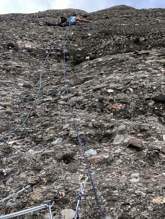
Routes range in difficulty from 3rd class scrambles & via ferratas to 5.14c. Lengths range from the ridiculously short 2-bolt power route, to multi-pitch adventures in excess of 10 pitches.
The vast majority of lines are bolt protected, but many of these are runout, and there are opportunities for intermediate natural gear placements. A small rack of nuts will prove useful on most lines. Helmets are a good idea here, and seem to be favored by the vast majority of local climbers. Although these routes see nearly constant traffic, pockets of loose rock remain.
First-time visitors will be drawn to the Gorros formations that tower above the Monastery. More accomplished climbers should not miss the imposing

When to Visit


Beta
Getting There
The parking situation at the Monastery can be troublesome, particularly on weekends. Arrive early or expect to waste a good bit of time looking for a space. There is a ~5 Euro fee if you are lucky enough to get a spot in the parking lot.
There is a train from Barcelona that will literally take you up the mountain to the monastery. We regretted renting a car, especially given how expensive all car related things are in Europe. Recommend the train, as it drops off at the monastery, and that is very very close to the hiker/ climber camping and where you begin many hikes to get to climbs.
Camping
Approach
Many routes will require a significant hike in, given how large Montserrat is. All but the easiest tourist paths are only maintained by foot traffic, and are covered with rocks from the conglomerate which have fallen out. Sturdy hiking shoes are a must on this approach if you don't want a turned ankle.
To access the main popular areas from the Monastery (Gorros, Sant Benat, plus the Normal Route on Cavall Bernat) one can take the Sant Joan Funicular for a fee. It cuts down the 1700' vertical approach to mere minutes. A nice option if you have bad knees or are making the approach on multiple days.
Classic Climbing Routes at Montserrat


Weather Averages
|
High
|
Low
|
|
Precip
|
Days w Precip
|
| J | F | M | A | M | J | J | A | S | O | N | D |
| J | F | M | A | M | J | J | A | S | O | N | D |
Photos


All Photos Within Montserrat
Most Popular · Newest · RandomMore About Montserrat
Printer-FriendlyWhat's New
Guidebooks (3)


12 Comments