
 Continue with onX Maps
 Sign in with Facebook


Maybird Slide Area Rock Climbing
| Elevation: | 8,000 ft | 2,438 m |
| GPS: |
40.5754, -111.7083 Google Map · Climbing Area Map |
|
| Page Views: | 44,368 total · 197/month | |
| Shared By: | Ryan Brough on Jun 27, 2007 · Updates | |
| Admins: | Perin Blanchard, GRK, David Crane, Nathan Fisher |
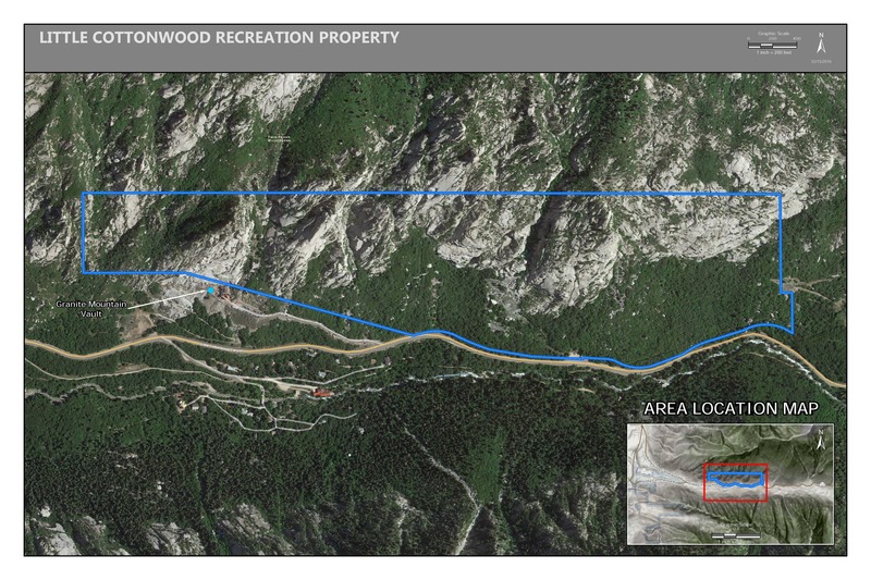
 Access Issue: Gate Buttress Area Recreational Lease: Climbs on Church Buttress above vault remain closed
Details
Access Issue: Gate Buttress Area Recreational Lease: Climbs on Church Buttress above vault remain closed
Details
June 1st, 2017:The Salt Lake Climbers Alliance (SLCA), the Church of Jesus Christ of Latter-day Saints (LDS Church), and Access Fund announce the signing of an unprecedented lease for 140 acres in Little Cottonwood Canyon (LCC). The parcel, known as the Gate Buttress, is about one mile up LCC canyon and has been popular with generations of climbers because of its world-class granite.
The agreement secures legitimate access to approximately 588 routes and 138 boulder problems at the Gate Buttress for rock climbers, who will be active stewards of the property. The recreational lease is the result of several years of negotiations between LDS Church leaders and the local climbing community.
Access Note: The climbs on the Church Buttress above the vault as well as the Glen boulders that have been traditionally closed will remain closed.
Please help us steward this area and leave no trace.
Read More:
saltlakeclimbers.org/climbe…
Description

The Maybird Slide Area is home to some recently developed areas. A big thanks to those who built the trail; that must have taken a lot of work. The rock here is Little Cottonwood's famous quartz monzonite, but don't be expecting to find sweeping slabs here. Most of the walls are steep, juggy with the occasional crack or seam. The rock quality is good and the routes have been cleaned up, but there are sections of rotten rock. Given that this is further up the canyon and the trail isn't obvious, this area is secluded in nature. Most of the cliffs are east-facing, so they are in the shade after 2pm or so. This makes for great climbing on hot summer afternoons or for early morning climbing in cooler weather. There was a gentle breeze coming down the gully in the evening. If you're looking for something new, this is definitely worth the hike.
Getting There
Reset your odometer at the "neon" sign at the mouth of Little Cottonwood Canyon. Drive ~3.8 miles up the canyon. You'll pass the "Maybird Avalanche Area" sign, go around a corner and then pull off to the side of the road. A lone broken, mostly fallen pine tree (not very big) and a rock cairn mark the trail. This trail has cleared away most of the brush but is still relatively new. It is easy to follow and leads to a rock-filled gulch. Rock cairns take you on the path of least resistance through the gulch and into the side canyon. There are remnants of two stone huts at the first climbing area, the Purple Wall. The Maybird East Area is visible to the east from this point. Plan on a 20-25 minute approach from the car to this point. Parking coordinates (40.5712441,-111.7073306)
Classic Climbing Routes at Maybird Slide Area


Weather Averages
|
High
|
Low
|
|
Precip
|
Days w Precip
|
| J | F | M | A | M | J | J | A | S | O | N | D |
| J | F | M | A | M | J | J | A | S | O | N | D |
Photos


All Photos Within Maybird Slide Area
Most Popular · Newest · RandomMore About Maybird Slide Area
Printer-FriendlyWhat's New
Guidebooks (9)


6 Comments