Continue with onX Maps
 Sign in with Facebook


New and experienced climbers over 50 #37


|
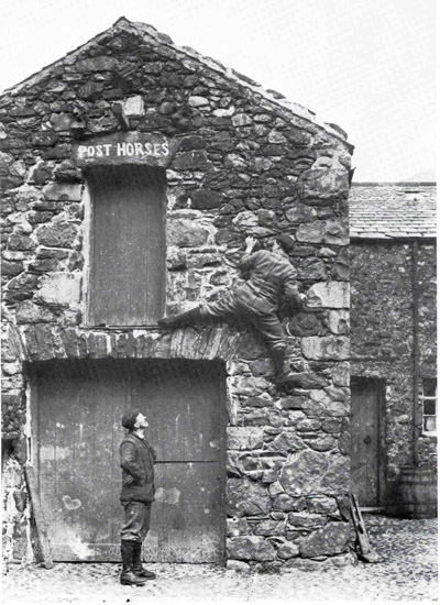
John Gillwrote: Ha! The original Horseman route! |

|
John Gillwrote: I love that picture, John. To me it clearly illustrates that despite how many changes have occurred over the past century and a quarter, climbing, and climbers, fundamentally remain unchanged ( though spotting has improved a bit!!!). |
|
|
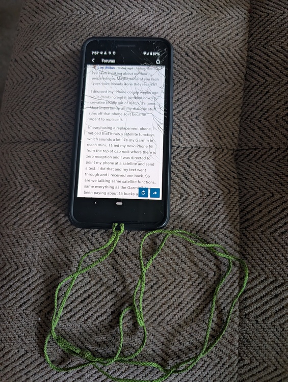
I’ve been thinking about outdoor preparedness. Maybe some of you tech types have already done the research? I dropped my iPhone couple weeks ago while climbing and it tumbled down a crevasse totally out of reach. It’s gone. Most importantly, all my diabetic stuff runs off that phone so it became urgent to replace it. In purchasing a replacement phone, I noticed that it has a satellite function, which sounds a lot like my Garmin in reach mini. I tried my new iPhone 16 from the top of cap rock where there is zero reception and I was directed to point my phone at a satellite and send a text. I did that and my text went through and I received one back. So are we talking same satellite functions, same everything as the Garmin? I’ve been paying about 15 bucks a month for the security of having an in reach which I have never used. The in reach mini operates from a cell phone, so is there really any difference? I never did figure out how to navigate with it. One thing I like about the iPhone 16 is that apparently it has a reserve battery that will keep pinging even after the phone has gone dead. So supposing I’m wandering around the Wonderland and I get totally lost or snake bit, will my iPhone 16 work as well as the Garmin to get help to me? What I seem to recall is that if I hit that SOS button on the Garmin it might still be 3 to 4 hours before someone gets to me. Is there any way that any device could lead me step-by-step out of a wilderness location? The original Garmin showed navigation “as the crow flies“ which would be useless here. 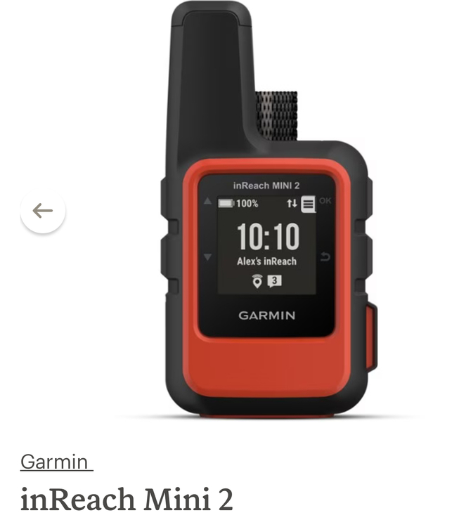
—- On a separate subject, it’s been 117° three days running. Tony and I were driving to Palm Desert yesterday and my thought was I hope we don’t have a breakdown along the way. We would be in big trouble if that car stalled for any reason. So I’d like to purchase some emergency supplies for our cars. If you were stuck on the side of the road in direct sun what would keep you shaded and cool? What would save a life while waiting for help to come? I will say that almost the second the air conditioner is turned of The interior of that car becomes a furnace. I would think the cooler option would be to get outside. I’m just trying to work this through in my head today. |
|
|
3 or 4 1-gallon water jugs in the trunk is very cheap insurance. Couple of umbrellas in there too? |
|
|
If you and Tony drove separate cars you'd always have a backup in case of a breakdown. We California carpool in my family during harsh weather, etc. Up to four cars if everyone is available. Super safe! |
|
|
Lori Milaswrote: the iphone sat messaging is slowly moving from "cutting/bleeding edge" tech to production quality. starlink I think is now offering plans that support DTC (direct to cell) I'm not getting rid of my inReach just yet, but it's life is probably limited to a couple more yrs. I'm still also living by the adage "two is one, one is none" with regards to all you need is a phone....some backup to that smart device is probably advisable.... some comments on your other questions: - The NOCO battery banks will both support phone charges and jump start a dead battery |
|
|
 Lori |
|
|
Lori - I consider not ever needing your inReach a complete success! Garmin uses the Iridium network whereas Apple is using Globalstar. My research indicates the Iridium network is much better suited for this type of use. As always do your own research :) I think the choice really boils down to what scenarios are important to you. I carry an inReach Mini because I want the one button SOS feature. I do a lot of solo dual sport motorcycle riding in the Coast Range of Oregon and one thing that could happen is to crash and be trapped under my bike. The Iridium network is much more capable of getting a message out through a dense canopy of Douglas Fir. I also expect to run out of gas, blow out a tire or have a problem with my bike so the preset messages that I can send to my buddies to come and help me are very valuable to me. About two weeks ago a friend crashed his motorcycle while on a rally and used the SOS feature of his Garmin inReach Explorer. I'm on his emergency contact list so I got a call from Garmin's Incident Response Team. Ultimately there was nothing I needed to do but they were able to let me know the nature of his injuries (broken clavicle, broken ribs), that his wife was was his other emergency contact, that there were others there to take care of his motorcycle and where he was being flown to. One review of the Apple satellite messaging capability I saw on YouTube indicated that the Apple only kicks over to the satellites when there is no cell coverage. The reviewer was able to get into a situation where the cell coverage was marginal enough that a text message would not go out but the phone would not kick over to the satellite system. This was a pretty early review of the technology so this issue may have already been fixed. |
|
|
Back from our epic road trip, the scenery was jaw dropping, pics don't do it justice.  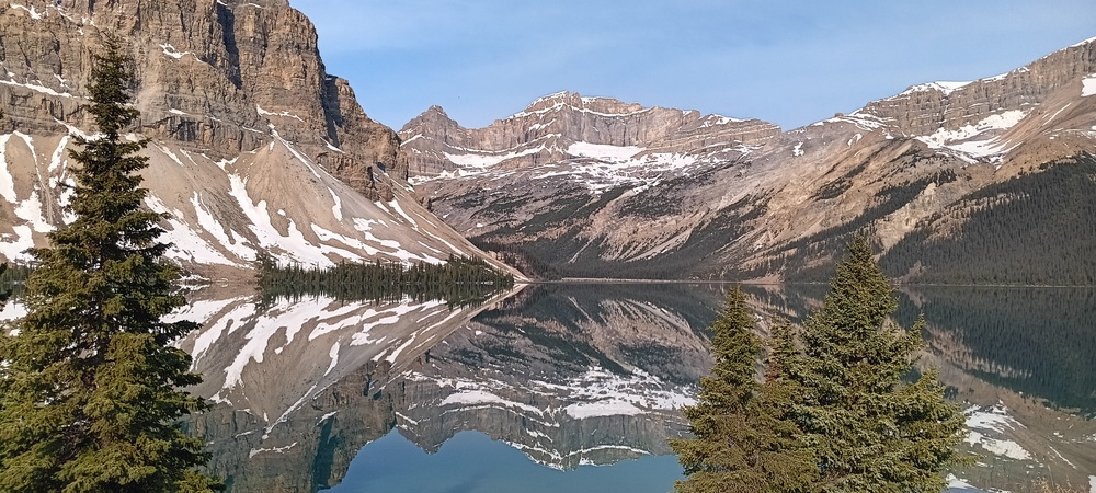 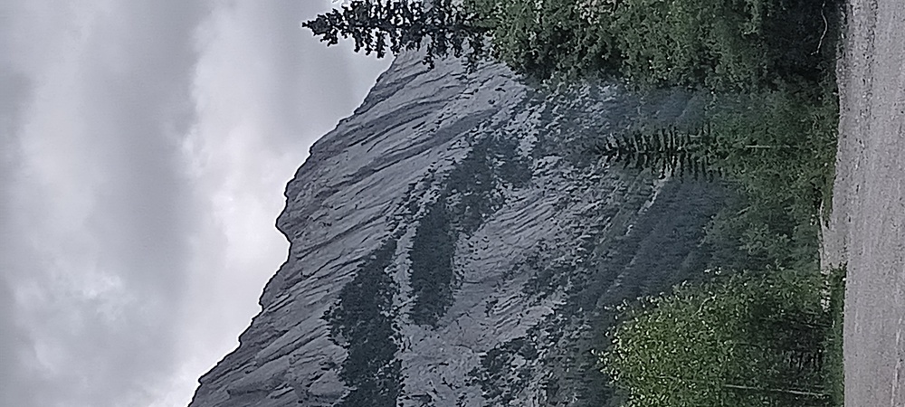  |
|
|
Oh, man! Why didn't I ask this question earlier? Thank you all so much! Jay, I'm all for California carpooling. Tony would not be. He likes to go on dates together. It kind of surprises me that he sees no danger driving out here in this desert heat, with the possibility of getting stuck or broke down somewhere along the way. Or on the 10. Even if you had good towing coverage, it could take an hour or longer for a tow to get there. I'll start with Cherokee's idea of buying some gallon jugs of water and umbrellas, maybe a few foldout chairs. That's a start. --- Ken, my phone looks like yours. I have perpetual screen covers, and they are replaced almost monthly. But I never actually lost a phone... but this one fell so deeply in that crevasse and there was no way to fish it out. I couldn't get that information on satellite systems from Apple, so thank you so much! I understand your need in a similar way... you want something simple and fast in an emergency. The Iridium sounds like the better deal. We don't have douglas fir, but we have rocks and boulders. It I had to 'point to the satellite' in the sky (as with my iphone), that could be a problem. What's important to me is that if I fall down a deep hole, or get injured out there while hiking alone, I would have some way to get help. Like you, I like that SOS button. I also like what Jim U suggested "two is one, one is none"... if my phone gets lost, or fails, the Mini would be a good backup. Maybe it's worth it to keep it around. The other thing that is important to me is that someone could find my last known location if I am passed out or incapacitated. What if you just didn't return home, your phone/inreach is dead, and no one knows where you are? Wouldn't the tracking function help someone locate you--at least to know where you were last? I don't know if the iPhone has that capability. But I also don't know if Tony would EVER think to dial up inReach and start browsing for me. Adding in the diabetic issue for me... it's never happened, thank god, but a low blood sugar could knock me out if not cause death. I carry a remedy in my backpack. But in that instance there would be no time for a long rescue... so I'm thinking that through. If I can't take care of myself, it could get bad fast. Also, we spent quite a while talking about rattlesnake bites here last summer. It could quite easily happen. It sounds like the steps are: 1) circle the bite with a pen 2) walk back to car 3) drive to hospital. I also discovered National Snakebite Support which is staffed with experts who will respond to a patient or doctor about steps to take for treatment. https://www.facebook.com/groups/987850051297436 (a surprising one: keep limb elevated) ---- As to navigation. Will anything help? When I had the regular Garmin inReach the screen, the 'breadcrums', the dotted lines etc were not understandable. At least by me. If I have a massive hill or formation in front of me, I need directions around it. Of course the mini has no on-screen navigation... I guess for that you use what it sends to your phone. Maybe best just never to leave home. |
|
|
Lori Milaswrote: You can charge a cell phone off just about any battery that has the correct USB connection (search for "cell phone backup battery" in your usual shopping outlet, or ask at Staples or whatever local resource you have). You'd need the correct USB wire to connect the two. I'd suggest keeping a rechargable battery charged at home, and bringing it in the car when you go out, otherwise it will get fried after baking in the sun for days (at least IME). You would have to remember to bring it, though, which is a bummer, and also have to remember to check that it's functioning periodically. Many new cars have chargers built in, FWIW, a very nice feature these days. Meanwhile, back in the east, there is no climbing in Mudville. It was still wet (and humid) from yesterday's rain this morning. And now this just passed over us around noon: 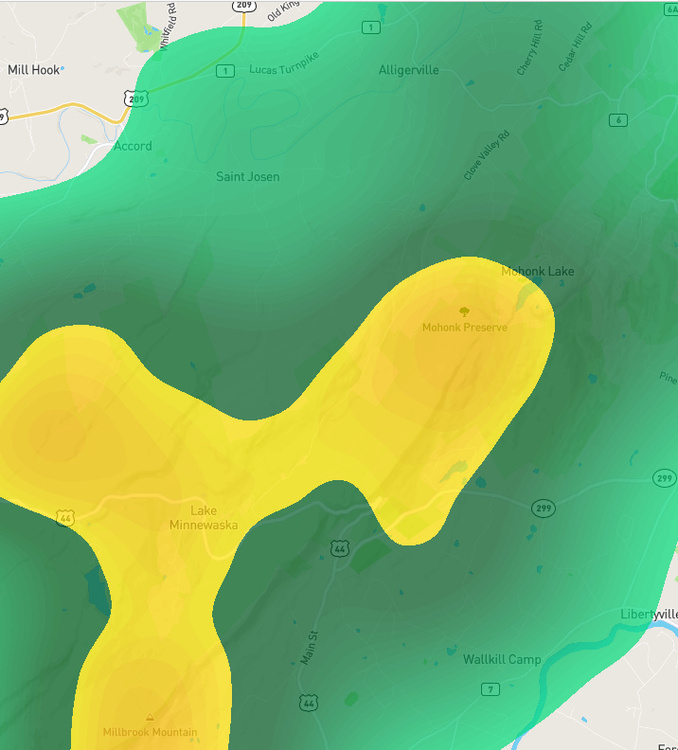 |
|
|
Lori Milaswrote: Just remember, in the famous words of Senator Joni Ernst, "We are all going to die!". That'll perk you right up in emergencies. |
|
|
John Gillwrote: 1898 was one of my best years. They had the best architecture. Now we're stuck with concrete and glass. |
|
|
Re phone droppage, I've found this to be a good product. Room for snacks and maybe diabetic stuff? The waist belt is especially secure compared to the usual fastex buckle rigs. https://avantclimbing.com/products/snack-pack 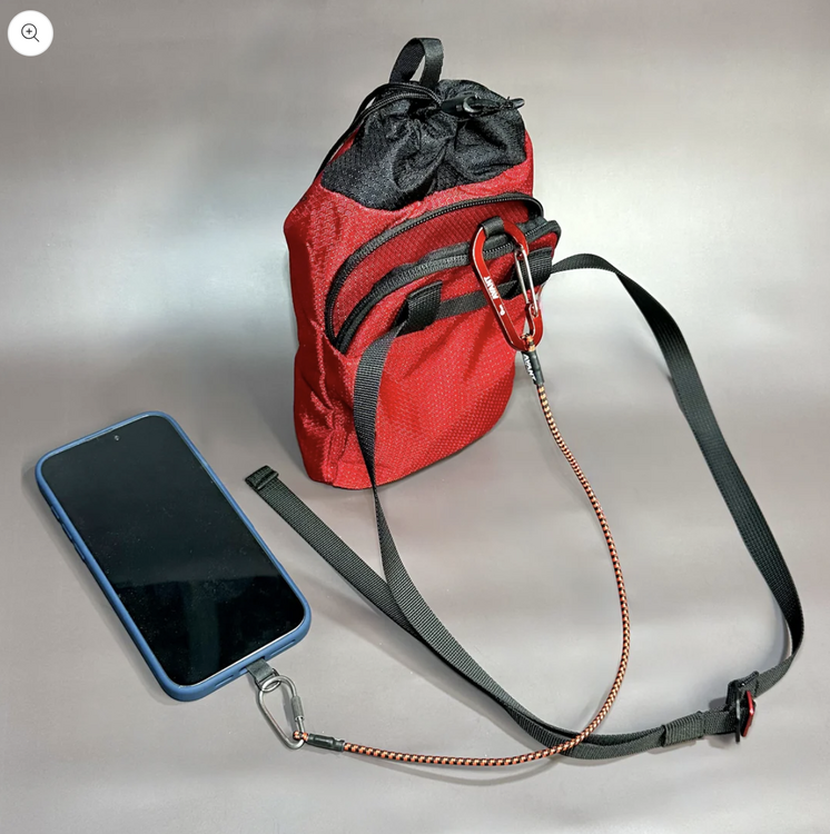 |
|
|
Lori Milaswrote: this is where my watch is my back up. phone then watch for map reading to nav. watch then inreach for SOS. I upgraded/downgraded from older inreach se+ to mini 2 (older delorme model) when the garmin Fenix and Epix had inreach integration... excuse me my nerd slip is showing..lol so depending on how much navigational help you want that's pretty integrated solution. this may be a matter of more orienteering-style navigation training vs technology (e.g. reading contour lines)? partner and I moved from one frozen water fall to another via my watch last winter, it kept us on azimuth deep in the mountain laurel of NC. example of map data on watch 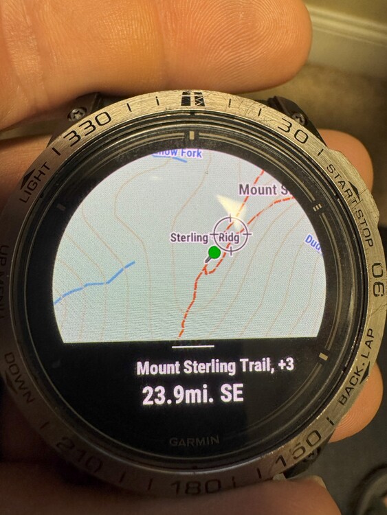 |
|
|
rgoldwrote: Thank you Rich! I just ordered it! I've been looking for something exactly like this! I was climbing with Dragons 1 or 2 weeks ago and I had a small Fish bag (that I use for my aid climbing hooks when aid climbing) attached to the back of my harness that my cell phone was in and I had to check the beta at one of the mid-climb belays. I stuck the phone back in the bag and finished the climb, rapped off, and then found out that I'd actually stuffed my phone into my active chalk bag and not the very similar Fish bag! Oooof! Not my finest hour! Thankfully the phone still works but this one that you linked seems like will be better for my phone, keys, ID, etc. on the multi-pitch climbs! And also yes, Dragons and I were rained out today at the Gunks! Damn! Really wanted to do Minty and Tipsy as they are the main ones that I want to lead prior to deep diving into the .5's! Oh well, there's always later next week, God willing and the creek don't rise! |
|
|
I'm on info overload again. Just really appreciate the input, I hope this is a topic that others can benefit from, too. I have reupped my InReach Mini2 subscription. Since it had expired, I have had to start over with the setup etc. But there is a "Messenger App" and an "Explorer App"... and then there is the device itself. I'll be relearning that. I like thinking of the inReach as 'redundancy'. As for navigation... has anyone tried ONX Backcountry through MP? Right now I am only wanting some basic navigation wherever I am. For instance, if I wanted to get from the Barker Dam parking lot to the AstroDome... I wonder if the nav on this app would get me there. Guess I have to experiment. |
|
|
Lori Milaswrote:
You absolutely don't want to approach the Astrodomes from the Barker Dam parking lot (or from Barker Dam). Too much scrambling, particularly if water is behind the dam. The approach is from Uncle Willie's dirt parking area; just a short distance further past the Barker Dam lot, taking a left onto the next dirt road. A direct and flat approach into the Southern Wonderland. |
|
|
Can OnX get me to the Bighorn Mating Grotto? Boy is that a tough one to find, amazing routes if you can find it |
|
|
I admit that I am very old-fashioned, but we had no trouble getting to the Astrodomes--and many other parts of JT ( not Bighorn Mating Grotto, though---never been there) just using the directions in Randy's original guidebook--possibly even a predecessor. I understand the value of current devices for emergency situations, but still prefer words and maps on paper to get around--walking or driving. Above, Jim U. mentioned 'orienteeering'---a venerable sport in certain places, especially the UK, I imagine that activity may now be on the 'endangered list', if not already extinct, as a result of today's electronics!!!! |