
 Continue with onX Maps
 Sign in with Facebook


Kawakawa Bay Rock Climbing
Use onX Backcountry to explore the terrain in 3D, view recent satellite imagery, and more. Now available in onX Backcountry Mobile apps! For more information see this post.
| Elevation: | 1,202 ft | 366 m |
| GPS: |
-38.6619, 175.86571 Google Map · Climbing Area Map |
|
| Page Views: | 35,717 total · 214/month | |
| Shared By: | Ryan Haeseley on Jun 27, 2011 | |
| Admins: | Cameron Fraser, Muscrat, Mauricio Herrera Cuadra |
Description

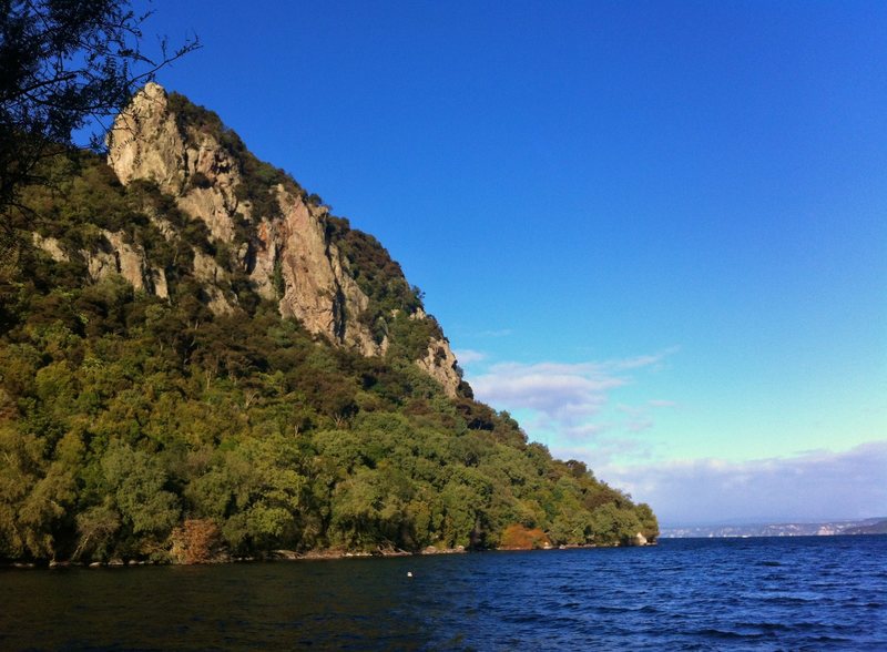
Kawakawa Bay is probably the best crag in the North Island featuring a good range of sport, trad and mixed routes that will appeal to climbers of all levels. If you dont find something that appeals to you here, youre probably in the wrong sport! At the eastern end of the bay stands a number or rhyolite cliffs towering over the lake's blue waters. Most routes are 1-3 pitches, although some are longer. The Bay still has many lines added to it every year, and there is no doubt that this will continue for years to come as only a fraction of the possible routes here have been established. Good rock quality and a large number of easy trad routes makes this a great place to learn to climb on gear.
There is a small grassy campsite on the shore of the bay that is free to use. It has basic facilities like a long drop toilet and a newly constructed shelter. Be sure to hang your food in trees (prussic cord is great for this) unless you want rats to eat it for you. They have been known to chew their way through tents and packs to get to food, you have been warned! At times you will be the only people in the campsite, giving it a wilderness feel, at other times there are dozens of boats parked in the bay and mountain bikers/ hikers galore (by New Zealand standards anyway).
Definitely worth a visit.
![]()
![]()
![]()
There is a small grassy campsite on the shore of the bay that is free to use. It has basic facilities like a long drop toilet and a newly constructed shelter. Be sure to hang your food in trees (prussic cord is great for this) unless you want rats to eat it for you. They have been known to chew their way through tents and packs to get to food, you have been warned! At times you will be the only people in the campsite, giving it a wilderness feel, at other times there are dozens of boats parked in the bay and mountain bikers/ hikers galore (by New Zealand standards anyway).
Definitely worth a visit.


Getting There
The Kawakawa Bay Walkway starts from Nisbet terrace in Kinloch. The walk takes around 2 hours staring from the western side of Whangamata bay then following the peninsula out and over to Kawakwawa bay. Water taxis can also be chartered from Kinloch if you don't want to walk in. They cost arround $80 for 4 people. Another option is to kayak in from Kinloch which is also much quicker than walking.
Topos

Guidebook Rock Deluxe North features a good seletion of the climbs at Kawakawa, but for a more comprehensive list refer to freeclimb.co.nz
Classic Climbing Routes at Kawakawa Bay
Mountain Project's determination of the classic, most popular, highest rated climbing routes in this area.


Weather Averages
|
High
|
Low
|
|
Precip
|
Days w Precip
|
Prime Climbing Season
| J | F | M | A | M | J | J | A | S | O | N | D |
| J | F | M | A | M | J | J | A | S | O | N | D |
Photos


All Photos Within Kawakawa Bay
Most Popular · Newest · RandomMore About Kawakawa Bay
Printer-FriendlyWhat's New
Guidebooks (1)


0 Comments