The Spillway/Camp 2 Bouldering
| GPS: |
38.9344, -105.4075 Google Map · Climbing Area Map |
| Page Views: | 13,279 total · 59/month |
| Shared By: | Aeon Aki on Jun 18, 2007 |
| Admins: | Leo Paik, John McNamee, Frances Fierst, Monty, Monomaniac, Tyler KC |
 Access Issue: Seasonal Raptor Closures January 1- July 31st, 2016-2021
Details
Seasonal Closures in effect January 1-July 31st, 2016-2021.
For details visit:
fs.usda.gov/Internet/FSE_DO…
Maps:
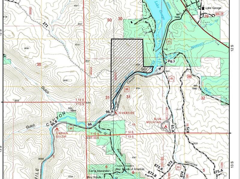
fs.usda.gov/Internet/FSE_DO…
fs.usda.gov/Internet/FSE_DO…
Contact phone number: (719) 553-1400.
Description

A plethora of seemingly untouched, free standing, granite boulders with mostly soft, flat landings.
Getting There

The Spillway campground is 8 miles up the dirt road after the fee station. Camp 2 is one of the first sites on the right after you enter the parking lot and is marked appropriately with a "2" on the picnic table. There are several problems found in the camp itself and the rest can be found by walking up the hill through the site.
Classic Climbing Routes at The Spillway/Camp 2
Weather Averages
|
High
|
Low
|
|
Precip
|
Days w Precip
|
| J | F | M | A | M | J | J | A | S | O | N | D |
| J | F | M | A | M | J | J | A | S | O | N | D |
Photos
All Photos Within The Spillway/Camp 2
Most Popular · Newest · RandomMore About The Spillway/Camp 2
Printer-FriendlyWhat's New
Guidebooks (13)

 Continue with onX Maps
 Sign in with Facebook


3 Comments