|
|
rgold
·
Jun 27, 2018
·
Poughkeepsie, NY
· Joined Feb 2008
· Points: 526
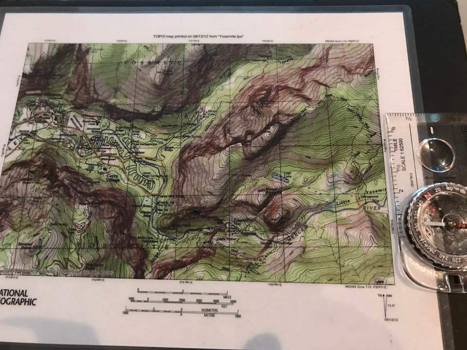
Some additional remarks. Don't use anything but a baseplate compass (with rotating bezel) that has a built-in declination adjustment. You set it for your locale and don't have to worry about declination any more until you move to a new locale sufficiently far away to require a new declination. (But don't think you can ignore declination and pretend magnetic north is true north if you really have to navigate with your compass.) The baseplate compasses simplify calculations and procedures and really should be the only game in town for back country orientation.
Staying found in a place like J-Tree with a map and compass requires continual attention, taking of bearings, pace-counting---far more than most people will want to devote to the process, unless there are easily-recognized landmarks you can use. At the very least, you should frequently turn around and look back to understand what your route will look like when retracing it. A step beyond that is to try to informally keep track of your wandering on a map. In any case, no compass procedure comes anywhere close to the ease of GPS methods for such terrain. I've spent weeks in alpine back country like the Wind Rivers and never needed to do anything but glance at a map, but in the desert, even for a single-day outing , I carry a GPS and extra batteries if going off-trail or if there is any chance of being benighted.
|
|
|
Andrew Rice
·
Jun 27, 2018
·
Los Angeles, CA
· Joined Jan 2016
· Points: 11
rgold wrote: Some additional remarks. Don't use anything but a baseplate compass (with rotating bezel) that has a built-in declination adjustment. You set it for your locale and don't have to worry about declination any more until you move to a new locale sufficiently far away to require a new declination. (But don't think you can ignore declination and pretend magnetic north is true north if you really have to navigate with your compass.) The baseplate compasses simplify calculations and procedures and really should be the only game in town for back country orientation.
Staying found in a place like J-Tree with a map and compass requires continual attention, taking of bearings, pace-counting---far more than most people will want to devote to the process, unless there are easily-recognized landmarks you can use. At the very least, you should frequently turn around and look back to understand what your route will look like when retracing it. A step beyond that is to try to informally keep track of your wandering on a map. In any case, no compass procedure comes anywhere close to the ease of GPS methods for such terrain. I've spent weeks in alpine back country like the Wind Rivers and never needed to do anything but glance at a map, but in the desert, even for a single-day outing , I carry a GPS and extra batteries if going off-trail or if there is any chance of being benighted. Rgold is dead right about J-tree. At least the parts that interest us rock climbers. Man, you can get really turned around in places and the consequences of getting lost there are a lot higher than most other places.
|
|
|
John Barritt
·
Jun 27, 2018
·
The 405
· Joined Oct 2016
· Points: 1,083
Lori Milas wrote: Some ten year olds found her bones there in the desert, 15' from the trail with little packets of mustard laying all around her body, clutching her Boyscout Orienteering manual. Re-Fixed it...... ;)
|
|
|
Lori Milas
·
Jun 27, 2018
·
Joshua Tree, CA
· Joined Apr 2017
· Points: 250
Here’s what I’m thinking. I’m thinking Jeff Constine should consider paying back to society by offering an Uber helicopter service to and from the crags of choice. That way some of us can avoid learning map and compass skills...win-win.
|
|
|
Lori Milas
·
Jun 27, 2018
·
Joshua Tree, CA
· Joined Apr 2017
· Points: 250
Señor Arroz wrote: Rgold is dead right about J-tree. At least the parts that interest us rock climbers. Man, you can get really turned around in places and the consequences of getting lost there are a lot higher than most other places. Oh my gosh! So it’s not just me? I’m so glad you guys said this. I was feeling really stupid for getting SO lost so quickly—and in the heat. I’ll bet they have special orienteering classes in the desert FOR the desert. Perhaps that’s something to consider in the fall when I return. I’ve noticed the locals really know their rock and native herbs and wildlife.
|
|
|
John Barritt
·
Jun 27, 2018
·
The 405
· Joined Oct 2016
· Points: 1,083
Lori Milas wrote: Oh my gosh! So it’s not just me? I’m so glad you guys said this. I was feeling really stupid for getting SO lost so quickly—and in the heat. I’ll bet they have special orienteering classes in the desert FOR the desert. Perhaps that’s something to consider in the fall when I return. I’ve noticed the locals really know their rock and native herbs and wildlife. It's all in the manual.....Some locals know more about herbs than others....they are usually the first ones to get lost..... ;) My friend Brian got lost every trip he ever made into Charon's gardens alone....pretty sure it was the local herbs....and, everything looks the same there too.....
|
|
|
Andrew Rice
·
Jun 27, 2018
·
Los Angeles, CA
· Joined Jan 2016
· Points: 11
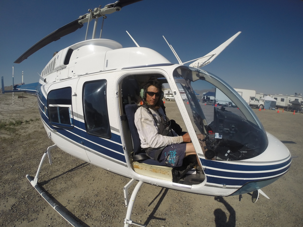
Lori Milas wrote: Here’s what I’m thinking. I’m thinking Jeff Constine should consider paying back to society by offering an Uber helicopter service to and from the crags of choice. That way some of us can avoid learning map and compass skills...win-win. If only he were a helicopter pilot.
|
|
|
Jeffrey Constine
·
Jun 27, 2018
·
Los Angeles, CA
· Joined May 2009
· Points: 674
I've played in the woods mountains and deserts long before GPS, never needed any maps or GPS to this very day. You can use it I prefer to rely on myself, I'm still here. ;)
|
|
|
Lori Milas
·
Jun 27, 2018
·
Joshua Tree, CA
· Joined Apr 2017
· Points: 250
Señor Arroz wrote: If only he were a helicopter pilot. This is Jeff's opportunity to serve humanity. I believe he knows how to fly.
|
|
|
Andrew Rice
·
Jun 27, 2018
·
Los Angeles, CA
· Joined Jan 2016
· Points: 11
Lori Milas wrote: This is Jeff's opportunity to serve humanity. I believe he knows how to fly. Oh, he does. Just not the way you imagine.
|
|
|
Jeffrey Constine
·
Jun 27, 2018
·
Los Angeles, CA
· Joined May 2009
· Points: 674
|
|
|
Lori Milas
·
Jun 27, 2018
·
Joshua Tree, CA
· Joined Apr 2017
· Points: 250
John Barritt wrote: Re-Fixed it...... ;) Yes, that flows better. And is probably more accurate. You know if it actually happens, it's all on you. Some kind of mustard inhalation.
|
|
|
Old lady H
·
Jun 27, 2018
·
Boise, ID
· Joined Aug 2015
· Points: 1,375
Nivel Egres wrote: I actually had a trip to BC scheduled as a birthday present to myself, but with the pulley injury I cancelled it :( Eh, what about the rest of the body parts!! If you only have one bit AWOL, at any given moment, you're waaayyyy ahead of me, sir! Happy birthday anyway, huggsess and kissesses and all that jazz if ya go in for that sorta thing.
Don't set off the smoke detector when the candles are lit. I turned 50 and my kid turned 13, a few days apart, so we had quite a bonfire going on our shared cake.
Best, truly, happy birthday and heal well, Helen
|
|
|
Carl Schneider
·
Jun 27, 2018
·
Mount Torrens, South Australia
· Joined Dec 2017
· Points: 0
Lori Milas wrote: Took an REI Map and Compass class last night which didn't go so well. In two hours we learned how to shoot a bearing with an adjusted declination, and triangulate our location.
Ok, really... does anyone use a map and compass?
This summer is about safety. There's a follow up 5 hour field Navigation class later this month. So far, completely overwhelmed...
I LOVE compass/map navigation. We used to use old prismatic compasses when I was in the army, this was WAY before GPS systems. I think map to ground navigation is a real art, and learning the differences between true north, grid north and compass north and how to convert a grid bearing to a magnetic bearing and vice versa is a good challenge that gets the brain working. I think heading out with a map and compass (and also a GPS or your phone for confirmation) and using the map and compass can add a fun factor to your trips. However, that being said, I'm a nerdy little fellow, so I might be quite alone with those thoughts
|
|
|
Lori Milas
·
Jun 28, 2018
·
Joshua Tree, CA
· Joined Apr 2017
· Points: 250
Carl Schneider wrote: I LOVE compass/map navigation. We used to use old prismatic compasses when I was in the army, this was WAY before GPS systems. I think map to ground navigation is a real art, and learning the differences between true north, grid north and compass north and how to convert a grid bearing to a magnetic bearing and vice versa is a good challenge that gets the brain working. I think heading out with a map and compass (and also a GPS or your phone for confirmation) and using the map and compass can add a fun factor to your trips. However, that being said, I'm a nerdy little fellow, so I might be quite alone with those thoughts I think it's all backwards down there. Upside down. That could explain your confusion.
They have an army there? For what? No doubt as protection from the next stupid thing we do here in the US.
|
|
|
John Barritt
·
Jun 28, 2018
·
The 405
· Joined Oct 2016
· Points: 1,083
Lori Milas wrote: I think it's all backwards down there. Upside down. That could explain your confusion.
They have an army there? For what? No doubt as protection from the next stupid thing we do here in the US. To protect the people in the event of civil unrest...... ;)
|
|
|
Lori Milas
·
Jun 28, 2018
·
Joshua Tree, CA
· Joined Apr 2017
· Points: 250
rgold, senor, dallas... helen, (everyone) thanks for the wealth of advice. rgold, I ordered the book. It looks great. Will get the correct compass and some starter maps. I can practice on my son's property up in Truckee, which backs up to the Pacific Crest Trail. I'm envious of the climbers I see cutting through his property to climb a beautiful mountain about 5 miles away on foot.
Jeff's helicopter never showed up, so I guess we have to do this the old fashioned way. "Earn it".
BTW, googled JTree classes, and there are many. Sounds like it's a whole different skill set, but one that would be nice to have. Maybe could work in a few classes on rest days.
REI has a 2-hour GPS class for the Garmin. The instructor's feeling was that it's worth it to go to the full screen (rather than the mini)... not sure all the reasons yet, except battery life of 100 hours.
|
|
|
FrankPS
·
Jun 28, 2018
·
Atascadero, CA
· Joined Nov 2009
· Points: 276
Lori Milas wrote: rgold, senor, dallas... helen, (everyone) thanks for the wealth of advice. rgold, I ordered the book. It looks great. Will get the correct compass and some starter maps. I can practice on my son's property up in Truckee, which backs up to the Pacific Crest Trail. I'm envious of the climbers I see cutting through his property to climb a beautiful mountain about 5 miles away on foot.
Jeff's helicopter never showed up, so I guess we have to do this the old fashioned way. "Earn it".
BTW, googled JTree classes, and there are many. Sounds like it's a whole different skill set, but one that would be nice to have. Maybe could work in a few classes on rest days.
REI has a 2-hour GPS class for the Garmin. The instructor's feeling was that it's worth it to go to the full screen (rather than the mini)... not sure all the reasons yet, except battery life of 100 hours.
The Mini does not have maps on it, so you must pair it with your phone for navigation. I don't want to bring my phone in the backcountry. So I will use the standalone Explorer+.
|
|
|
John Barritt
·
Jun 28, 2018
·
The 405
· Joined Oct 2016
· Points: 1,083
I keep thinking about the 50# pack......what could be in there that would add up to 50 lbs.? No rope or rack yet.......hmmmm.......
Important medical supplies, insulin, meter etc. 1/2 lb.
Shoes 1/2 lb.
Harness 1/2 lb.
Full chalk bag 1/2 lb.
Locker, belay device, couple biners 1/2 lb.
Helmet (with stickers and gold star) 2 lbs.
Lunch 1/2 to 3/4 lb.
Gallon of water 7 lbs.
Sunblock (unopened) 1 lb.
keys, wallet, phone 1 lb.
576 2 oz. mustard packets, 36 lbs.
TOTAL 50 LBS.
Disclaimer: The author makes no claims as to the actual weights of any the items listed above in the fictious list, all items listed above are imaginary and intended for satirical purposes only. Said list should not be considered an actual packing list for a desert climbing trip although some items may or may not be useful........... ;)
|
|
|
Chris Little
·
Jun 28, 2018
·
Albuquerque N.M.
· Joined Jul 2017
· Points: 0
John Barritt wrote: I keep thinking about the 50# pack......what could be in there that would add up to 50 lbs.? No rope or rack yet.......hmmmm.......
Important medical supplies, insulin, meter etc. 1/2 lb.
Shoes 1/2 lb.
Harness 1/2 lb.
Full chalk bag 1/2 lb.
Locker, belay device, couple biners 1/2 lb.
Helmet (with stickers and gold star) 2 lbs.
Lunch 1/2 to 3/4 lb.
Gallon of water 7 lbs.
Sunblock (unopened) 1 lb.
keys, wallet, phone 1 lb.
576 2 oz. mustard packets, 36 lbs.
TOTAL 50 LBS.
Disclaimer: The author makes no claims as to the actual weights of any the items listed above in the fictious list, all items listed above are imaginary and intended for satirical purposes only. Said list should not be considered an actual packing list for a desert climbing trip although some items may or may not be useful........... ;)
I recommend some Tabasco to go with the mustard. No sandwich recipe is complete w/o either. IMO.
|

 Continue with onX Maps
 Sign in with Facebook