
 Continue with onX Maps
 Sign in with Facebook


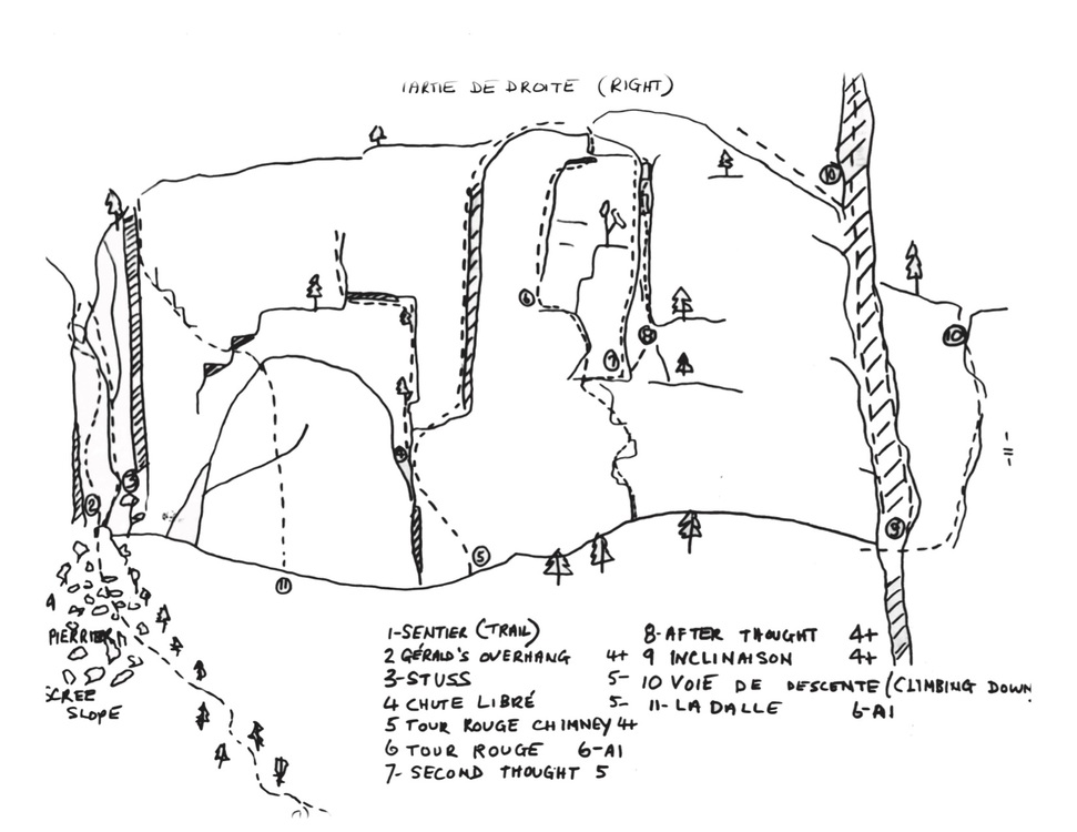
| Type: | Trad, 2 pitches |
| GPS: | 45.56191, -73.17479 |
| FA: | John Turner 1958 |
| Page Views: | 536 total · 8/month |
| Shared By: | petzl logic on Mar 26, 2020 |
| Admins: | Richer Lariviere, Luc-514 |
Your To-Do List:
Add To-Do ·
Your Star Rating:


Use onX Backcountry to explore the terrain in 3D, view recent satellite imagery, and more.
Now available in onX Backcountry Mobile apps! For more information see this post.
 Access Issue: It is illegal to climb there at the moment.
Details
Access Issue: It is illegal to climb there at the moment.
Details
Mont-Saint-Hilaire was closed to climbing in the mid 90's following a dispute with a local guiding company.
The Gault Nature Preserve has decreased its access since this period, access to XC Skiing is being stopped for the 18-19 season.
Any un-authorized access will further limit our ability to climb there again.
The Gault Nature Preserve has decreased its access since this period, access to XC Skiing is being stopped for the 18-19 season.
Any un-authorized access will further limit our ability to climb there again.
Description

Impossible to know as it can't be seen and we will never have access because it is on private preserve land and in someone else backyard.
This line required more care of not dropping rocks than technical climbing.
Impossible de le savoir car elle ne peut pas être vu et nous n'y avons plus l'accès car elle se trouve sur la réserve privé et dans la cour de quelqu'un d'autre.
Cette voie exige plus de soins pour ne pas faire tomber les roches que l'escalade technique.


1 Comment