Which brings back us to Mt Neva. Comments online run the gamut from ‘not too bad’ to ‘we turned back, YGD!’ (Climber-speak for ’Yer Gonna Die!’). I began to wonder if this particular scramble was too much for my failing bodily equipment, and if it would be wise to find a companion for safety’s sake, but insecurity is exciting, and exciting is just what my doctor ordered.
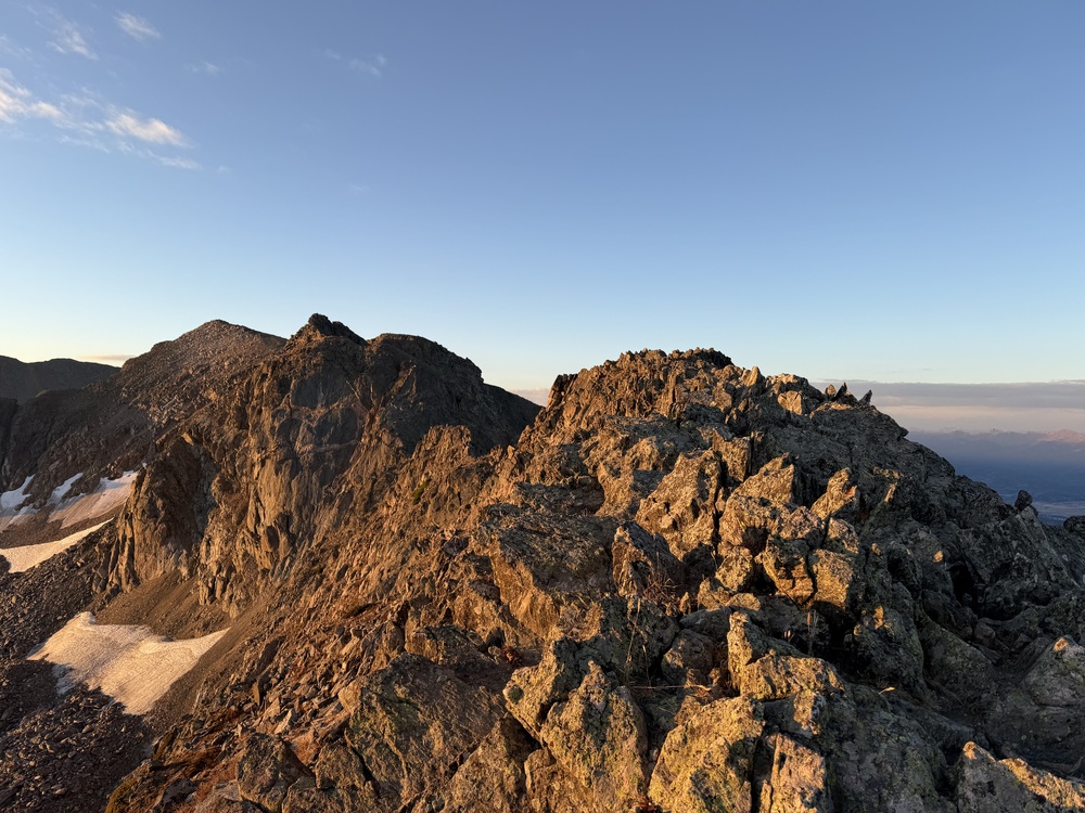
The North Ridge of Mt Neva begins on the far right, following the skyline left.
I discarded that idea as soon as it entered my head. In the last several years I’ve taken pride in my solo ventures in the deserts of Utah and Arizona, as well as the mountains of Colorado. Beginning with Grand Gulch in Bears Ears, Death Hollow and numerous slot canyons in Escalante, Grand Canyon rim to rim, the Blue Lake Traverse in the Indian Peaks, and this spring finishing two additional backpacks in Cedar Mesa. Over three days I hiked the trail-less canyon just east of Slickhorn to the San Juan River (Ranger: “No one ever goes there! We want a full report when you get back.”) and then along the river and out Slickhorn Canyon. Day 1 was like a desert escape room with massive boulders, pour-offs, log jambs, quicksand, and water wading which covered 17 miles, but to be fair I was only aged 62 at the time. Two weeks later I hiked the Fish & Owl loop, one of the most beautiful circuits I’ve ever done. If I could navigate these, I should be able to still manage a Class 4 ridge at elevation, or worst case scenario, realize when I’m over my head and turn around after a pleasant few hours.
I don’t carry a Spot or other GPS device as a rule, partly because I enjoy being fully aware and responsible for my own safety, but also because they’re just too expensive; I already expect to work until I turn 70. My job is physical and demanding, and I’m at a point where I realize that I could leave for a job one morning and not return; the same thing can be said for my outdoor travels. I’m okay with this, I could use the rest.
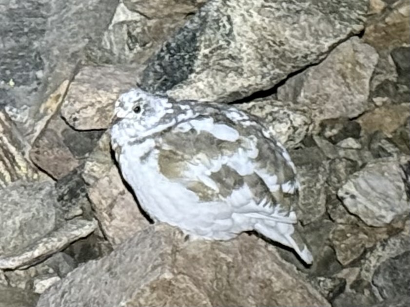
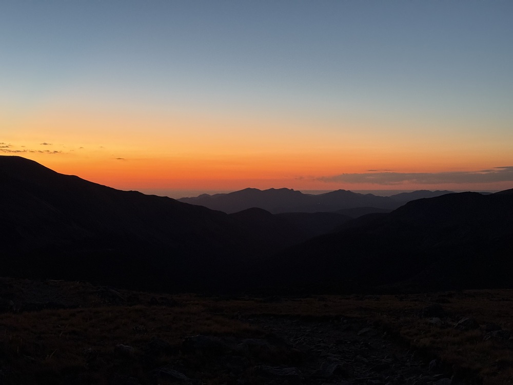
I leave the Fourth of July trailhead by headlamp, ascending slowly through stunted trees under a flood of stars. A ptarmigan drums to my right, her feathers half brown and half in her winter coat of white. As the sun starts to crest the eastern horizon in brilliant orange and red, I turn off the headlamp and get my first up close view of the ridge running from Arapaho Pass south to Neva’s summit. It indeed looks imposing, but I trust a comment from the route description in Mt Project which says it’s no big deal. These are climber comments and I still think of myself as a climber, and so I trust them; my kind of people.
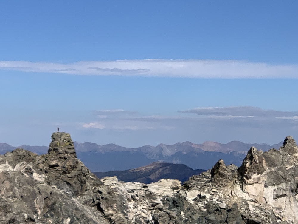
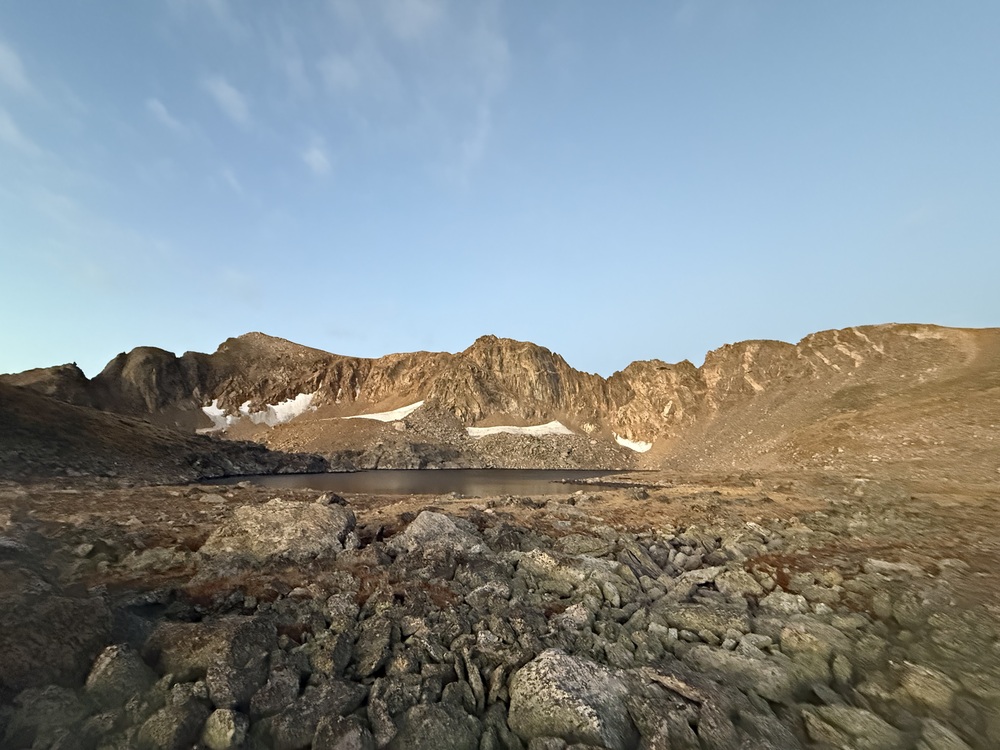
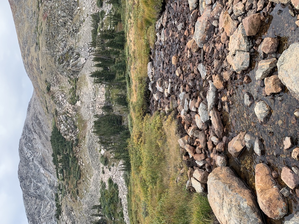
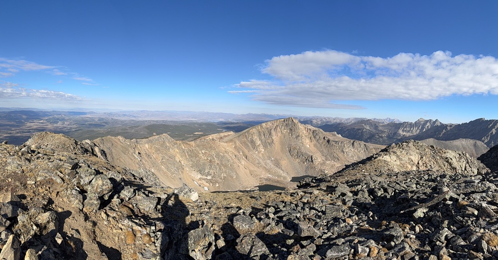
Walking around Lake Dorothy, the highest lake in the Indian Peaks, leads me to a low angle talus field leading up to the ridge proper atop the Continental Divide. The route ahead is obvious, bordered on the East by rocky slabs and cliffs dropping off to Lake Dorothy, and to the west down steep slopes of tundra with spectacular views of Winter Park, Grand Lake, and endless peaks fading off into the distance. The line of least resistance follows the apex between these two sides via steep hiking and boulder-hopping until I scramble up a crest and find myself looking down at a 30’ drop of technical fifth class that would require a rappel to negotiate.
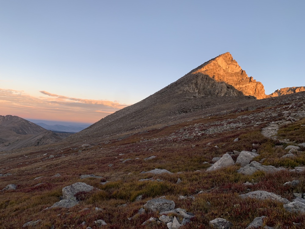
Sunrise over Lake Dorothy from the start of the route
I backtrack 20 yards or so and spy a series of ledges circumventing this gendarme to the left, perched precariously above the steep east facing slabs. Walking carefully along these ledges so as not to slip on patches of lichen or loose soil soon puts me back on the knife edge under the backside of the rock tower. Several other gendarmes and high points along the ridge ahead require similar trickery, but whenever possible I follow the crest, as this is why I’m here.
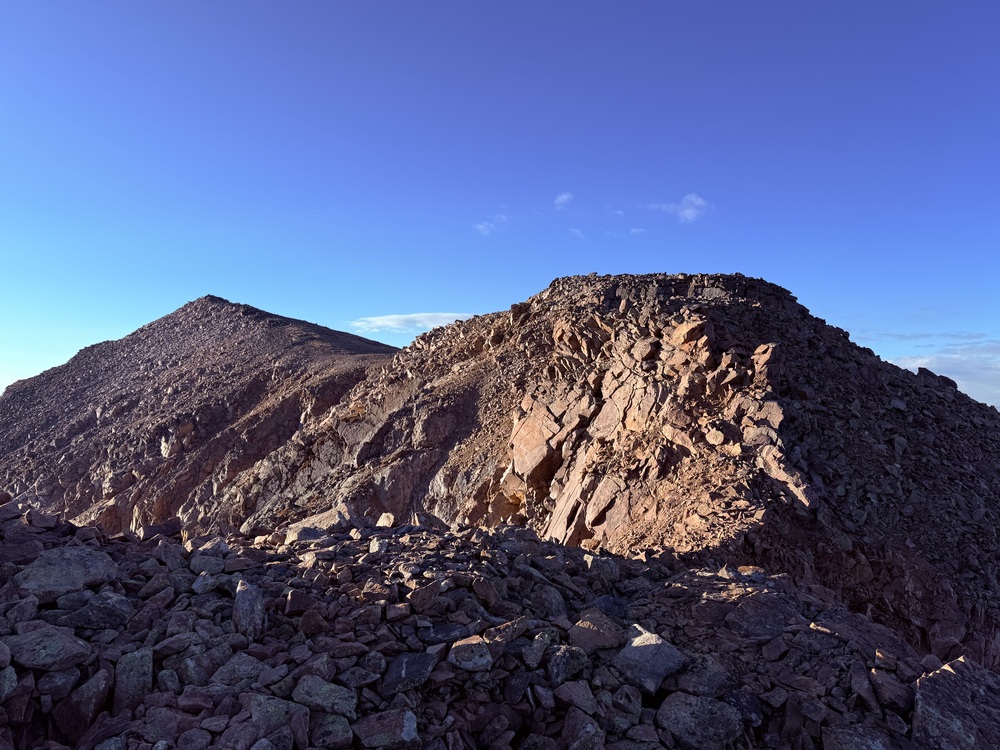
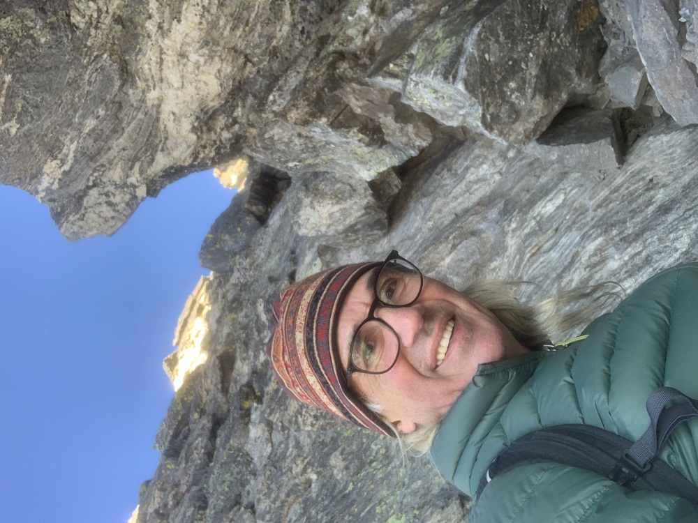
Beginning the route.
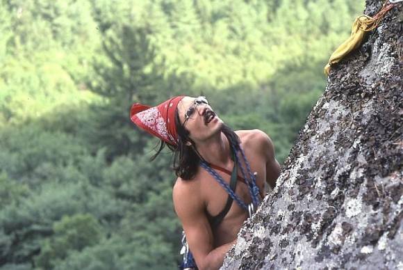
The exposure increases as I approach the crux, a well documented 40’ of steep fourth class slab hanging out over a 600’ drop on the east face. As I pause to examine the cliff band and choose my preferred line, I hear my Dad’s voice from 50 years ago in my head. “You can never do that.”
I had just finished 8th grade, and returned home with a stellar report card and a brochure that detailed summer break activities abroad; I thought the former would support the latter. One program in particular had grabbed my attention, a guided climb of a mountain in the Alps. Dad had previously pointed out Mt Washington and promised to hike it with me, but never did and never would, so I made my play to climb a summit without him. “Don’t be stupid. You can never do that. You’re afraid of heights and we don’t have the money.” Tact was not in Dad’s playbook, but he spoke the truth. I was notoriously afraid of heights, paralyzed by recurring dreams of falling through space, and my parents never gave me money for anything without giving a similar amount to each of my three siblings. He worked at a lumber yard and there was just no way, but it would have been nice if he could have told me without crushing my spirit.
Out of spite I took his rebuke as a personal challenge, and in the following years I read everything that I could related to climbing and scrambled around on local boulders and small cliff bands that I could ride my bike to. I acquired a fair amount of skill by practicing techniques from the books, but still could not dispense with the fear. I almost gave up when I received a National Geographic magazine in the mail that detailed the first clean ascent of the Regular Route on the NW Face of Half Dome, and I got physically ill looking at a picture taken from above the Zig Zags.
I was in community college at the time, and in an act of desperation sent away for a self-hypnosis cassette that I listened to every night as I fell asleep. Two years later I would lead those Zig Zag pitches and set up a semi-hanging belay above them at the start of Thank God Ledge, and looking down I knew that I was no longer a prisoner of my fear. Dad passed away just last year, leaving me a raging case of arthritis in both thumbs, the now dormant alcoholic tendencies, and a mile wide stubborn streak as my inheritance. I’m perfectly imperfect, and grateful for everything that he was able to give to me, things that make me who I am.
“Someone I loved once gave me a box full of darkness. It took me years to understand that this, too, was a gift." - Mary Oliver
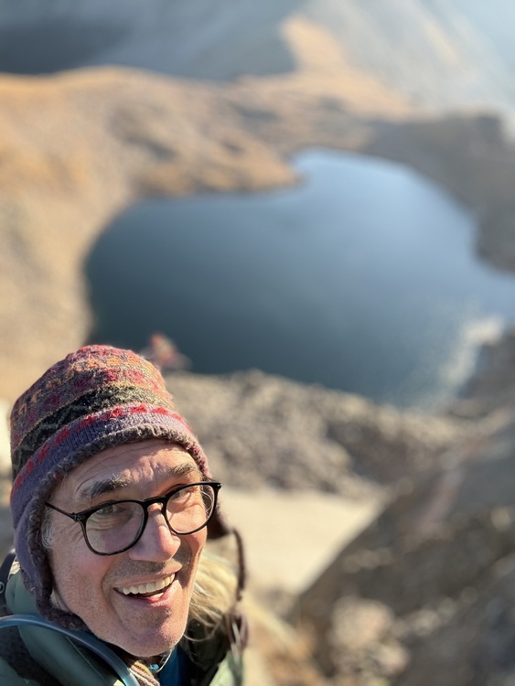
So here I was, alone and exposed, and I pushed the word ‘never’ out of my mind. These things are rarely as bad as they are made out to be, and that was the case here. I found the moves to be easy fourth class and the exposure exhilarating, so much so that I paused halfway to take a selfie. It felt good to flow over the surprisingly solid stone, focused and in control.

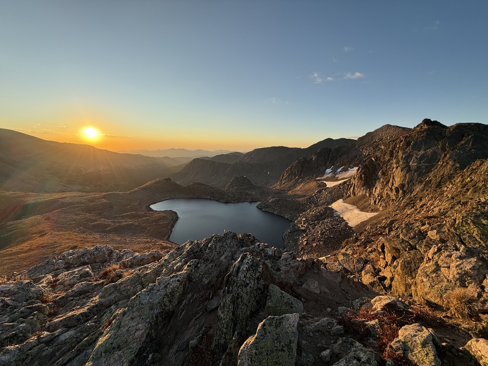
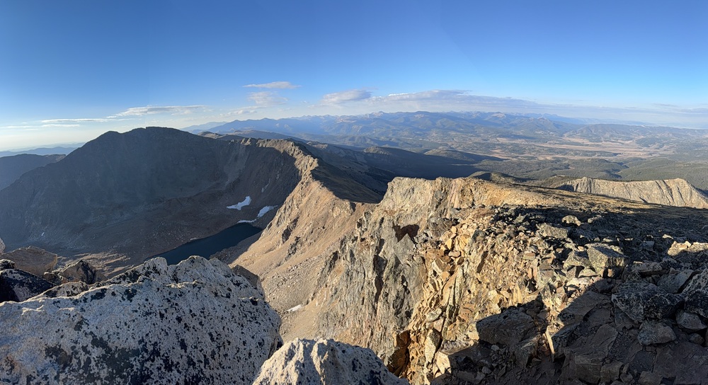
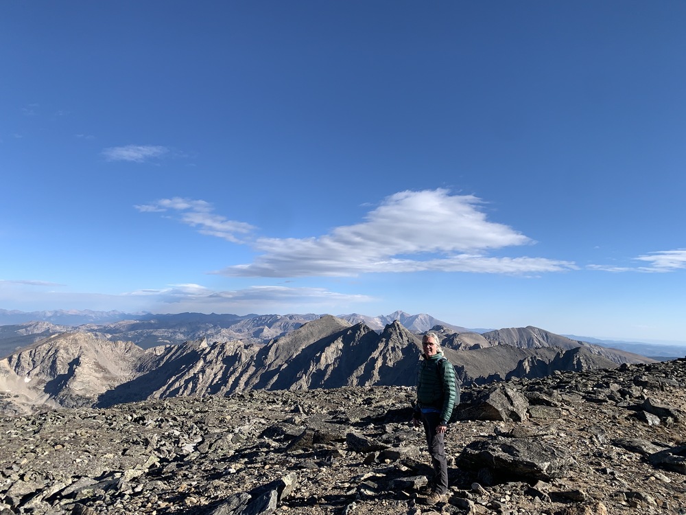
High over Lake Dorothy.
The crux was over far too soon, and led me to a rounded knife edge ridge of rotten, loose rock where the angle lessened. I paused here to eat some electrolyte tablets as a precaution; I had suffered severe leg cramping the month prior halfway through the Arapaho Traverse, likely from limiting salt intake to help reduce chronic high blood pressure. The setting of the ridge here is magnificent, and I pass the tops of numerous gullies entering from the east that make fine snow climbs in earlier months. Finally, after almost a mile of travel since I had first gained the ridge line, the route turns to steep slopes of tundra and rock angling up to the summit and a brief rest.
Past the crux.
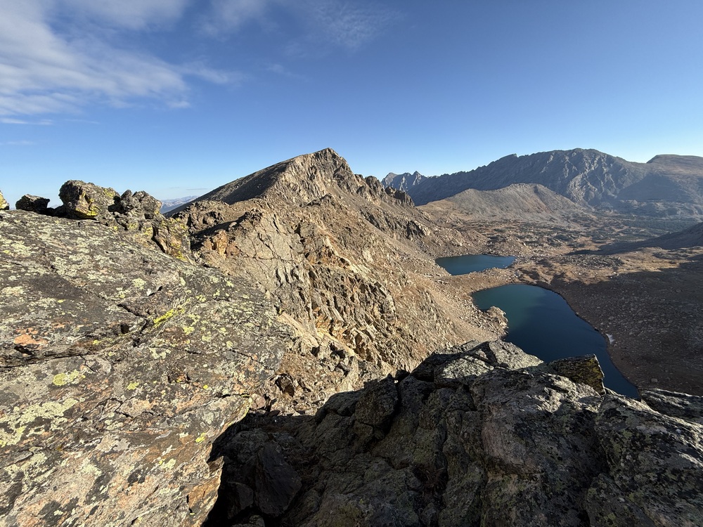
Both of my guide books had suggested a descent to the east just south of Neva’s summit, but now that I see the ridge in its entirety I know that won’t happen. A beautiful, sweeping curve of class 2-3 ridge extends out for just over a mile to the ramparts of Mt Jasper, and it’s calling my name. It’s 8:25 am, I’m feeling strong, and I have read absolutely nothing about the route ahead or the descent off of Jasper.
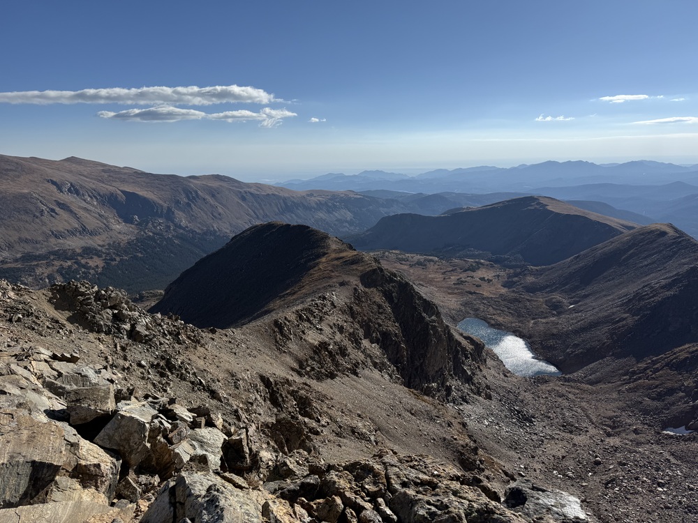
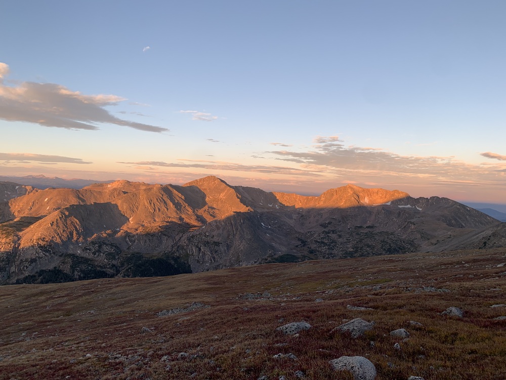
The traverse ridge leading to Mt Jasper, in shadow on the left skyline.
“Discovery consists of seeing what everyone else has seen, but thinking what no one else has thought.”
I think I’ll discover a new way home.
I must sacrifice elevation by dropping west, skirting cliff tops along the way, to access the mile and a quarter long undulating spine of rock and tundra leading south. The way forward is not difficult, but it’s engaging with unparalleled views both left and right. Two lakes appear in the eastern cirque, hidden from most vantage points in the Fourth of July valley, and unnamed on the topo map that I’m carrying. Jasper is higher than Neva, and the wind, which had been gentle all day, picks up, blowing loose strands of hair into my mouth. When the ridge line ends and morphs into the summit cone, I notice my breathing is becoming more labored. I’ve been playing at just under 13k feet for a while this morning, and find myself stopping more frequently before reaching the confusing summit.
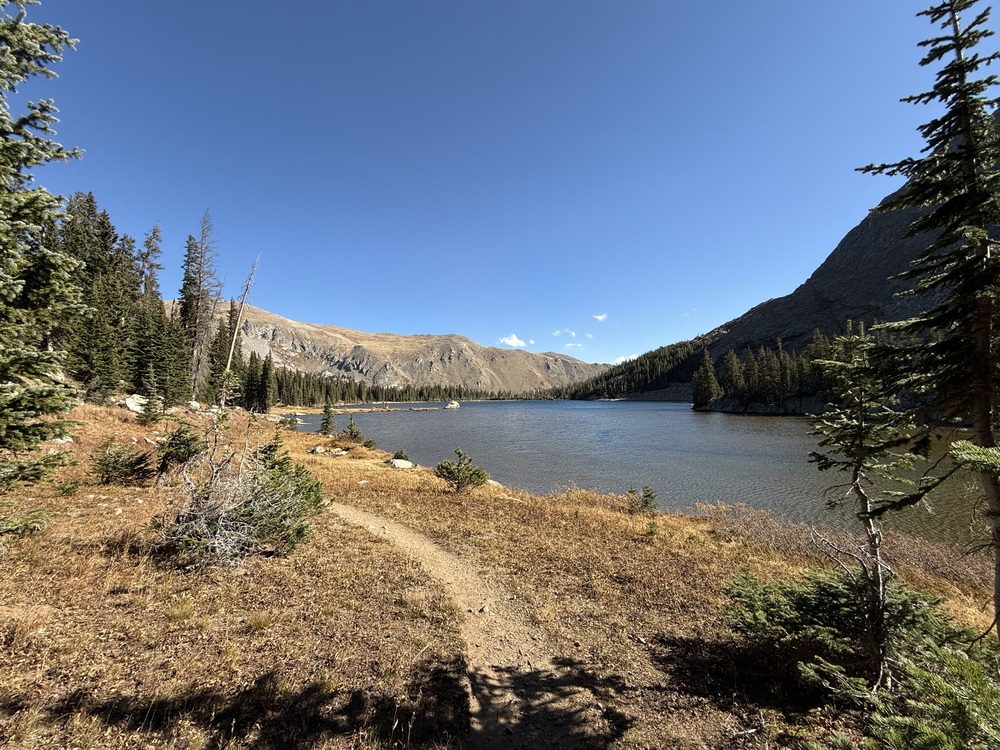
There are several rocky promontories that could be the actual peak, so I pick one and pull out a hair tie and the topo map. The easiest walking continues south to Devils Thumb Pass, but puts me one valley over from where I’m parked. There are three prominent ridge lines extending into the Fourth of July valley; the one trending southeast looks long, hard to access, and with a great deal of elevation change up and down. The two ridges running northeast and east both share a common start before splitting, heading into two separate cirques. I choose the east trending ridge because I can see it passing Upper Diamond Lake about half way down and know I can pick up a trail there.

 Continue with onX Maps
 Sign in with Facebook