
 Continue with onX Maps
 Sign in with Facebook


El Capitan conditions spring 2023


|
|
Kevin DeWeese wrote: Awesome. Thanks Kevin |
|
|
I'm getting a decent amount of questions about how safe I think the East Ledges descent is these days - the descent is super easy in the snow. Water running down the cracks of the route you are trying to climb will be much, much more difficult than walking through snow for a couple hours and getting your feet wet. |
|
|
Anyone have an update? |

|
Photo from Sunday April 23rd, water running down in numerous places. We went to Chapel Wall in the afternoon, could see lots of snow at the top. Horsetail fall is running pretty good and there is another small waterfall to the left of it. 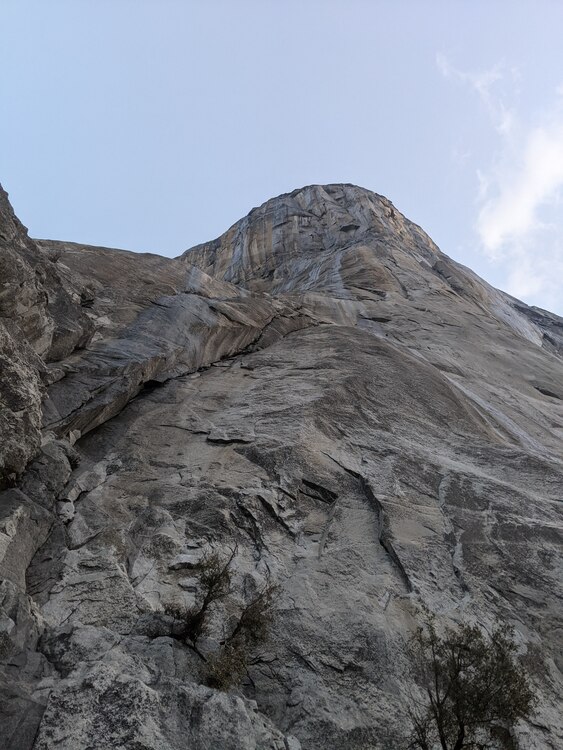 |
|
|
Wet, wet, and some more wet. |
|
|
Looks like valley is closed from 4/28 to 5/3 for anticipated flooding. |
|
|
If I read the notice correctly, El Cap will be open (but manure pile closed, so anyone wanting to top out will have to walk back (potentially through ankle deep water) to their car at the meadow. |
|
|
Steph Evanswrote: Much of it, yes. From the Yosemite Flooding thread:  |
|
|
Some info I got from Park Rangers today via email. I'm arriving in the Valley on Sunday 4/30 to solo Zodiac and asked some questions about approach, permits, and parking: "At this point the closures don't affect areas of the park west of El Cap bridge, so you should be able to access Zodiac via the Nose trail. If access to the permit kiosk is not possible due to floods, I'd say it's safe to assume you can go without one although we haven't released any official announcement about this. In regards to parking, as long as you steer clear of "no overnight parking" signs you should be good, although I cannot speak to whether or not your car will be safe from flooding. A couple things to consider with these floods: The park has not announced any restrictions on recreation but is encouraging people to limit risky activity since emergency services will be impacted by the floods and response times will be slower than normal. The road will likely be very flooded near the parking for the Zodiac talus approach, so it might be a challenge (or even be impossible) to walk back to your car if you descend to the manure pile buttress. We haven't received any reports of recent east ledges descents. The conditions may be very slippery/snowy. It also may be impossible or very dangerous to cross horsetail creek in order to access the east ledges. This is all speculation, but definitely something to consider. Upper falls trail is an alternative descent route, but that trail may also be very snowy still. If you do make it down the east ledges or the falls trail, we would love to get a conditions report! I hope that helps, and please keep an eye on official park updates (on the Yosemite website or on their social media channels) in the coming days in case things change. Best, Yosemite Climbing Rangers" |
|
|
Wow. Thanks for the updates. Please keep them coming Edit: Thanks for that Sam. Please give us the whole low down, if you go for Zodiac. I'll bet crossing Horsetail at the top would be cruxy. Also, the rangers are still using "Manure Pile".... Dudes, it is "Ranger Rock" |
|
|
Yosemite Valley is closing but El Cap is staying open......it's a Sign Yo! Woot Woot! |
|
|
Thanks Alison, Question for the group: I'll have 2 crushingly heavy loads to shuttle down after I solo Zodiac, which of these egress options would you choose: 1) hike loads the long way around via Big Oak Flat Road. I'm planning on having waterproof mountaineering boots, gaiters, and micro spikes with me, but oh man, that's a long hike after a week on the wall 2) rap Zodiac: this would have the advantage of not needing to top out with all my gear, and I would be familiar with where all the belay stations are, though the very overhanging pitches will require down aiding, and since I'm solo, I'll have to rap down, secure rope, jumar back up, then rap with the pig unless it's dead straight. I can't pendulum for crap with a big pig between my legs. 3) rap a different route (Nose? Something else on the West side?) which offers more straightforward and slabby descent. Re-ascending the rope on a slabby section is soooo much easier |
|
|
Shuttle your loads down the east ledges. All above options are not advised. Wait till the flooding stops. |
|
|
S Twrote: See the message from Ranger Alison above, my firend. East ledges descent is currently closed. I bet it'll be open by the time I top out, but, you know, I need a backup plan. |
|
|
Good luck out there! |
|
|
Rapping lurking fear would be a good bet for getting down with east ledges closed. For Sam’s case, rapping with heavy loads solo would still be time consuming ..but comparably much easier than zodiac! |
|
|
Hi Everyone, I have another update. Sorry for the back and forth--things are ever-evolving around here! 1. We were just notified that the East Ledges are going to be OPEN during the closure since it's the only viable descent off El Cap, which is open. After descending, please stay off the road as you make your way back to El Cap meadow, and you should expect significant flooding in that area. 2. You must get a self-registration permit, even during the closure when the valley is closed. You can get one from our kiosk in front of the wilderness center on Friday 4/28 before 10pm, or you can get one at a self-service kiosk at the arch rock entrance station, which will be there 24/7 beginning Friday 4/28. I'm going to delete my previous post that said the East Ledges are closed to prevent any confusion. If you have any questions you can always reach us by email at yose_climbing at nps dot gov |
|
|
You're probably correct that everything will be back open when you top out. I wouldn't try those options with heavy packs - just stash your stuff on top, hike around with a reasonable load and then when it's open get a buddy to go back up and help you get everything down via the East Ledges. |
|
|
Will be on the nose may 14-17th and very excited about the ever changing logistics. Thank you guys for the continued updates and I can post a little trip report on here as well. Cool to think we have plenty of snow to melt for water on top! Cheers yo, -Millz |
|
|
Hey folks. Correct me if you think I am wrong. But it seems to me you have got 1.) rim runoff from snow on the summit slabs, 2.) waterfalls (e.g. Horsetail), and 3.) water coming through in seeps via El Cap's internal plumbing. I would wager that 2 and 3 will be active for a long time. My question is, how long before 1 is melted out and over? Like for the last pitches of Tangerine Trip or Zodiac to be dry? Also, is the Valley likely to close again next week with warming temps? Cheers from Osaka, John |


