
 Continue with onX Maps
 Sign in with Facebook


Double Vision Wall Rock Climbing

| Elevation: | 5,965 ft | 1,818 m |
| GPS: |
31.92031, -109.99825 Google Map · Climbing Area Map |
|
| Page Views: | 2,176 total · 49/month | |
| Shared By: | adrian montaño on Apr 16, 2021 | |
| Admins: | adrian montaño, Greg Opland, Brian Boyd, JJ Schlick, Kemper Brightman, Luke Bertelsen |
Description

Far up and left when looking at the Tombstone sits a distinctive, huge, & smooth neon shield of rock high above the valley floor. This dome is named for the two obtuse aretes that become apparent when the afternoon light hits the wall just right.
"Quiet, solitary, and not frequented except by a handful of folks who'd surely prefer to maintain that feel. With that in mind, please tread lightly, respect other users and those who came before you" in regards to anywhere in & around Hands Canyon.
This wall was first published in Bob Kerry’s guide Backcountry Rock Climbing in So. AZ, and hosts several DDC routes one of which is listed in the guide (Fool’s Errand), as well as great views of the Rockfellows, & all the West side domes.
There are rap bolts with slings on most of the climbable spires thanks to DDC having climbed them. If you're curious about what has and hasn't been climbed, reach out. Modern routes will be shared here.
Getting There
Approach time anywhere between 1-1.5 hours, depending on if you take the path of least resistance & how many headwalls stop progress if turning left out of the drainage too early. That being said, please do your best to stay on rocky clearings and in the drainage so as to minimize the impact on the surrounding vegetation. It's wild being up there, and that remote feeling can certainly be maintained if we do our part to follow leave no trace principles as best we can. I express this importance in an effort to pass on the sense of value of Cochise to other climbers. Please, please tread lightly.
Park and approach as for the Tombstone (straight shot from the West through the wash) but before leaving the wash for the steeper switchbacks, turn left towards a cluster of geometric boulders on the North side of the Tombstone. Continue past the Tombstone on the left & continue through a rocky clearing to gain the drainage heading up and right towards the saddle right of Double Vision Wall. When in doubt, stay in this drainage. Took a couple trips to dial in.
If you are too far left while heading up hill, several headwalls may block progress. Grovel up boulders through the drainage, when just shy of the saddle, at the elevation of the base of the wall, head left towards it. When you encounter granite slabs on your left, you can leave the trees, & you'll be standing on top of the little headwall below Double Vision, & the wall will be looming overhead. Scramble up the low angle slab/mini chimney to get to the base of the routes.
I concur with what I was told before my first visit, there’s no cruiser way up there.
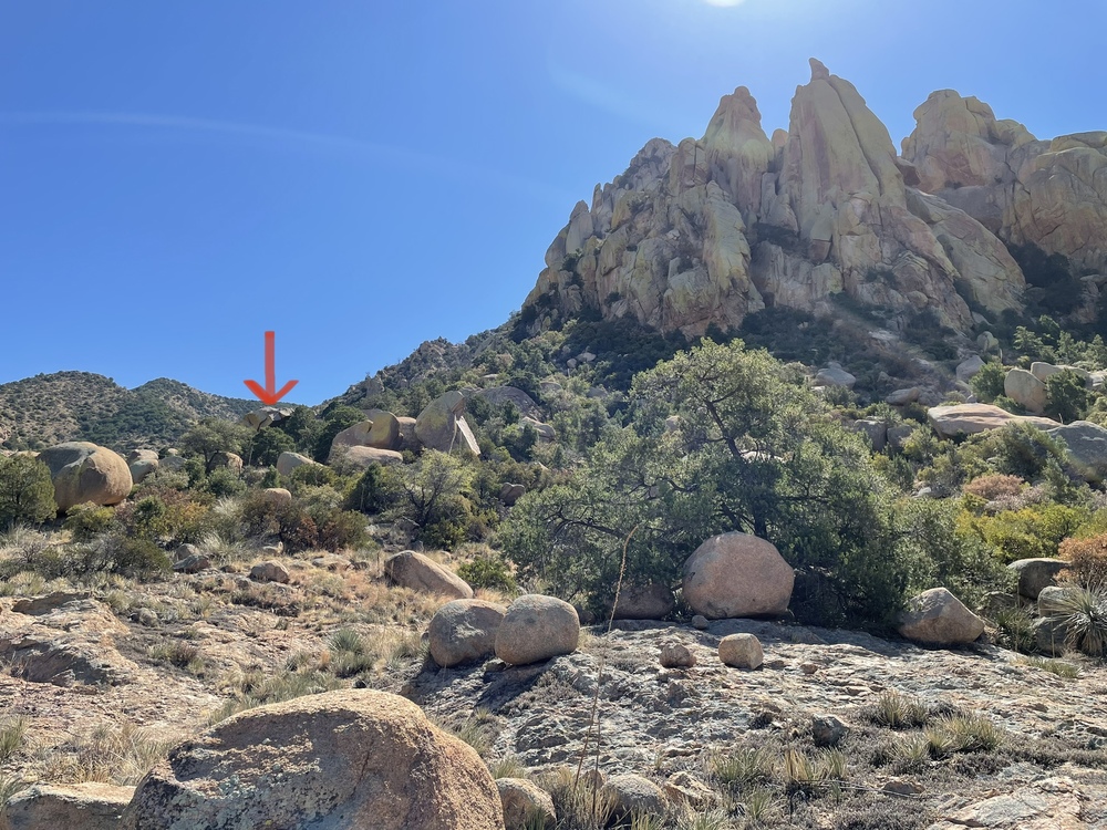

the geometric boulder with the Tombstone & Double Vision Wall visible
Weather Averages
|
High
|
Low
|
|
Precip
|
Days w Precip
|
| J | F | M | A | M | J | J | A | S | O | N | D |
| J | F | M | A | M | J | J | A | S | O | N | D |
Photos


All Photos Within Double Vision Wall
Most Popular · Newest · RandomMore About Double Vision Wall
Printer-FriendlyWhat's New
Guidebooks (12)


0 Comments