
 Continue with onX Maps
 Sign in with Facebook


Kanagawa Wall Climbing
| Elevation: | 8,590 ft | 2,618 m |
| GPS: |
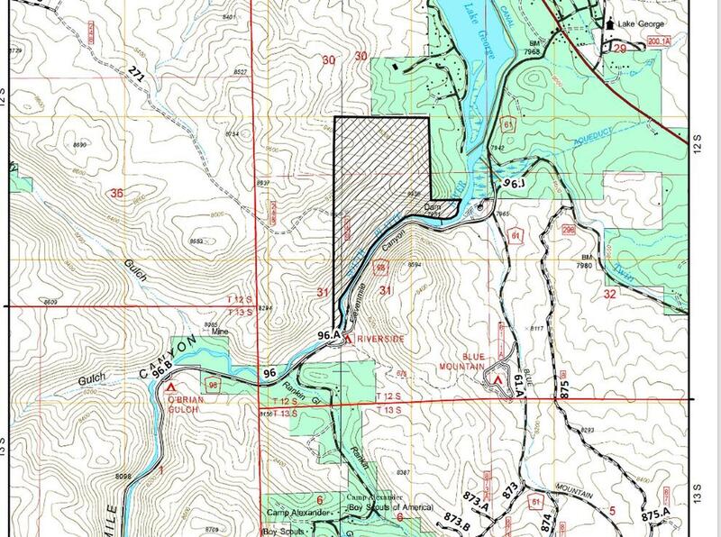
38.90917, -105.41456 Google Map · Climbing Area Map |
|
| Page Views: | 825 total · 12/month | |
| Shared By: | Adam bloc on Sep 15, 2020 | |
| Admins: | Leo Paik, John McNamee, Frances Fierst, Monty, Monomaniac, Tyler KC |
 Access Issue: Seasonal Raptor Closures January 1- July 31st, 2016-2021
Details
Access Issue: Seasonal Raptor Closures January 1- July 31st, 2016-2021
Details
Seasonal Closures in effect January 1-July 31st, 2016-2021.
For details visit:
fs.usda.gov/Internet/FSE_DO…
Maps:
fs.usda.gov/Internet/FSE_DO…
fs.usda.gov/Internet/FSE_DO…
Contact phone number: (719) 553-1400.
Description

Named for its resemblance to the famed Japanese painting, this wave of rock catches the eye of anyone driving along Wagon Tongue. This is quickly becoming a stand out crag of SoCo, already hosting some of the hardest climbing in the area, with some projects left to boot. If you're tired of the Spray Wall scene, already sent everything at Heaven's Gate, or just looking for good cragging among the aspens; this is the place for you. Like many crags around, the rock can be crunchy at times, but the movement always fun and athletic.
Getting There
This area really lies outside the canyon proper and is briefly visible while driving along Wagon Tongue Gulch Rd. (FS 393). It is accessible from both the North (from the canyon) and the South (from Blue Mtn. Rd. / County Rd. 98). One can avoid the fee or tie in a day of fishing or climbing at other crags. It lies to the east of the road halfway along Wagon Tongue (~2.5 miles from both the canyon and County Rd. 98). Walk or drive a rough spur road that leads practically underneath this wall. A few spectacular campsites exist around this area.
Caution: the crag lies on Forest Service Land, but some nearby roads lead to private property. If you see any signage, turn around.
Weather Averages
|
High
|
Low
|
|
Precip
|
Days w Precip
|
| J | F | M | A | M | J | J | A | S | O | N | D |
| J | F | M | A | M | J | J | A | S | O | N | D |
Photos


All Photos Within Kanagawa Wall
Most Popular · Newest · RandomMore About Kanagawa Wall
Printer-FriendlyWhat's New


0 Comments