All Locations >
California
> Eastern Sierra
> Southern Area
> Indian Wells Ca…
> Owens Ridge
> Owens Ridge N Face
Rock II - North Face Rock Climbing
Use onX Backcountry to explore the terrain in 3D, view recent satellite imagery, and more. Now available in onX Backcountry Mobile apps! For more information see this post.
| Elevation: | 6,300 ft | 1,920 m |
| GPS: |
35.7266, -117.9667 Google Map · Climbing Area Map |
|
| Page Views: | 2,348 total · 15/month | |
| Shared By: | Chris D on Oct 16, 2011 | |
| Admins: | Aron Quiter, Euan Cameron, Mike Morley, Adam Stackhouse, Salamanizer Ski, Justin Johnsen, Vicki Schwantes |
Description

Rock II is the middle of three "rocks" on Owens Ridge that contain most of the long, developed routes. The rock sees little sun, as it's aspect is generally northeast-facing. The rock is granite, and is generally of the worst quality that most would consider worth climbing on. Still, it's a fantastic and beautiful location.
Getting There

Owens Ridge is accessed by driving to the parking area for the Owens Peak Trail, as described in the Indian Wells Canyon area entry.
From the parking area, walk down into the bottom of the canyon, then climb about 1,000 feet on loose soil and talus up ridges and along game trails to get to the rock, aiming for the left-center of the south face of Rock II.
The South Face of Owens Ridge. Middle Saddle is between Rocks I and II, but approach it from the base of Rock II to avoid difficult terrain.
When you are near the base of the rock, begin countouring to your right, aiming for the Middle Saddle, which is between Rocks I and II. Approaching the saddle from directly below instead of from along the base of Rock II will get you into cliffs that are difficult to get around.
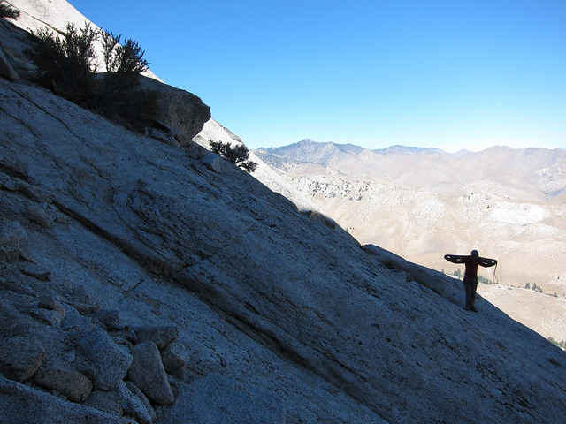
From Middle Saddle, descend to the north between Rocks I and II. This descent is characterized by steep, loose, dangerous talus and sand surrounded by steep slab covered with ball-bearing gravel. Be careful.
The slab and talus descent to The Forest from Middle Saddle
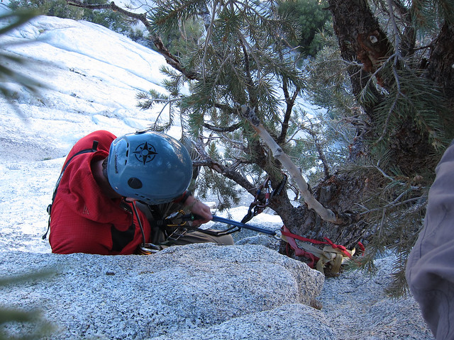
Sticking to the flowing band of talus, and keeping as far to the left as possible, you'll eventually come to a point where fourth-class downclimbing is required to reach a tree with some tat and a rap-ring. This tree permits an 85-foot rappel to "The Forest," a collection of trees and shrubs on a huge sloping ledge. Most of the routes on the North Face of Rock II begin in The Forest.
Setting up the rappel to The Forest.
Weather Averages
|
High
|
Low
|
|
Precip
|
Days w Precip
|
Prime Climbing Season
| J | F | M | A | M | J | J | A | S | O | N | D |
| J | F | M | A | M | J | J | A | S | O | N | D |
All Photos Within Rock II - North Face
Most Popular · Newest · RandomMore About Rock II - North Face
Printer-FriendlyWhat's New

 Continue with onX Maps
 Sign in with Facebook


0 Comments