
 Continue with onX Maps


ID 118179931 ·
·
Copyright Violation?


Rate Photo

Heliodor Jalba
Dec 25, 2019
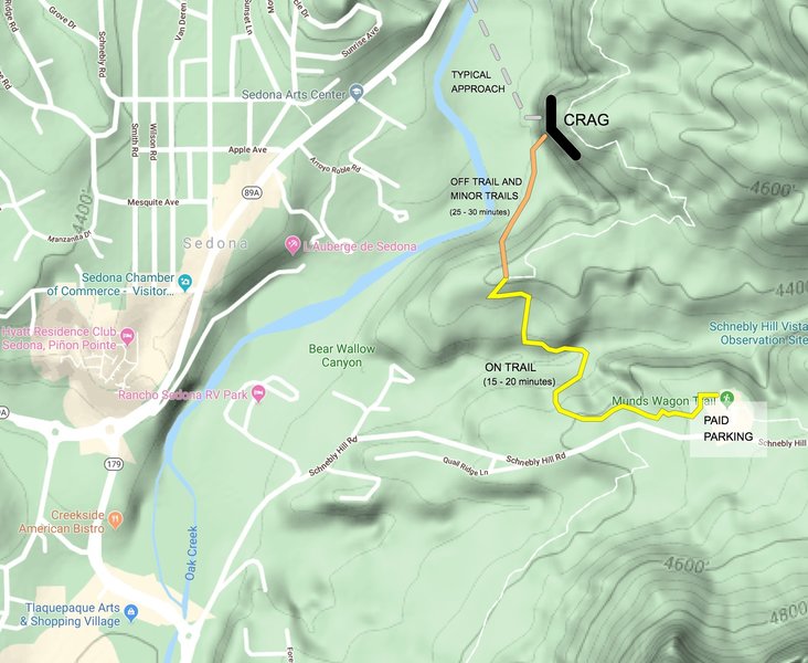
“Alternate approach using the Huckaby hiking trail, in case the water level in Oak Creek is too high to cross. Goes off-trail at lat/long 34.868938, -111.754062. See comment for more details.”


1 Comment