
 Continue with onX Maps
 Sign in with Facebook


Any interest in 3D printed mountains?
- Do not use PayPal "gift" payments, wire transfers, Western Union, etc.
- Use PayPal credit card payments, or other systems that protect you from fraud.
|
|
Hi there! I’ve been experimenting with 3D printing mountain terrain and overlaying GPX tracks from climbs. Here are prints of Mount Everest and a Mount Baker climb (red path = route). Would anyone be interested in 3D prints like this to commemorate your own climbs?  |
|
|
Nice! I did a print of devils tower with the arcgis data. |
|
|
Eli Chasewrote: Oooh do you still have the file? Would love to print this too. Thanks! |
|
|
Xan Mihalaswrote: I’ll try and get it uploaded to printables today. (Cat for scale)  |

|
In Europe you can buy 3D printed maps of the alps that people hang on their walls as art/trip planning devices. Super handy. I wish we had something like that here. A 3D map of the local mountains would be awesome. |

|
I would for sure buy a 3D version of the abajos in s utah |
|
|
Graham Johnsonwrote: I can make a 3D printable terrain map of anywhere on earth! If you give me the coordinates of the local mountains you're talking about, I can see if I can create one! |
|
|
Eli Chasewrote: That's a great print! I'll have to refine my code and see if I can get that level of detail! Cory Nwrote: Interesting idea! I made one to see what it could look like: 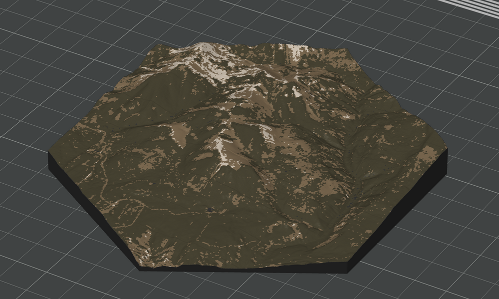 I used these coordinates: 37.87914° N, 109.50526° W, and a radius of 5km. It could easily be anything, though. I could also exaggerate the terrain. MB MB wrote: Thanks for asking! I’m still working out the exact pricing, but here’s a rough idea based on size and color options: 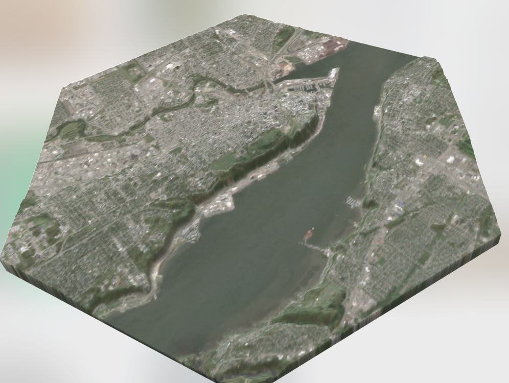 |
|
|
Haha that’s rad!! Ok took me a few seconds to figure out where I was, but that’s looking S at Foy Lake! Let’s DM a bit on location and where it would be. What does it mean to exaggerate the terrain? Are there options for which base map to use for coloring? Where does this spring/early summer coloring come from? |
|
|
Would you do el cap or half dome? This is a neat idea |
|
|
Cool! 24cmx24cm seems small - could you do bigger? Like 100 cm x 100 cm? So I could hang it on the wall like a piece of artwork? |
|
|
I would be very interested in this as well. Probably my number 1 pick would be Mount Rainier. But I would want something more in the 400mm range with good detail. Still trying to decide whether I would want to add gpx files in the 3D print or just hand draw the lines after. |
|
|
I would buy one of Ship Rock for sure |
|
|
Cory Nwrote: Message sent :D Christian Vasquezwrote: I absolutely could! I made one of half dome. Were you thinking of something like this? 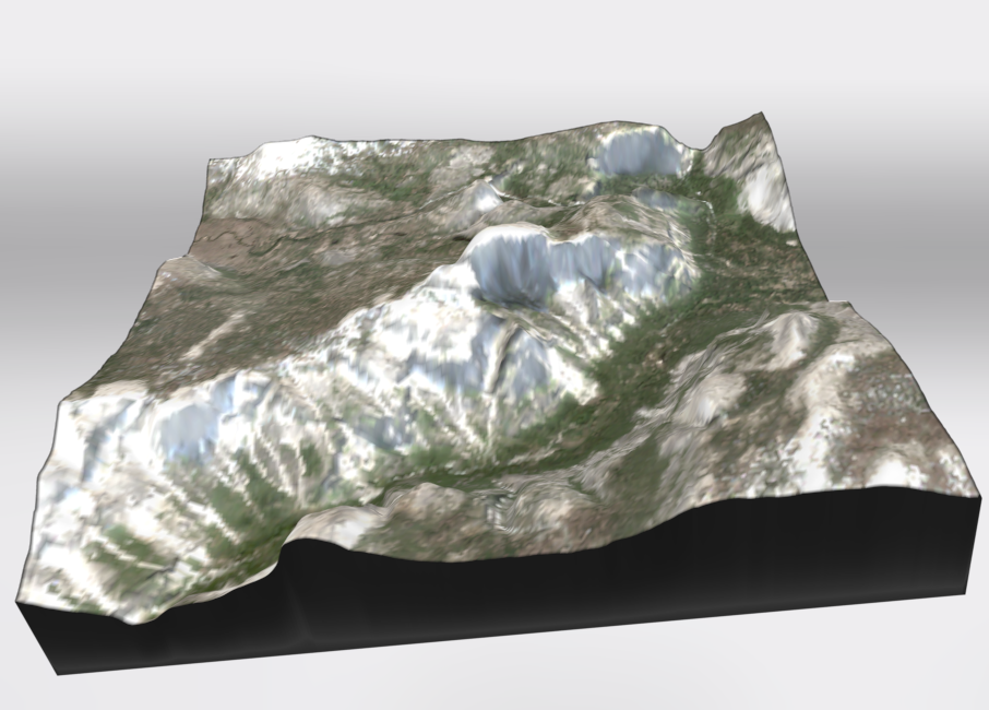 Graham Johnsonwrote: Yes it could! That's a great idea. Marlin Thormanwrote: Great idea! I think a 400 mm print with good detail is definitely possible, but I’ll need to double-check with my supplier to make sure they can produce high-detail prints at that size. If not, we could always split it into tiles so the final piece is just as large. As for the GPX files, I can absolutely add those directly into the model. If you send me the tracks, I can extrude the route slightly so it stands out from the surface—subtle but easy to see. Or if you’d prefer a cleaner model with no routes on it, hand-drawing them afterward works too. Totally up to you! |


