
 Continue with onX Maps
 Sign in with Facebook


Full Evolution Crest attempt July 2025
|
|
My friend Dave Schultz and I just got back from an attempt on the Evolution Crest Traverse. We started at Bishop Pass and exited at Lamarck Col. We decided to write separate reports since it'd be fun to see how we describe things differently, so be on the lookout for his report! Overall this was a delightful wonderful fulfilling fantastic highly enjoyable time out in the wilderness :):) It wildly surpassed my expectations, which is really saying something given that they were already completely off the charts. 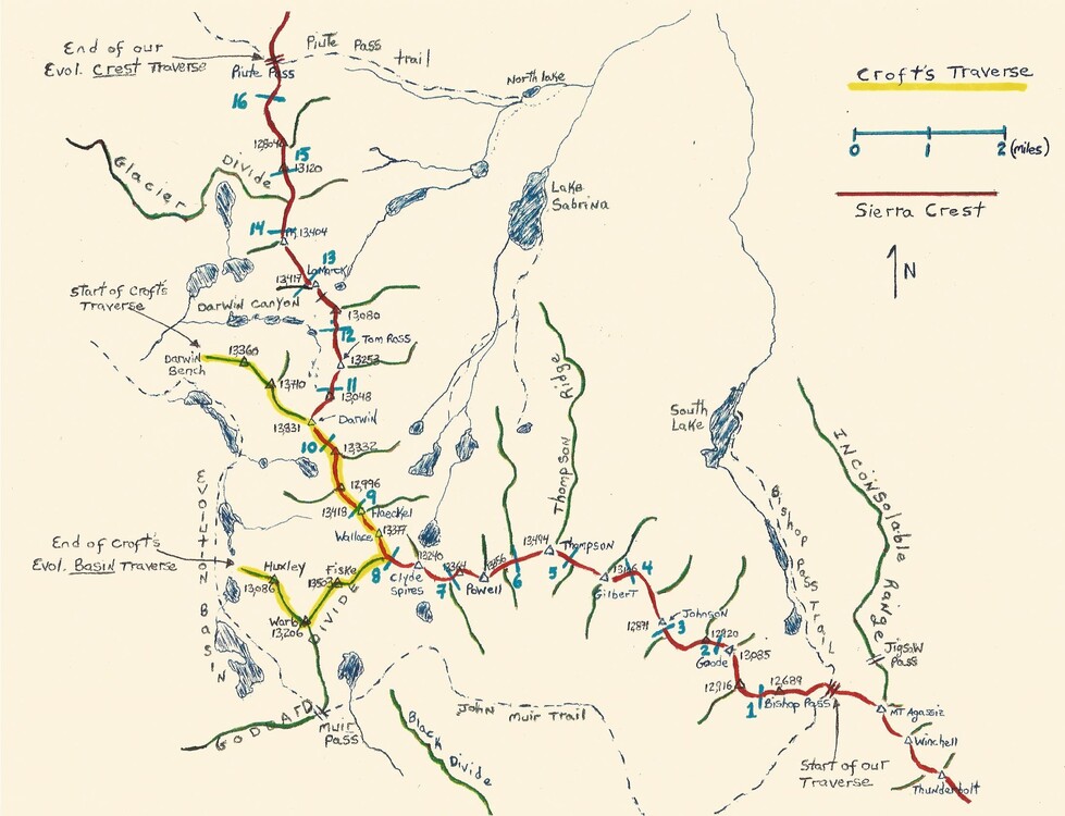  It wasn’t quite ideal — I hadn’t gotten many big endurance days out this year yet, but at least had been climbing rock a bunch. In contrast, Dave hadn’t climbed much rock lately at all but had recently completed a thirty-hour bike race so he was in good shape. We felt confident and decided to go for it anyway, of course! Day 1: Trailhead to Treasure Col This day we hiked to Bishop Pass and climbed through Mt. No Goode, Mt. Goode, Trapezoid Peak, and Mt. Johnson. I recall passing most features on the left-hand side. In fact, this persisted across subsequent days and the theme of the entire route seemed to be “pass mostly on the left”. Compared to the other days this day had the least amount of technical terrain, I think? Unfortunately, this night I popped my sleeping pad so it ended up being rather cold and uncomfortable. 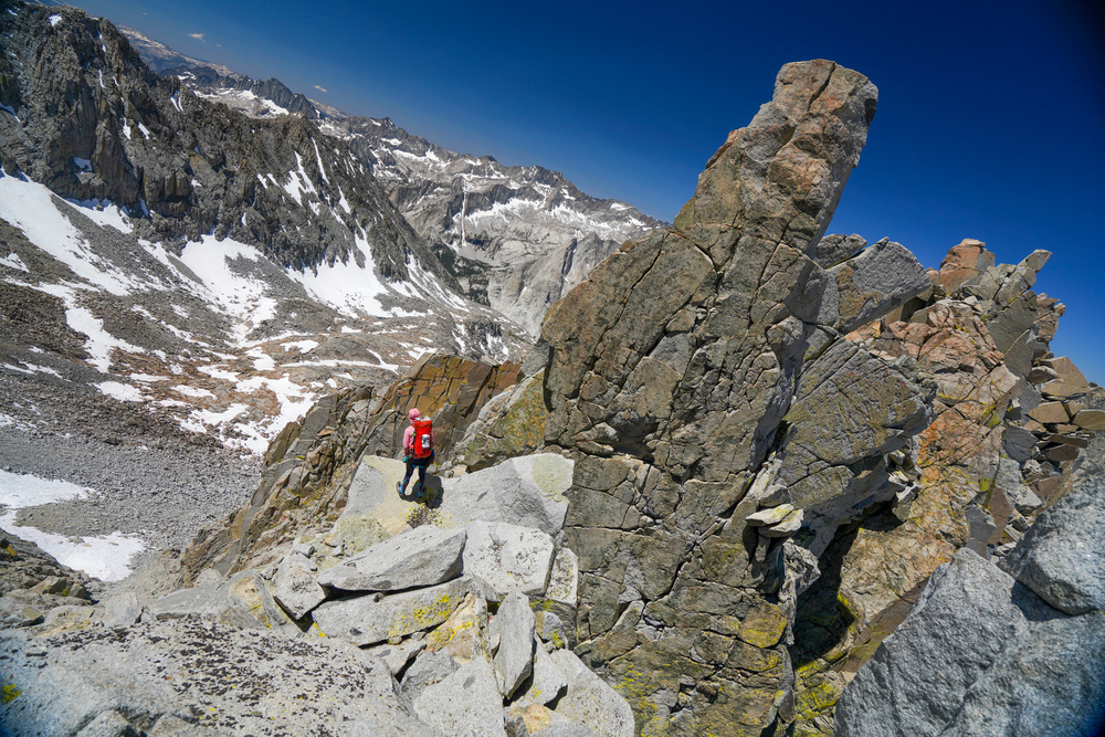 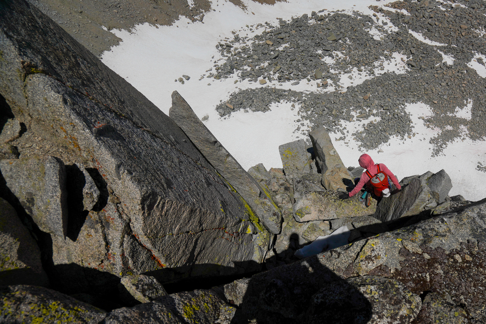 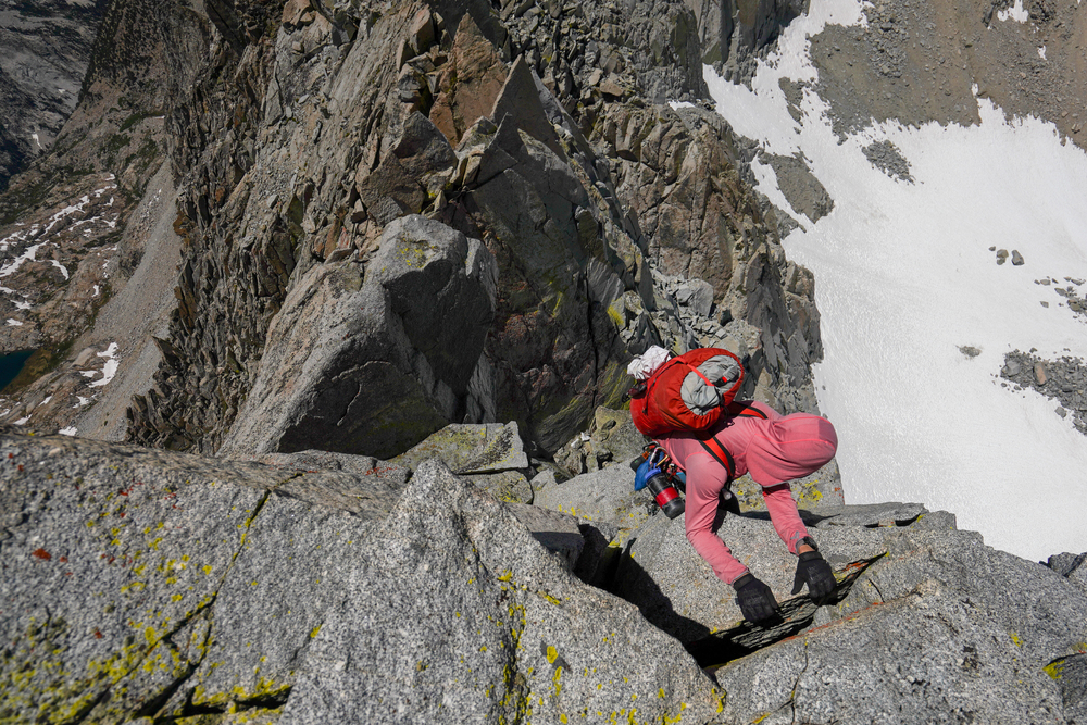 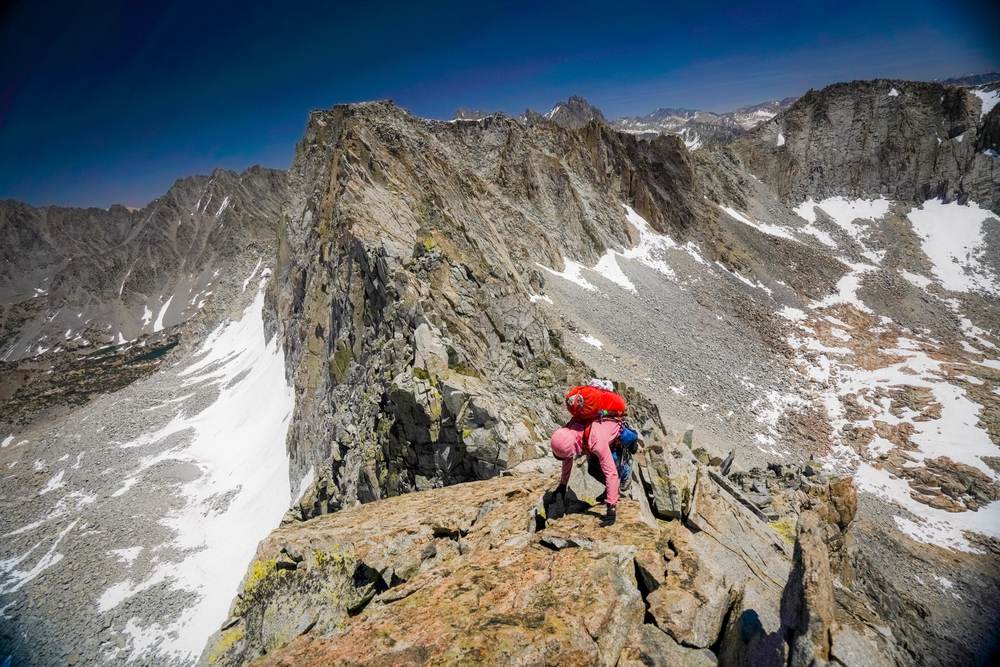  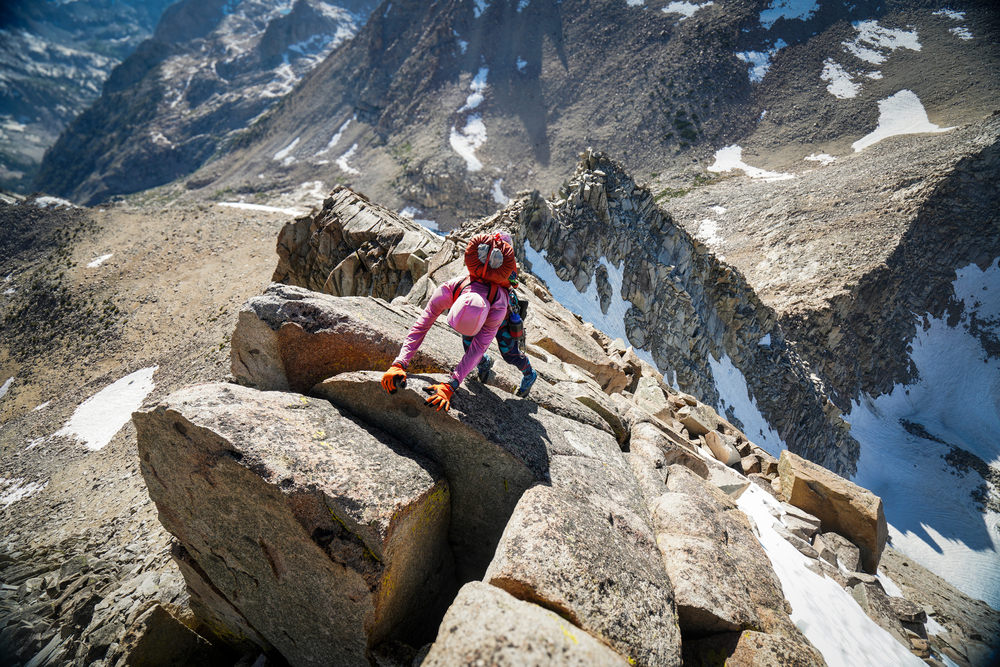 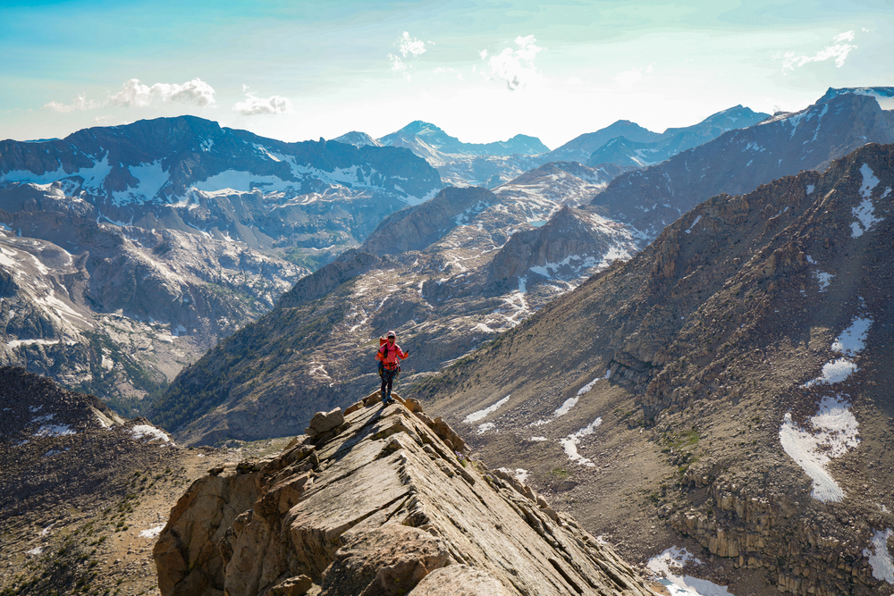 Day 2: to Point Wesley This day we climbed Moonwalk Peak, Moonshot Peak, Mt. Gilbert, Mt. Thompson, and Pt. Powell/Wesley. Descending Mt. Gilbert, we did a full 30m rappel immediately off the summit plateau. 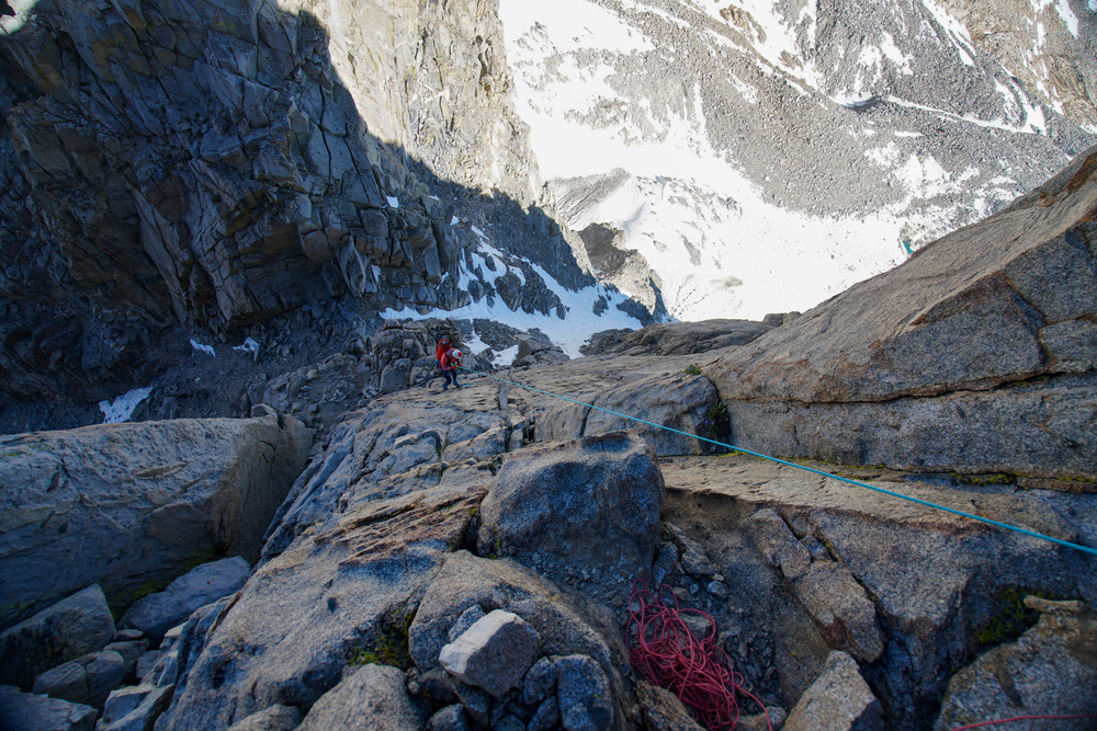 From the notch, we climbed up some 5th class terrain and crossed to the other side to downclimb. The other side is the most enormous slab of all time... it’s hard to overstate how striking and enormous this thing is. It’s perfectly flat and has a constant angle across its entirety. It's, like, the size of Bishop or something. The moves ranged between 3rd and 5th class, but the exposure was way more intense-feeling than any 3rd class I’ve ever been on. You could see a long way down. 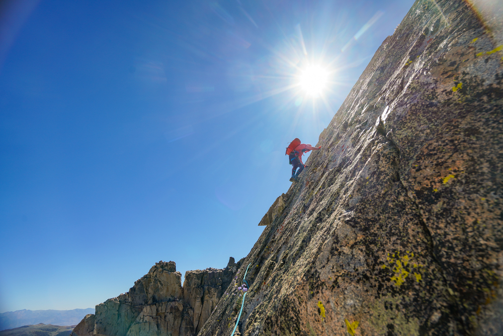 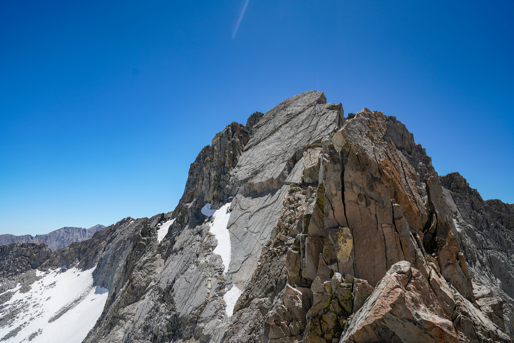 After descending the slab we climbed the E ridge of Mt. Thompson. Looking back, we could see the slab head-on, then Mt. Gilbert, then Mt. Agassiz, Mt. Winchell, and Thunderbolt Peak. The base of Mt. Agassiz is Bishop Pass, where the traverse begins, and each day it grew further and further away, giving a sense of the distance covered. 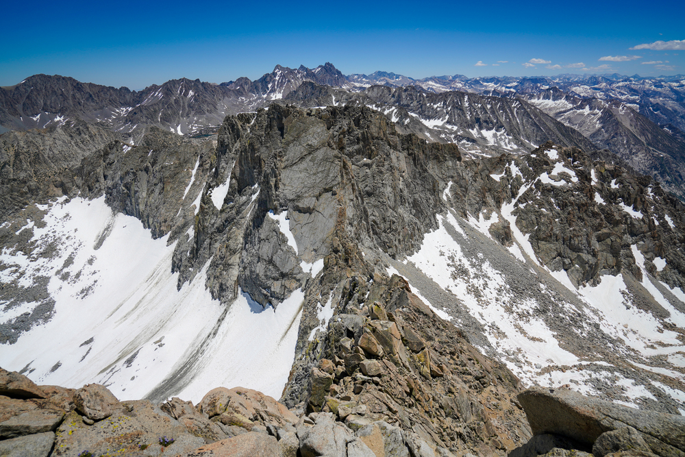 The first two days we were treated to amazing views of the John Muir Trail, which travels this valley. On the west side of the valley we could see Langille Peak and The Citadel very clearly.  From the Mt. Thompson summit plateau we could see Point Powell and Point Wesley, where we would spend the night. 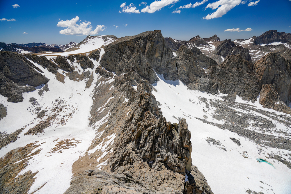 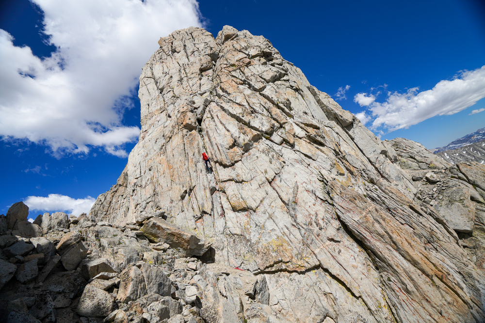 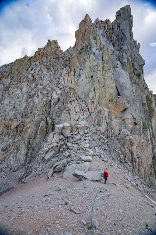 The sunset was beautiful this evening. I started to get really excited at this point since we could finally see Mt. Darwin (top right in this photo). Since I was familiar with the terrain from the Evolution Basin Traverse I knew that reaching the point where the two intersect would be a big milestone for us since from that point onwards most terrain would either be familiar or moderate, even though that intersection is only halfway in terms of mileage. We were still a long ways away, though. 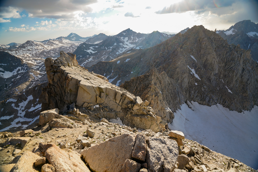  We repaired my sleeping pad, so I tried sleeping on it again this night, on top of my backpack and the rope. However, it quickly became apparent that no amount of duct tape would provide an airtight seal. I definitely didn’t sleep great this night either and it was even colder than the first. Day 3: to Haeckel Col This day we climbed Mt. Powell, the Clyde Spires, Mt. Wallace, and Mt. Haeckel. In the morning we headed over to Mt. Powell: 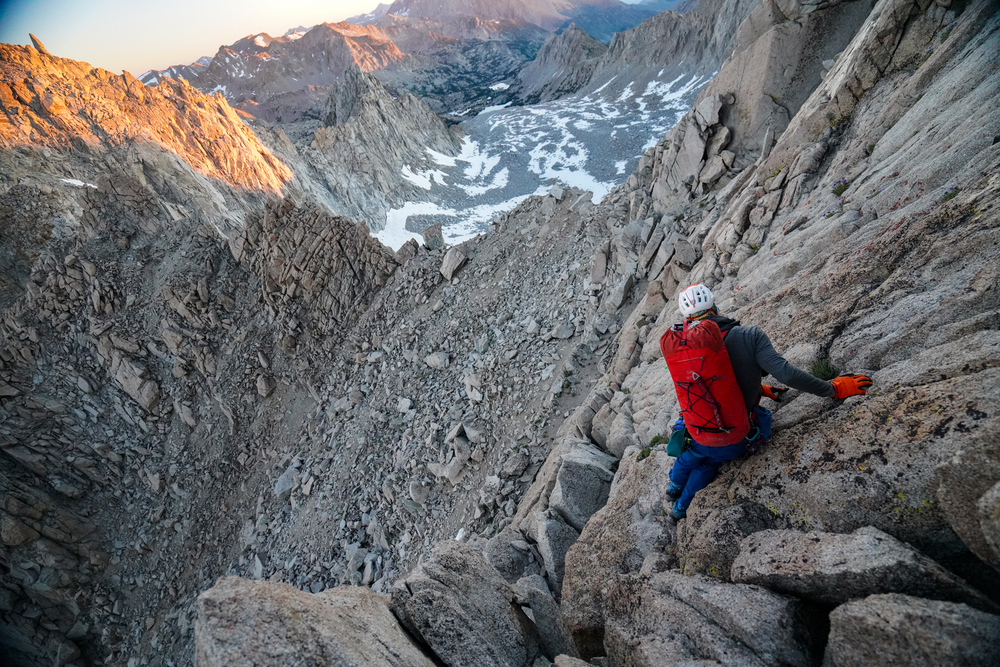 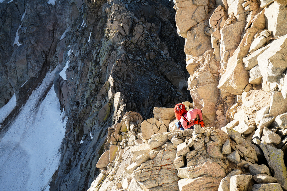 From Mt. Powell, looking back at Point Wesley: 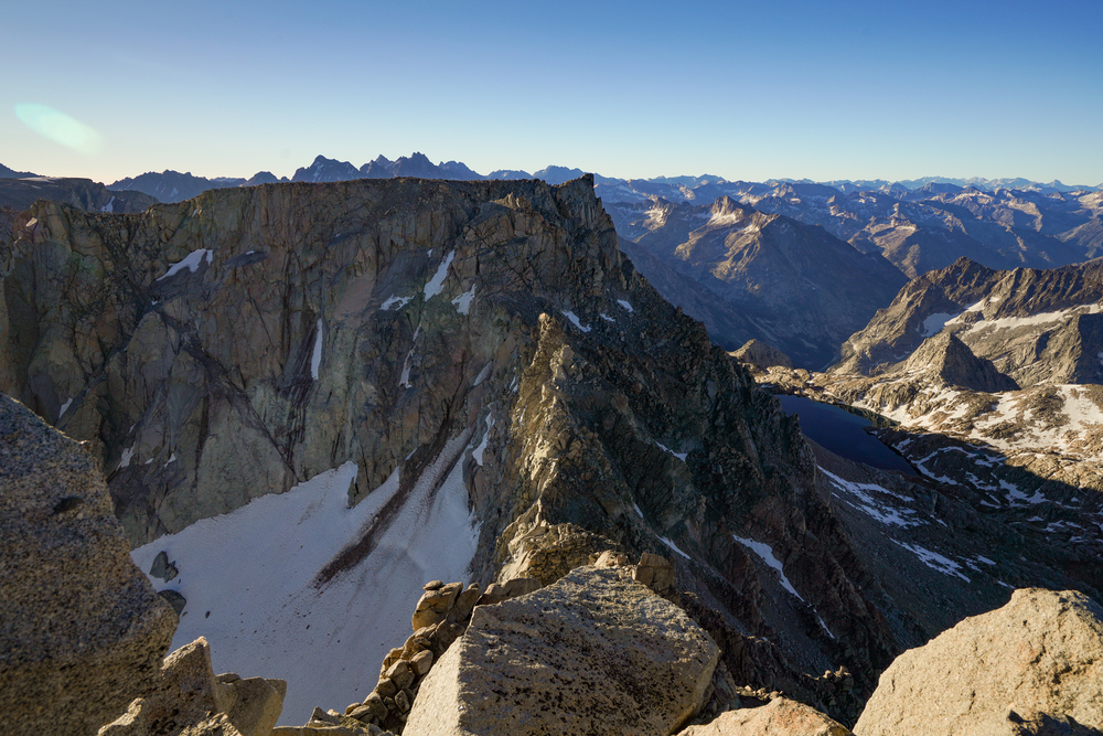 Descending into Echo Col, we found a bunch of loose rock. It did have this one really cool feature, though, which we passed on the left and which for some reason reminded me of a fighter jet: 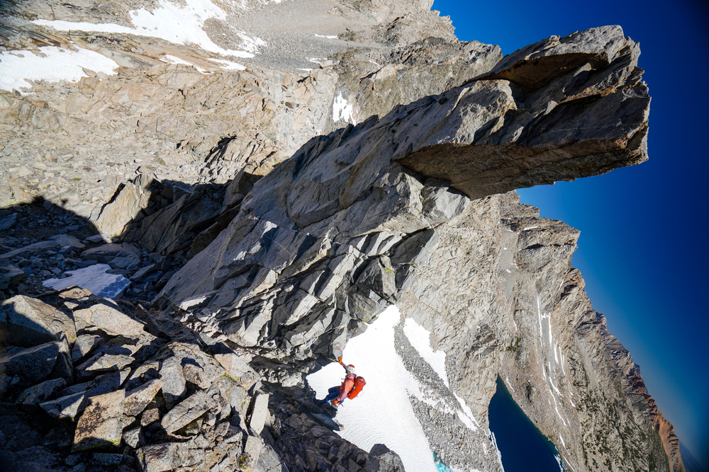 The black-colored ridges leading out of Echo Col to the Clyde Spires had generally solid rock and I recall thinking this would surely be a contender for one of the best scrambles around. Each the ridges linked easily to the next, but the last ridge didn’t lead naturally to the Clyde Spires themselves to so we had some routefinding challenges here and made a rappel or two. Eventually we reached the base of Clyde Spire East, which has this really cool amphitheater-feeling area with shining white rock which we exited — you guessed it! — on the left: 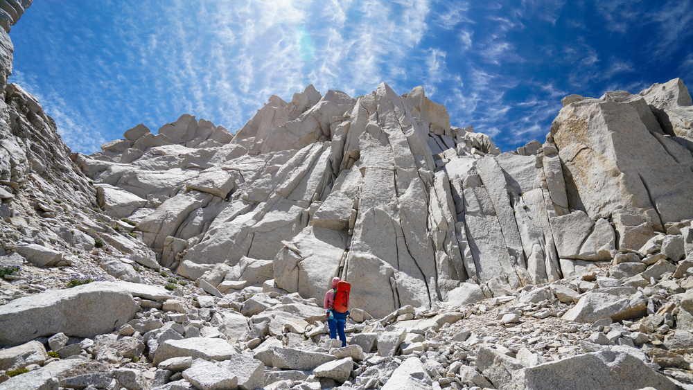 At the Clyde Spires themselves, there’s a chockstone the size of a shipping container. I wonder how many thousands of years it’s been since it fell and wedged itself there? Also, check out the Jenga tower on the left here: 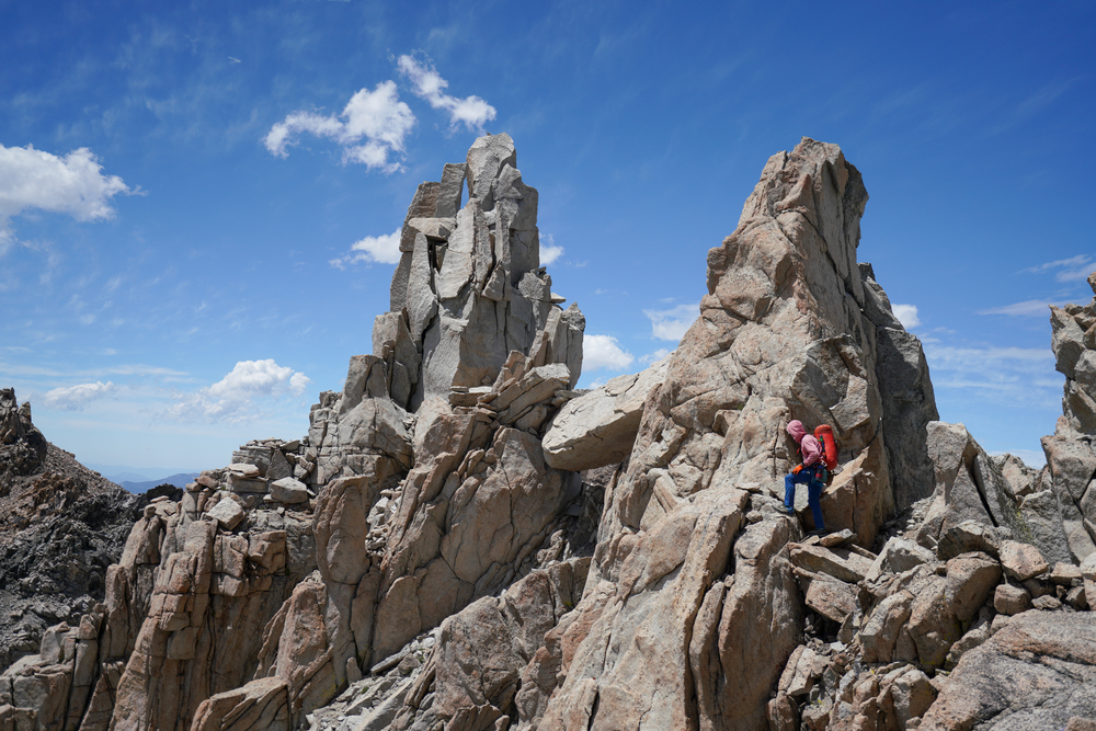 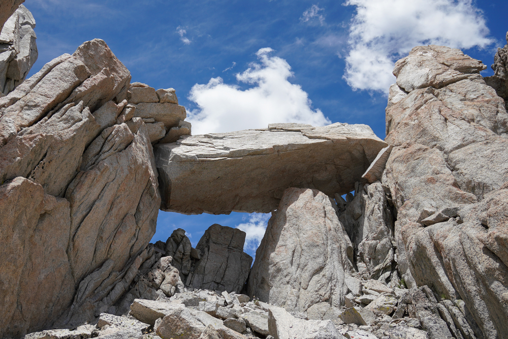 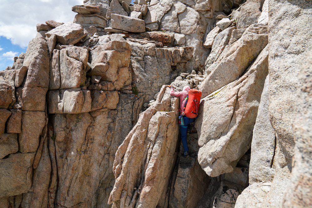 Once we got to the summit area, though, the rock quality deteriorated to frighteningly rotten. This section took a lot of care to navigate as safely as possible without having any footholds or handholds crumble into nothingness. 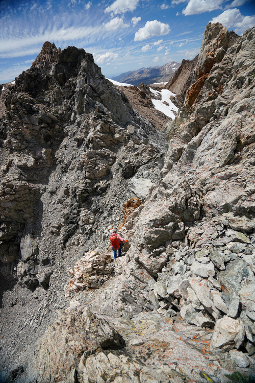  All told, we spent almost the entire day just getting from Mt. Powell to Crumbly Spire. All the loose rock warranted extra caution which was very time-consuming. But, it was correct and appropriate to spend extra time on that, so it didn’t feel like time wasted. Once we reached Crumbly Spire, the cumulative effects of three bad nights of sleep in a row (I didn’t sleep great the night before we began the trip either) plus the day’s mental load of dealing with all the loose rock started to take their toll. Physically I was fine but was feeling a bit mentally frayed. Fortunately, all of the rock from here on was quite solid, the terrain familiar, and the routefinding easy, so it didn’t require the same level of focus. We headed up and down Mt. Wallace and Mt. Haeckel and found a spot we could make flat around Haeckel Col on the west side. This time we shuffled around our sleeping systems a bit: Dave slept on his inflatable pad on the rope and on top of my deflated pad, and I slept on his half-length pad which I supplemented with my quarter-length pad and backpack. Finally got a good five or six hours! Day 4: to Lamarck Col (and down to car at North Lake) 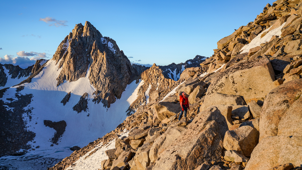  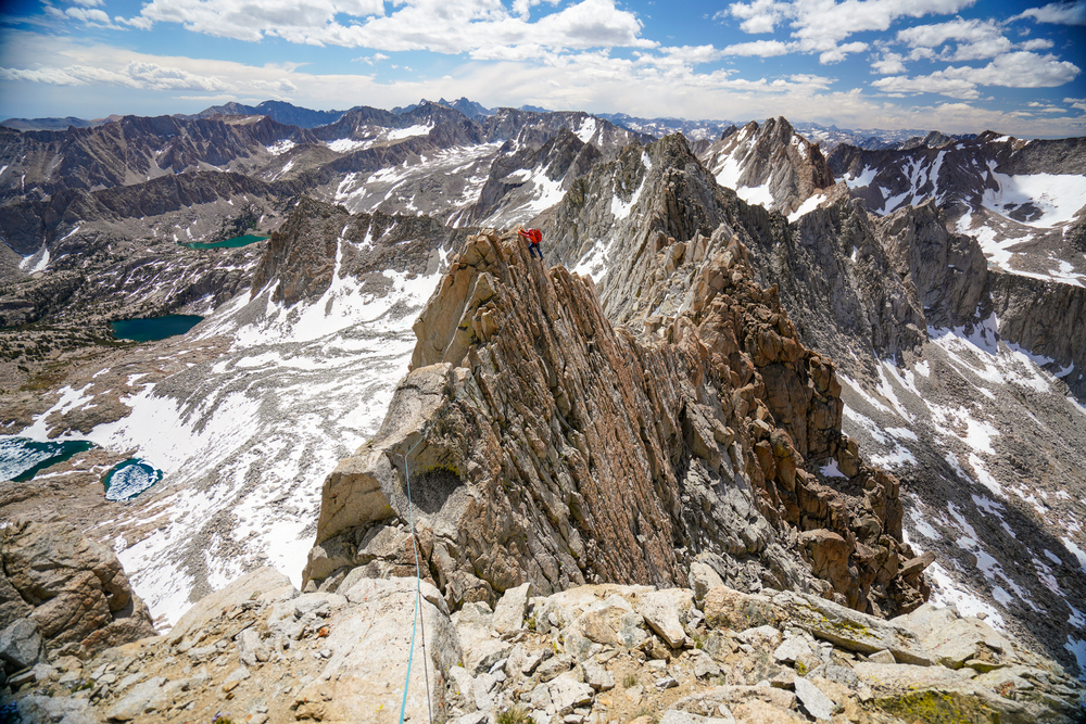 The section between Peak 13,332’ and Mt. Darwin was delightful as always, and the loose rock on that chimney off the Darwin summit was awful as always. We boiled snow on the summit plateau and headed for the NE ridge of Darwin to descend. Our path started on skier’s left of the ridge and then crossed over to skier’s right, never straying far from the ridge itself. Partway through descending this ridge, though, we got hit with a snowstorm. The snow made the rocks wet and slippery so we ended up making quite a lot of rappels, cutting our tagline all the way down to nothing. Dave was a total champion here and his excellent routefinding intuition was very helpful in getting us down. 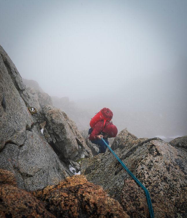  From here we decided the snowstorm was unfortunately a trip-ender since we hadn’t brought any shelter so when we reached Lamarck Col, instead of spending the night there and finishing the last three miles the next day, we headed down. Once we got down below the snowline on the Lamarck Col trail, for the first time in days could walk freely without paying attention to the ground, which felt nice but was definitely bittersweet. We jogged down to the car and turned the heat on full blast. Good times! 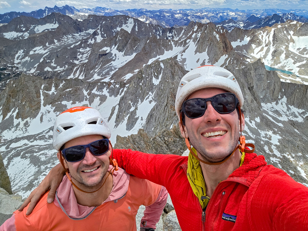 |


|
Badass fellas nice work! |
|
|
Amazing Brett! What an adventure! Photos are stunning. |
|
|
Rad AF guys!! Looks like a trip that you'll remember for the rest of your life. Major respect for persevering through the sleeping pad/sleep deprivation challenges - that takes some real grit to stay the course after back to back nights of bad, cold sleep. Thanks for sharing, this is awesome |
|
|
I really enjoyed reading your report! Nice trip! |
|
|
Incredible job on the traverse and TR, Brett! |
|
|
You guys are badass! Good work out there! And glad you made it out safe during that storm. I’m the guy you ran into between Wallace and Crumbly Spire going for the measly Croft Evolution Traverse. Your encouragement was much needed, and was definitely a morale booster. Though I was making okay time, thirty minutes after we passed I was hit with a nasty wave of nausea. After projectile vomiting my entire stomach contents, I decided I wasn’t in good enough shape to continue on. I didn’t even think I had it in me to hike back to basecamp at the Darwin Bench. My in-a-day attempt was over, and I’d surely bail in the morning after a long shiver bivvy between Fiske and Warlow. All night I nibbled on my last remaining food to stay warm - a caffeinated bar… As the sun came up, I was excited to get moving, get the blood flowing, and warm up. I thought: fuck it, those guys have been on this ridge for 3 days already, and have another 2 days to go, I can get it together for another 2 peaks. So I decided to buck up and go for it, and finished off Warlow and Huxley. I’m glad I did because they had some of the best climbing on the whole traverse. I think I cried on top of Huxley. I’m genuinely not sure if I would have finished it off if I hadn’t seen you guys up there too. I hiked back to camp and hunkered down through the storm as it pissed down for a solid 6 hours. I was hoping you guys were okay up there. |
|
|
Cole!!! So glad you are safe! It was delightful to run into you out there. Very very very impressed with you for finishing the next day, and for your pace before you got sick :0 That's an incredible story!  (photo credit: Dave) |
|
|
Awesome! |
|
|
Great effort guys. Top notch reporting also. |
|
|
Great job! Great photos and report! Helped me re-live own time on this section of the Sierra Crest. You didn't really miss out on much interesting climbing in the section from Lamarck to Piute. Most of the excitement there is on couple very loose and scary sections. Some fun stuff too, but you can easily dayhike it as a loop from North Lake TH. |
|
|
Amazing report and absolutely gorgeous photos ! What camera are you using that creates such nice images but is small enough for an effort like this? Love the map too! |
|
|
Suz Zak wrote: Thank you so much, Suz! It's a Sony a7r iii and the lens is a 16–35mm f/4. I'm pretty intense about optimizing weight but then offset all of that by taking the camera which is a little under 3lbs Also the map isn't mine, it's from the AAC report linked at the top, wish I could claim credit for it since it's beautiful! |
|
|
First - Big Thanks to Brett for the idea and invite. Big thanks to the AAC and Vitaliy Musiyenko for publishing their respective reports on this traverse, without the inspiration Brett and I would certainly have done something else. Hopefully Brett and my accounts will give some more info for someone else to give this thing a go! --------------------------------------------- Finally getting around to digesting some details from this trip, I've had a crazy busy late-May through now. Background from me: I had a 350mi bike race in late-May, mostly biked and tapered in May (only one day climbing), then took a couple weeks to recover post-race before feeling anywhere close to 100%, so I was probably on the wrong side of "off the couch" prior to Brett and I jumping into this thing in late-Jun. I think I had one trail run after the race before this climb to prove to myself I was back enough to give it a go. Some details and MMQB from me: - There was plenty of snow, so we have ample opportunities to generate water. Mid- or late-season and this would prove a serious crux, it was not for us. The strategy of stuff snow into a Nalgene or any other container was the pro move, it took us about a half day to figure that out, and then we became pros at shoving any/all snow into the bottles. It works. - There were relatively frequent bivy spots. We stopped each night with more time on the clock, and probably could have pushed further day. But on the flip side, if you guess wrong, you might be moving deep into the night or you might be setting camp in a really shitty spot. - We started thinking we were on a three night, four day itinerary. We quickly adjusted to thinking four nights and five days. At the end we might have been five nights, really short sixth day (but know knows, lol, we got dumped on). - The concept a small foam and a small inflatable pad saved our bacon on this (and it was warm at night), and on a route with major success/failure on the ability to sleep and the hostile terrain, this strategy is worth it. I believe many folks on Denali use both a foam and inflatable, but this was my first time employing it. - We brought a big (16 oz) fuel so we would have no concern on melting snow if necessary. I think we used about 1/3 of the fuel, so we had plenty. You could probably get away with 8oz, but 16oz makes you feel invincible. - The rack was pretty solid, not too much, and enough to get away with everything we needed. I brough my mythos as an insurance policy, probably not necessary, but it's nice to know someone can put on real shoes and bust some moves if it comes down to needing to get out of a jam. - We brought crampons, but never used them. Again, insurance to ensure we could pass anything. I'm sure with recent 1st person knowledge of the conditions high in the alpine, you could probably leave them in the car. - It felt like it was about half fairly technical movement, with either conscious soloing or roped with slow and deliberate progress; and about half was pretty chill and fast. No single day or section was truly fast and easy, it felt like we were working hard for every mile of forward progress. - I think we only made three rappels before the descent off Darwin, basically one per day (marked with a blue down arrow on the map). We down-soloed or down-lead most things to avoid the time to transition and to avoid leaving anything. Going down Darwin we made about 8 rappels as it was snowing. - Every single day was AWESOME!!! Day 1. About 2.5 hrs to Bishop Pass. 10 hrs on the ridge to bivy, covering about 3.5 of the ridge at about 0.35 mph. Day 2. About 12 hrs bivy to bivy, covering about 3.0 miles of the ridge at 0.25 mph. Pretty complicated and slow going. wow. Day 3. About 14 hrs bivy to bivy, covering only about 3.1 miles of the ridge at 0.22 mph. Super complicated and slow. This had the scariest party for me, with the Clyde Spires and SUPER chossy and loose section. WOW!! Day 4. About 11 hrs bivy to bailing, covering only about 2 miles of the ridge before bailing, 0.18 mph. REALLY complicated and slow, HOLY SHIT!!! 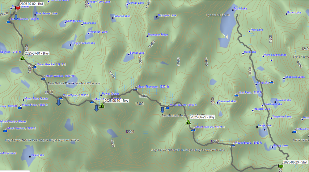 |


