Continue with onX Maps
 Sign in with Facebook


Fire Near The Needles


|
|
This post violated Guideline #1 and has been removed.
|
|
|
Damn, that sucks. |
|
|
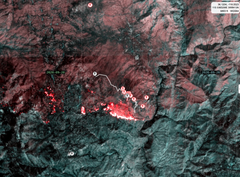
@ Fat Dad https://caltopo.com/map.html#ll=36.13378,-118.48394&z=13&b=mbt&a=modis_mp%2Cmountainproject |

|
Fat Dadwrote: gaia GPS has a current wildfires map. not sure exactly how often it is updated and how accurate it is, but for the fires near me it seems pretty accurate. |
|
|
The Needles has always been a place I have looked at as a goal for when I was stronger and bolder... I hope the rock is not damaged. |
|
|
:( this makes me sad. The Needles are such a cool and special place. Here are some shots from a few years ago: 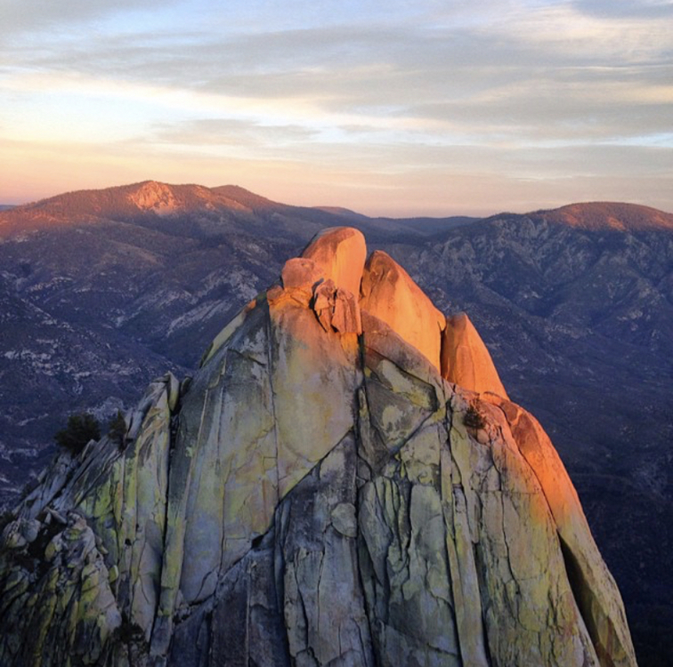 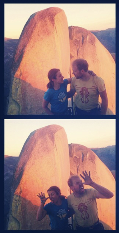 |
|
|
Thanks everyone (except Zippy). I'll have to check the same for Camp Nelson. Despite what the map shows, I wouldn't lose all hope yet. Fire maps don't always describe the severity of the burn. A couple years ago when a fire occurred down canyon of Camp Nelson, the fire map reported extensive burning over an entire area. While accurate, there were areas within the zone that were COMPLETELY fried (were talking like it had been stuffed in a kiln and baked) and other areas that looked completely untouched. Fingers crossed. |
|
|
Alex Swrote: Can someone less daft than me explain this map? There seems to be no key or certain functionality is not present on mobile. Is the yellow line a containment line and red is actively burning? |

|
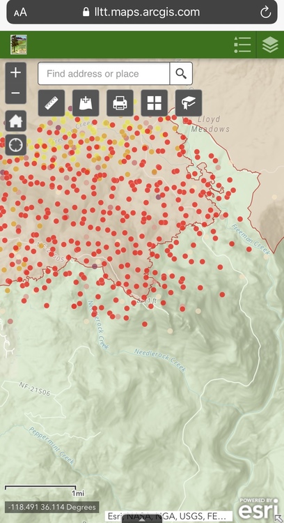 https://lltt.maps.arcgis.com/apps/webappviewer/index.html?id=a70e6ef762f3406b8e6829d61a70523f |
|
|
Thomas Claibornewrote: Something that can help is to click on 7.5 Topo Maps in the left column and uncheck the box in the right hand column that says "Fire Activity." Zoom in as needed to see the names of campgrounds and Ponderosa (then recheck the Fire Activity box, as desired). Edit: I'm doing this on a laptop. You may be more limited on your phone. |
|
|
|
|
|
Fat - The "red" flares are overlays from satellite IR imaging. They typically represent more intense heat signatures. EO/IR is my line of work. ;) |
|
|
Dave Dalywrote: Not on CalTopo. Red/yellow refers to the age of the signature, not the intensity. |
|
|