
 Continue with onX Maps
 Sign in with Facebook


These Sun Angles maps

|
Summertime- so hot- poking around MP for places that are shady (favorite) to get my send on. |

|
The arrows show where the sun is coming from at that time of the day (theoretically). Topography and/or plant coverage can affect it as well |
|
|
Yep. |
|
|
I find it's easier by looking at which direction the wall is facing rather than trying to figure out how the sun angles work. If you know it's a north facing wall then you know it'll be in the shade most of the day, south facing is in the sun, east facing in the evenings has shade, west facing in the morning has shade. I just find it very difficult with the current sun angles map to figure out if it'll melt my shoes to the rock or stick to it. |
|
|
Desert Rock Sportswrote: I've never used the sun angle feature on Mountain Project, but it surprises me that they don't take the topography into account. CalTopo, a free web-based mapping software has this feature built in. Check out the series of sun-angle screenshots of Suicide Rock (Idyllwild, CA) modeled for June 25. For me, it affirms my belief that on most days, Suicide is not worth visiting before 3-4 in the afternoon during the summer months. As many summer climbers in Idyllwild have experienced, those north and east facing walls see full sun until late in the day. Legend: Yellow-Sun exposure; Violet-Shade 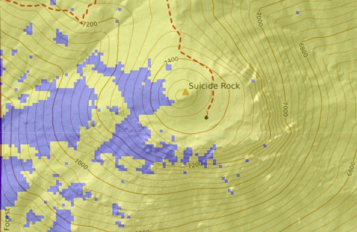 Suicide Rock 12pm 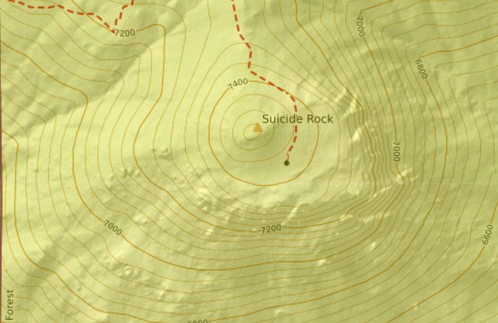 Suicide Rock 3pm 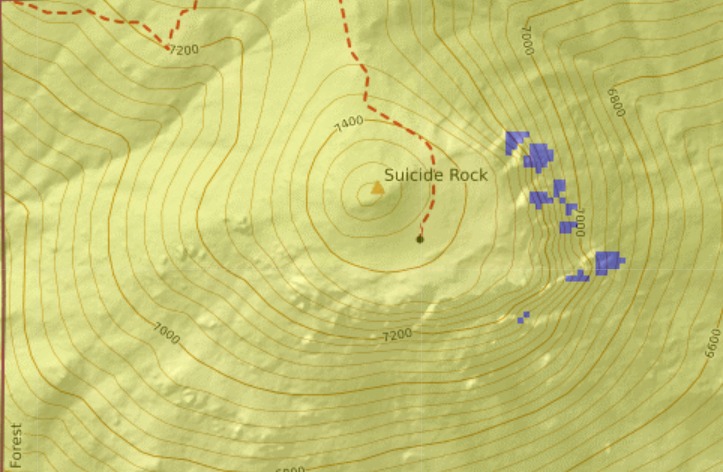 Suicide Rock 5pm 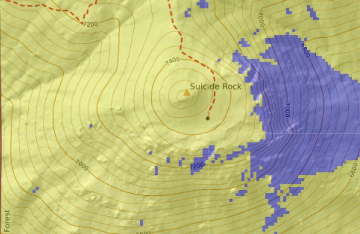 Suicide Rock 7pm 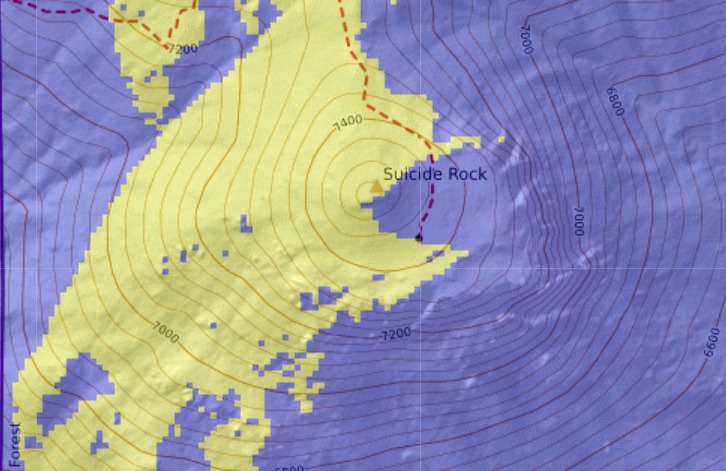 |
|
|
Nash Wardwrote: I find it's easier by looking at which direction the wall is facing rather than trying to figure out how the sun angles work. If you know it's a north facing wall then you know it'll be in the shade most of the day, south facing is in the sun, west facing in the evenings has shade, east facing in the morning has shade. I just find it very difficult with the current sun angles map to figure out if it'll melt my shoes to the rock or stick to it. Generally good advice, except you meant to say "...west facing in the mornings has shade, east facing in the evenings has shade." |
|
|
Ryan, yep you're right, I got mixed up |
|
|
Nash Wardwrote:...west facing in the evenings has shade, east facing in the morning has shade.... say what? summer is kind of tough. depending on where you are, even north faces might not have shade for very long or at all. in the northern hemisphere the sun will typically rise in the northeast and set in the northwest, which will limit the time that a straight NF will get shade. another problem is that the sun is very high, so if you are on a slabby north face you might not get any shade. |
|
|
slimwrote: I have edited it to match the correct west/east (got mixed up on directions) and that rule is a general rule of thumb. It doesn't work everytime and I don't claim it too work at every crag. But I would dare to say that at 80% of crags it would work to some degree. Hopefully though eventually the sun angles gets updated to the point where it is easier to tell if it'll be in the sun or not for sure at a certain time. |
|
|
Ryan Stricklandwrote: Real hot tip on the caltopo feature (love that site). A layout like the screengrabs you posted above are much more useful imo than the arrow/time schematics on MP. |
|
|
An area could have a link to caltopo with the sun layer enabled. That would be helpful. Assuming caltopo allows enabling layers via url. |


