
 Continue with onX Maps
 Sign in with Facebook






Cloud Wall Rock Climbing
Routes in Cloud Wall

|
Laputa T 5.11a 6c 22 VII+ 22 E3 5c |
|
|
Orographic Lift T 5.11 6c+ 23 VIII- 23 E4 5c |
| Elevation: | 10,241 ft | 3,121 m |
| GPS: |
40.53217, -111.72895 Google Map · Climbing Area Map |
|
| Page Views: | 1,002 total · 20/month | |
| Shared By: | Rosemary Bloom on Jul 4, 2022 | |
| Admins: | Drew B, Perin Blanchard, GRK, David Crane, Nathan Fisher |
 Access Issue: Gate Buttress Area Recreational Lease: Climbs on Church Buttress above vault remain closed
Details
Access Issue: Gate Buttress Area Recreational Lease: Climbs on Church Buttress above vault remain closed
Details
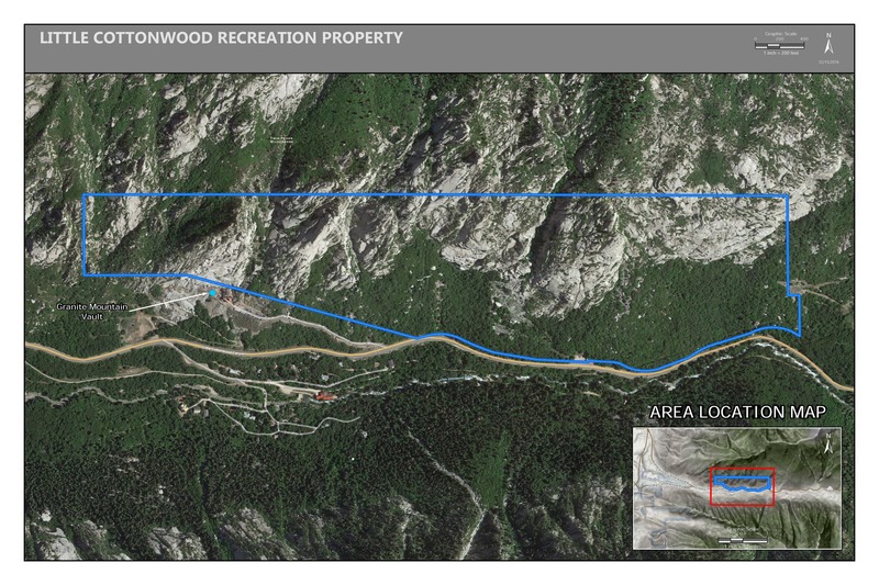
June 1st, 2017:The Salt Lake Climbers Alliance (SLCA), the Church of Jesus Christ of Latter-day Saints (LDS Church), and Access Fund announce the signing of an unprecedented lease for 140 acres in Little Cottonwood Canyon (LCC). The parcel, known as the Gate Buttress, is about one mile up LCC canyon and has been popular with generations of climbers because of its world-class granite.
The agreement secures legitimate access to approximately 588 routes and 138 boulder problems at the Gate Buttress for rock climbers, who will be active stewards of the property. The recreational lease is the result of several years of negotiations between LDS Church leaders and the local climbing community.
Access Note: The climbs on the Church Buttress above the vault as well as the Glen boulders that have been traditionally closed will remain closed.
Please help us steward this area and leave no trace.
Read More:
saltlakeclimbers.org/climbe…
Description

The cloud- themed wall. All routes have bolted belays and can be descended with a single 70M rope.
Splitter, compact granite
AM Shade.
Pm Sun.
Getting There
Take "Red Pine" Trail head into Maybird Gully. Have a nice break at the maybird lakes then hike south west to the " Notch" into Hogum Fork. ( see page 444 in the " Granite Guide" for picture).
Mentally commit to boulder hopping and talus scrambles as far as the eye can see, now go west and aim for the end of Hogum fork. Once "Thunderbolt Ridge" is in sight Walk up one last hill, then you have entered the cloud. Once in the cloud "Cirque" stick close to "Thunderbolt Ridge" and the cloudwall will be the first clean rock you see on the west facing wall.
Granite Guide suggest 3.5 hours approach. Took us 6 hours with no faffing around, id plan for something in between
 Sun Angles Details:
Weather Averages
|
High
|
Low
|
|
Precip
|
Days w Precip
|
| J | F | M | A | M | J | J | A | S | O | N | D |
| J | F | M | A | M | J | J | A | S | O | N | D |


All Photos Within Cloud Wall
Most Popular · Newest · RandomMore About Cloud Wall
Printer-FriendlyWhat's New


0 Comments