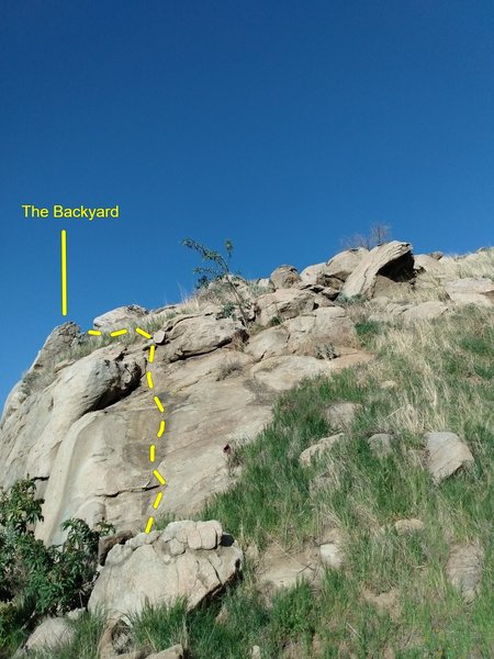
The Backyard Rock Climbing
Use onX Backcountry to explore the terrain in 3D, view recent satellite imagery, and more.
Now available in onX Backcountry Mobile apps! For more information see this post.
| Elevation: | 1,274 ft | 388 m |
| GPS: |
34.00347, -117.3068 Google Map · Climbing Area Map |
|
| Page Views: | 5,734 total · 90/month | |
| Shared By: | Ben O'Neal on Oct 26, 2020 · Updates | |
| Admins: | C Miller, Euan Cameron, Mike Morley, Adam Stackhouse, Salamanizer Ski, Justin Johnsen, Vicki Schwantes |
Crag Etiquette

- Please keep the noise down when on the approach and at the crag due to the close proximity of houses.
- Please do not walk off on the left side of the crag - rappel off or descend the west (right) side of the crag to minimize erosion in this sensitive and highly visible location.
- Please pick up any and all trash to help keep this area pristine.
Classic Climbing Routes at The Backyard
Mountain Project's determination of the classic, most popular, highest rated climbing routes in this area.
Sun & Shade

Routes Mostly Face: Northwest
Sunny Roughly 12pm to 4pm
during high season
6am
8pm
Weather Averages
|
High
|
Low
|
|
Precip
|
Days w Precip
|
Prime Climbing Season
| J | F | M | A | M | J | J | A | S | O | N | D |
| J | F | M | A | M | J | J | A | S | O | N | D |
Photos
All Photos Within The Backyard
Most Popular · Newest · RandomMore About The Backyard
Printer-FriendlyWhat's New
Guidebooks (2)

 Continue with onX Maps
 Sign in with Facebook


0 Comments