River Wall Rock Climbing
| Elevation: | 8,500 ft | 2,591 m |
| GPS: |
38.92102, -105.43212 Google Map · Climbing Area Map |
|
| Page Views: | 22,984 total · 34/month | |
| Shared By: | Julian Smith on Dec 31, 1969 · Updates | |
| Admins: | Leo Paik, John McNamee, Frances Fierst, Monty, Monomaniac, Tyler KC |
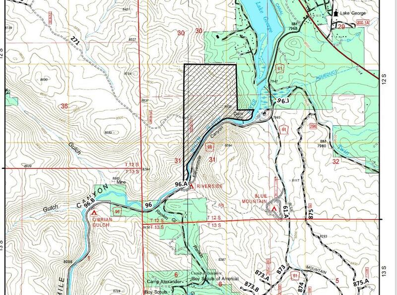
 Access Issue: Seasonal Raptor Closures January 1- July 31st, 2016-2021
Details
Seasonal Closures in effect January 1-July 31st, 2016-2021.
For details visit:
fs.usda.gov/Internet/FSE_DO…
Maps:
fs.usda.gov/Internet/FSE_DO…
fs.usda.gov/Internet/FSE_DO…
Contact phone number: (719) 553-1400.
Description

Getting There

The River Wall is located 6.3 miles up the canyon. Park just after crossing a bridge. The river will be on your right, between you and the wall. Walk downstream, back across the bridge, and work upstream on the opposite bank. You will run into the wall. (Per Alden Armstrong: you may not be able to cross the edge of the river below the bridge due to high water levels. If that is the case, scramble up the rock face to the right of the bridge, and work your way up the canyon that way, be careful to not dislodge loose rocks on the cars below.)
The descent is either lowering from anchors or walking off the top. Cheers.
Classic Climbing Routes at River Wall
Weather Averages
|
High
|
Low
|
|
Precip
|
Days w Precip
|
| J | F | M | A | M | J | J | A | S | O | N | D |
| J | F | M | A | M | J | J | A | S | O | N | D |
Photos
All Photos Within River Wall
Most Popular · Newest · RandomMore About River Wall
Printer-FriendlyWhat's New
Guidebooks (13)

 Continue with onX Maps
 Sign in with Facebook


2 Comments