
 Continue with onX Maps
 Sign in with Facebook


Winter ‘22/‘23 Tahquitz Ice Report?


|
|
“Really hoping to get the climbing started asap...rock climbing that is.” Did a little recon this afternoon…  Humber Park still has ‘Road Closed' signs at the entrance. Heading over to Suicide, the creek was pleasantly challenging to cross- the private road on the other side is clear up to the Fern Valley well, then there’s about 90% snow coverage.  The rains did knock a lot of the snow down, but what’s left is nasty stuff- lots of post-holing.  The Weeping Wall is very weepy, and the glacier at the bottom is still very much intact. 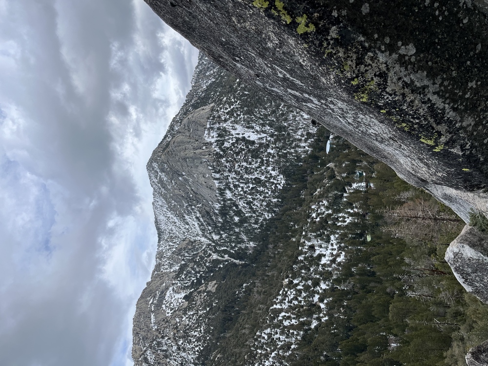 The approach to Tahquitz is prolly equally annoying- north side routes are likely very wet & snowy. West & south side routes might have some do-able climbing right now, but it would take some serious post-holing through mucky wet snow to get to ‘em. |

|
Friction descent will still probably be a mountaineering endeavor. I don’t think the damn thing is going to dry until May 2024. Also we are getting more snow and freezing temps later this week. |
|
|
apogeewrote: |
|
|
Ry Cwrote: It will be surprising how fast the snow melts, especially if there’s rain. Approaches will be difficult for awhile but rock will climbable. Will it be worth the slog? Probably not, but you can always slum it at JT in the meantime. |
|
|
This just in, the trail crossing the creek on Earnie Max is eroded away. |
|
|
Went up to Suicide to test out some new footwear. Turns out hiking up isn’t as bad when you’re using someone else’s boot pack. :) :) :) thanks apogee  I, then, lost my phone scrambling around on some rocks then panic and retraced steps, so I didn’t get additional pics of Suicide (it’s all just wet anyway)… so here’s a closer pic of Tahquitz.  Bonus pic of the county park taken by my friend:  |

|
Cool updates! Between this and the Needles getting continuously rocked...=[ |
|
|
Ry Cwrote: Is that the road to Humber? |
|
|
Robert Dizzlewrote: Looks like the road in one of the campgrounds. The never ending winter continues |
|
|
About 3-4" came down last night. While the precip is long overdue and appreciated, the excitement of more white stuff just ain't what it used to be. "Is that the road to Humber?" That road damage definitely isn't Humber, or County Park. Maybe State Park? Or one of the USFS campgrounds? Edit to below- Yep, that's it...Delano road, across from Royal Pines Trailer park. At the back entrance to County Park. |
|
|
Kinda looks like the road behind County park near the mobile home park. |
|
|
Another 8” last night, and the stuff is still falling today. Should be quite possible to kick steps right up to the first pitch anchors on Surprise… |
|
|
From yesterday at 6000’ around Spitler Peak. Probably a good 2’ of soft snow.  This one is from today:  Also it’s officially the third highest snowfall year in Idyllwild recorded history. Highest ever since 1940. Bad year to move to Idy lmao. |
|
|
“Bad year to move to Idy lmao.” Yes. Spread the word. Big Bear is much better- they have a Starbucks. |
|
|
Snow Creek from the hills north of I-10 3/25...  |
|
|
Did a alpine jaunt today, up the Tahquitz North Gully climbers trail, to the top of the rock, and then down the South side, and back to Humber. Road is still closed at entrance to Humber, but you can walk in. Thick snow cover everywhere. 
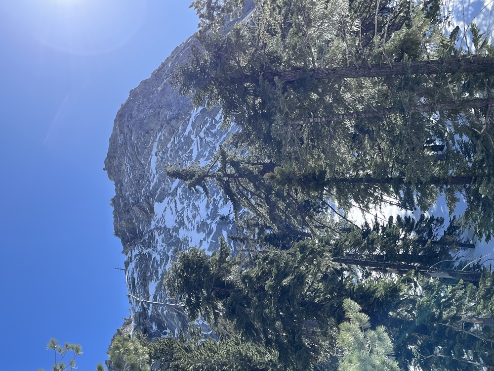 Once in the gully proper, no signs of track. Full on alpine steep snow- consolidated enough for good step kicking with a good boot- an axe is definitely required- 40-45 degrees, but very solid feeling. On top, glorious sun, and the peak and bowl are super alpine right now:  I normally like to traverse the top of th rock, then descend the Friction Slabs descent- but it’s pretty sketchy now, with heavy snow on all ledges, and lotsa runoff.  So descended along the south side, through lots of bushwhacking postholing hell in the warm soft wet snow. Once at Lunch Rock, a set of tracks down made travel better. Ernie Maxell is totally buried- the creek crossing is blown out, but very cross-able. And there’s more white stuff in the forecast for this week… |
|
|
Okay but why go to the alps when   |
|
|
Anyone have updated conditions for Tahquitz and the approach? Was planning on climbing there next weekend while visiting from out of town, but based on this thread it seems like we might have to consider other options? |
|
|
 Yesterday. Ton of snow on Devil’s Slide, so I assume approach is worse. If you slog up there, the South side might be dry enough to climb. Don't need snowshoes anymore though, so that's good. |
|
|
Old Prospectorwrote: Suicide might be better, expect deep snow at base though. |


