- All Forums
 FOR SALE / FOR FREE / WANT TO BUY
El Cap Detailed 3d Models- $20
FOR SALE/WANTED WARNING: Mountain Project
cannot
verify the identity or trustworthiness of any
member. Fraud has happened.
- Do not use PayPal "gift" payments, wire transfers, Western Union, etc.
- Use PayPal credit card payments, or other systems that protect you from fraud.
Original Post
— This topic is locked and closed to new replies
|
|
Max Manson
·
Dec 21, 2021
·
Superior, CO and Stanford, CA
· Joined Feb 2017
· Points: 526
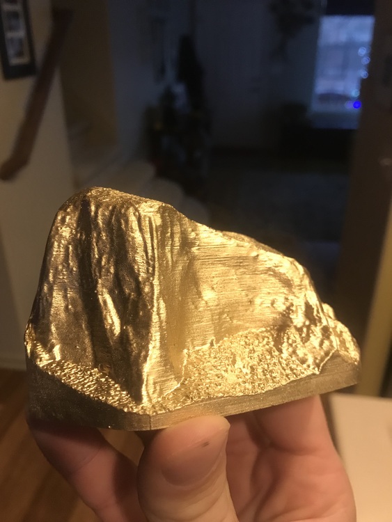
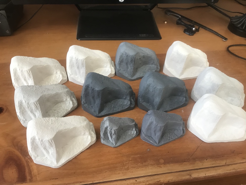
As a research project for a GIS class I took last quarter, I used LIDAR data to generate accurate 3d models of mountains. My favorite one was of El Capitan. I made a bunch of extra models out of plaster. They are about 4" long (1/18,000 scale) and very detailed. Colors are gold, white, or grey. I have about 10 left. Selling for $20 and only local pickup in Boulder area. Email mpmanson@stanford.edu if interested
|
|
|
Big Red
 ·
Dec 22, 2021
·
Seattle
· Joined Apr 2013
· Points: 1,206
·
Dec 22, 2021
·
Seattle
· Joined Apr 2013
· Points: 1,206
How about selling the CAD files for the mountains?
|
|
|
Nate J
·
Dec 22, 2021
·
Concord, NH
· Joined Nov 2017
· Points: 5
|
|
|
Max Manson
·
Dec 22, 2021
·
Superior, CO and Stanford, CA
· Joined Feb 2017
· Points: 526
Nate Jwrote:Similar files are available here on thingiverse... This user has many other related models as well. https://www.thingiverse.com/thing:270312 Max, those models look nice. I hope they sell for you! The ones on thingiverse and other ones I've seen were created using a workflow that turn the LIDAR point cloud into a 2d DEM where each pixel represents an elevation, then uses that to create a model. The issue with that is you lose all the detail underneath overhangs. If you look closely at the picture of the one on thingiverse, you can see in many areas (like everything above the heart), there is no detail, just vertical lines. Given that much of El Cap is overhung (including the entire wall in the Native Son/Zodiac area), you lose any detail in the wall there and just get a blank vertical face. I used a workflow that preserved all the detail, even under overhangs and in complex geometry that the DEM workflow can't model.
|
|
|
Nate J
·
Dec 22, 2021
·
Concord, NH
· Joined Nov 2017
· Points: 5
Max Mansonwrote: The ones on thingiverse and other ones I've seen were created using a workflow that turn the LIDAR point cloud into a 2d DEM where each pixel represents an elevation, then uses that to create a model. The issue with that is you lose all the detail underneath overhangs. If you look closely at the picture of the one on thingiverse, you can see in many areas (like everything above the heart), there is no detail, just vertical lines. Given that much of El Cap is overhung (including the entire wall in the Native Son/Zodiac area), you lose any detail in the wall there and just get a blank vertical face. I used a workflow that preserved all the detail, even under overhangs and in complex geometry that the DEM workflow can't model. Very interesting! I did notice that when I went to print the models from Thingiverse and was disappointed. I was wondering what you did differently to get overhangs in your model. Thanks for the explanation!
|
|
|
Ti ck
·
Dec 23, 2021
·
Unknown Hometown
· Joined Jun 2014
· Points: 2,480
sweet model! considering the way you modeled it, if it has a lot of detail selling the CAD model could be extremely helpful for route planning as BigRed suggested. I do wonder when MP or the beta for routes will become completely digitized so you can float around a rock in 3D land long before you go there. Probably not that difficult to strap a lydar or similar scanning device to a drone and program it to scan cliffs right?
|

 Continue with onX Maps
 Sign in with Facebook