
 Continue with onX Maps
 Sign in with Facebook






Geology - tell me about the biggest rockfalls in SE
|
|
Hi good people, I am working on my PhD at NC State and pursuing a rockfall component to my work. It's a really fun problem in the southeast where we don't really know how often or by what mechanism these big boulders come off the cliffs. The boulder fields at Moore's, or Rumbling Bald, for example - are these discrete events like earthquakes that shake things loose or are these large boulders/slabs coming down one at a time every decade or century? Lots of outstanding questions in this field. Out west they've put significantly more effort into this and the results are incredible. Greg Stock at Yosemite has done some great work - an overview here: https://www.nps.gov/yose/learn/nature/rockfall.htm |
|
|
The Gendarme at Seneca Rocks fell down in 1987. |

|
In 1916 shortoff was covered by a steep muddy slope. |
|
|
Here is some GIS imagery of the Shortoff slides ( techically not "rockfall" ): http://www.lgmaps.org/?p=886 |
|
|
more south but describes what your looking for. cbsaustin.com/news/local/ma… |
|
|
It seems every few years I-40 closes due to rockfall along the NC/TN border- usually resulting in months of road closures and some serious costs associated with cleanup. |
|
|
Ezra Ellis wrote: In 1916 shortoff was covered by a steep muddy slope. Awesome, I have studied the 1916 flood quite a bit but did not realize Shortoff was involved. I'll check out the FB page. Thx! |
|
|
WLK wrote: Here is some GIS imagery of the Shortoff slides ( techically not "rockfall" ): http://www.lgmaps.org/?p=886 That is great. Since Rick's GIS work in that link, NC has released submeter lidar data (Rick was working on the legacy 6-meter data). I'll pull this up today around Shortoff and see what pops in the new data and post back some shots. Linville Gorge is always in a state of failure, here is a slide I found that was triggered by Florence in 2018. Would like to get out there on the ground to see it. Pretty long with an apparent jump off the top. https://www.planet.com/stories/linville-gorge-2018-september-landslide-GFvt4QPmR |
|
|
I've heard plenty of second-hand lore about a large house-sized boulder that slid 100 feet down the New River Gorge during a rainstorm, destroying most of the boulder problems on it in the process. I'll ask around town for more NRG stories; this is a cool topic! |
|
|
The Ocoee rockslide took out Highway 64 in 2009. youtube.com/watch?v=CUXhjPk…; |
|
|
Alright folks, if I had more time and gusto, you'd get a nice web page or blog post, but alas, this will have to live on a Mountain Project forum post for now :) 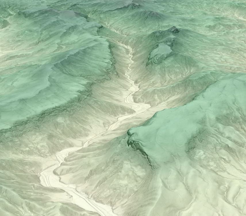 Here are some landslide deposits around Shortoff. First image is on east side of Shortoff, 2nd image on SE side: 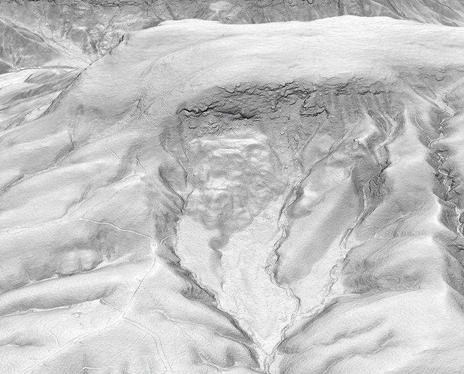 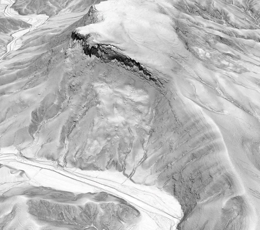 Here is some fun topography around the ampitheater. You can see the Prow, the North Carolina Wall, and I am sure a thousand other things. And how about this big old landslide/rockfall scar? Wow! To be around when that thing broke loose.... 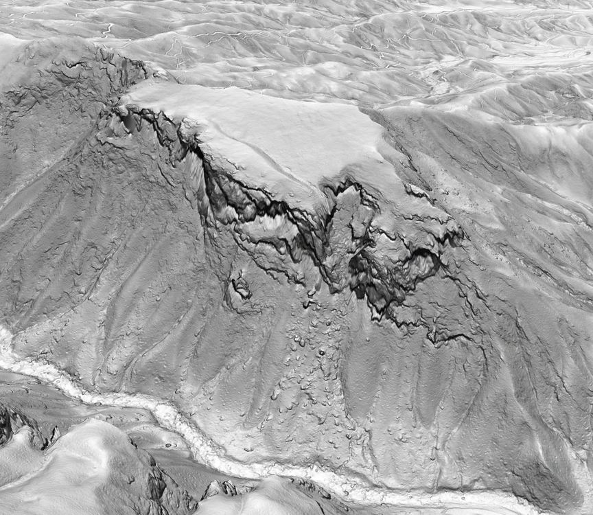 I am working on some satellite based methods to cleanly find relatively recent landslides. Here is an output from my workflow to find landslides triggered by Hurricane Florence in September 2018. Red represents a loss in vegetation - so likely landslides on the hillslopes and high-intensity channel scour/flooding in the Linville River. You can see one obvious slide on of the SW side, another toward the NW side, and a 3rd even further up the gorge. Has anyone seen these September 2018 slides in the flesh? 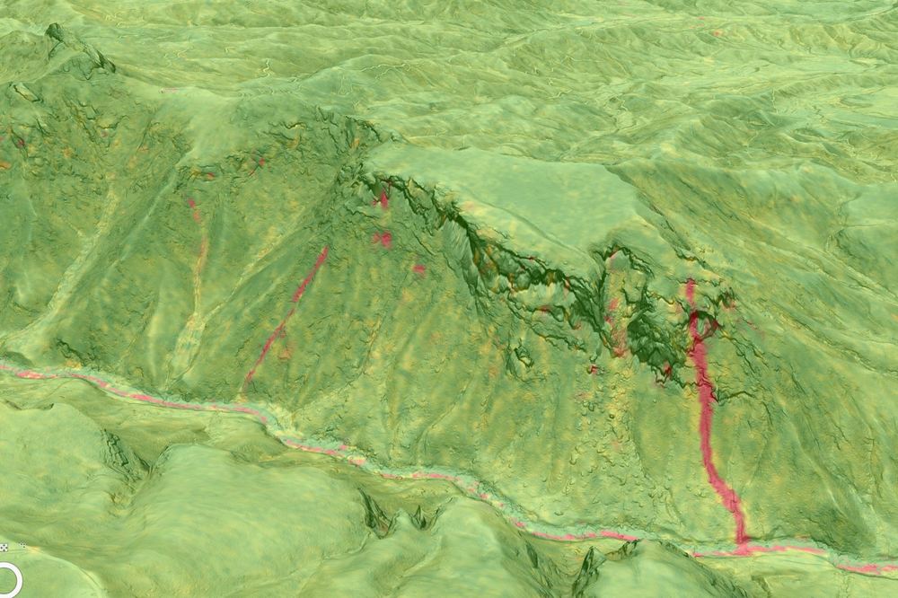 |
|
|
Cool stuff! |

|
I think the big buttress that separates the north side and south side of table rock south carolina will fall down one day. its really big and seems detached. |
|
|
Speaking of shortoff rock fall, this one scared me. not that large but a bad spot, for sure the fire made it worse, but i suspect frost pushed the blocks out 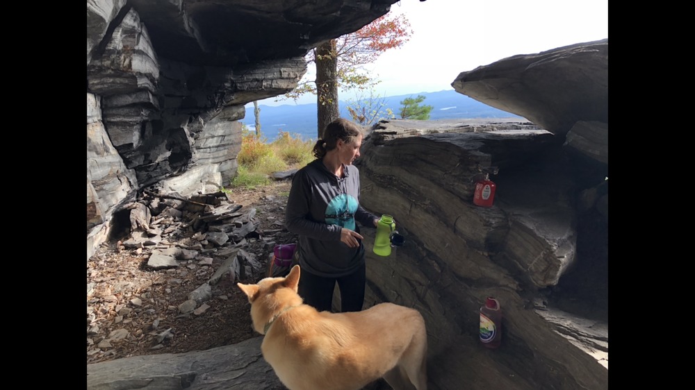 After nov 2017 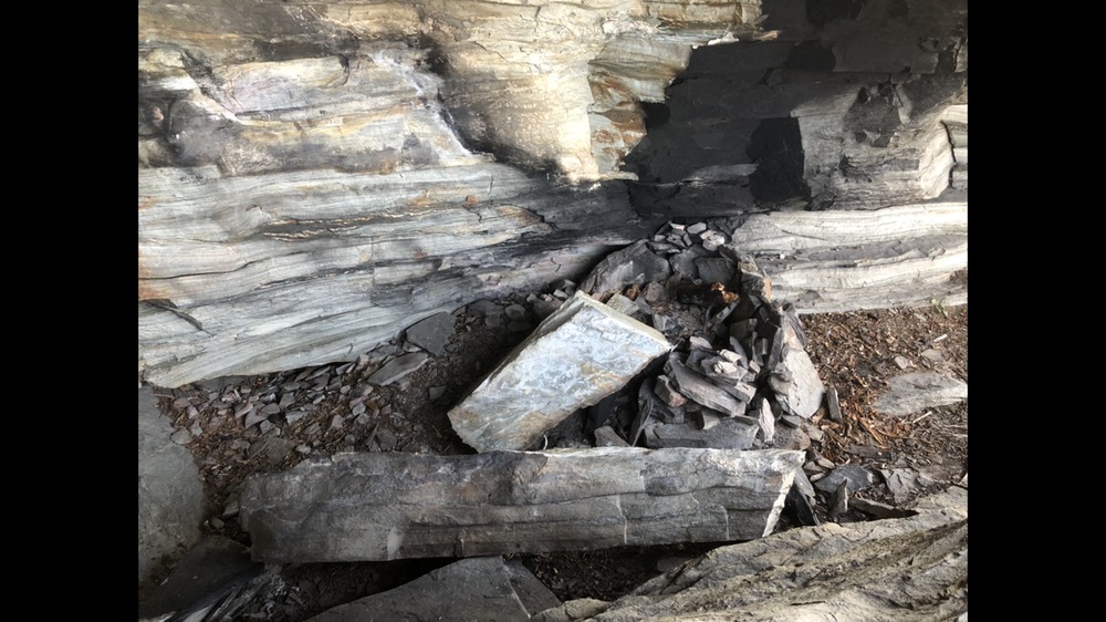 There was a landslide at big bradley falls in ~2018 Largest block i have seen fall was at victory wall when i was cleaning off and rappelling a route and realized i could tip a roughly 3000lb block with little effort |
|
|
here is a landslide |
|
|
https://www.weather.gov/gsp/PeeksCreek |
|
|
Guys and gals - this is all excellent stuff!!! I study debris flows around here day in and day out. Peeks Creek/Fish Hawk is a very good example and one that unfortunately resulted in several fatalities. The runout on that sucker was over 2 miles. Very humbling to be in these big old hills that are still modern day hazards. |
|
|
The rock that fell out of/off the right side of said buttress on the north side of table rock was a very large rock fall and is what formed reflections/cutlass. While no telling when it formed looking down on it definitely showed how massive it was when it occurred. And I agree the rest of the buttress looks detached from the main body of the mountain but hopefully will never come down. |
|
|
There can be no question that fires affect the rockfall in a given area. Basically the fire burns all the organic material from the soil that is holding loose rocks in place. Ash does not have much holding power. After the Party Rock fire the park wisely worked with the CCC and set up a trundle day to knock literally tons of fresh loose rock off many popular routes. Other places could stand the same remedy. |


