
 Continue with onX Maps
 Sign in with Facebook


South East Rock Climbing
Routes in South East

|
Awesome Alternatives TR 5.6 4c 14 V 12 S 4b |

|
Cat Cave T,TR 5.6 4c 14 V 12 S 4b PG13 |

|
Deep in My Mind TR 5.8+ 5b 16 VI- 15 HVS 4c |
|
|
Fun for the head TR 5.6 4c 14 V 12 S 4b |
|
|
In the corner of my mind T,TR 5.8 5b 16 VI- 15 HVS 4c |
|
|
Squiggly wiggly, jiggly giggly TR 5.7 5a 15 V+ 13 MVS 4b |
|
|
Tigger’s Day T,TR 5.6 4c 14 V 12 S 4b |
|
|
Unrelenting Finger Locks T,TR 5.10b 6a+ 19 VII- 19 E2 5b |
|
|
Wide Gear Only T,TR 5.4 4a 12 IV 10 VD 3c |
Order Wrong?
Sort Routes
Use onX Backcountry to explore the terrain in 3D, view recent satellite imagery, and more.
Now available in onX Backcountry Mobile apps! For more information see this post.
| Elevation: | 1,473 ft | 449 m |
| GPS: |
39.61496, -77.44704 Google Map · Climbing Area Map |
|
| Page Views: | 548 total · 13/month | |
| Shared By: | John Kelbel on Nov 7, 2022 | |
| Admins: | Frances Fierst, C S |
Description

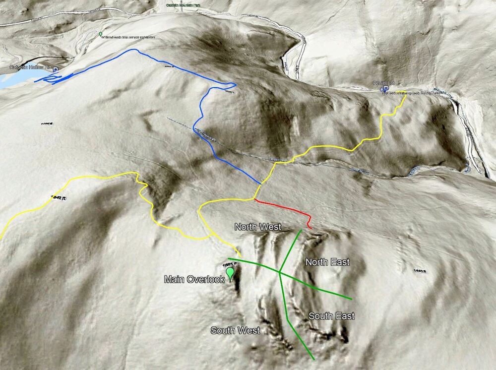
This area has the longest band of rock, which starts out short in height and gets taller the further you go reaching a height of about 38 feet. There are a few crack lines which make for some nice trad leads and lots of rout opportunity to top-rope.
Getting There
From the Cat Rock overlook stay to the left on the social trails heading East for about 300ft. Head slightly right (South) and follow the small band of rock. There are a lot of boulders at the base of the rock so it’s advisable to walk 200 to 300ft out from the base of the rock instead of crawling through the boulders. It's easy to end up on the South West band of rock so be sure to walk far enough East before heading to ones right.
Weather Averages
|
High
|
Low
|
|
Precip
|
Days w Precip
|
Prime Climbing Season
| J | F | M | A | M | J | J | A | S | O | N | D |
| J | F | M | A | M | J | J | A | S | O | N | D |
Photos


All Photos Within South East
Most Popular · Newest · RandomMore About South East
Printer-FriendlyWhat's New


0 Comments