Billy Goat Buttress Rock Climbing
Use onX Backcountry to explore the terrain in 3D, view recent satellite imagery, and more. Now available in onX Backcountry Mobile apps! For more information see this post.
| Elevation: | 9,500 ft | 2,896 m |
| GPS: |
43.82798, -114.55591 Google Map · Climbing Area Map |
|
| Page Views: | 6,636 total · 67/month | |
| Shared By: | Tim ball on Oct 3, 2016 | |
| Admins: | Mike Engle, Eric Bluemn |
Description

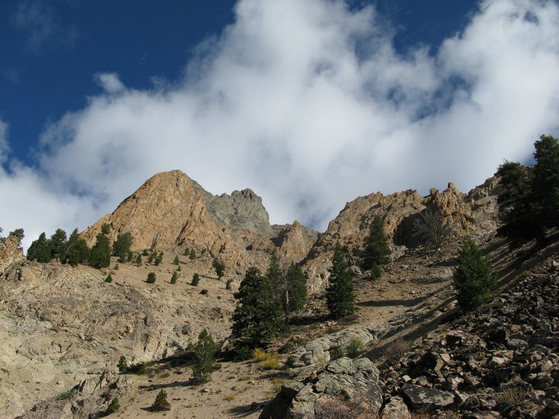
WNW facing alpine rock. Remote feel though relatively close to Ketchum. Pink/ orange granite intrusion surrounded by choss!
Getting There

Approximately 12 miles north of Ketchum, off highway 75. Turn right on silver ck rd, this is a steep, gravel road that varies in quality, a vehicle with good tires and clearance is advised, accessing this road is only open late spring, and closes again once the snow starts flying. Drive up this road, staying right at all junctions.After some steep switchbacks take the road that branches left. Follow this for to a dead end and old ruin, park here. From here, it is a 1500' rising traverse, crossing three drainages and lots of loose scree. A hiking pole and good boots are recommended. The billy goat is the obvious red buttress that rises to a point on the ridge.
Weather Averages
|
High
|
Low
|
|
Precip
|
Days w Precip
|
Prime Climbing Season
| J | F | M | A | M | J | J | A | S | O | N | D |
| J | F | M | A | M | J | J | A | S | O | N | D |
Photos
All Photos Within Billy Goat Buttress
Most Popular · Newest · RandomMore About Billy Goat Buttress
Printer-FriendlyWhat's New

 Continue with onX Maps
 Sign in with Facebook


0 Comments