Continue with onX Maps
 Continue with Facebook


Best Approach For Gash Couloir?
|
|
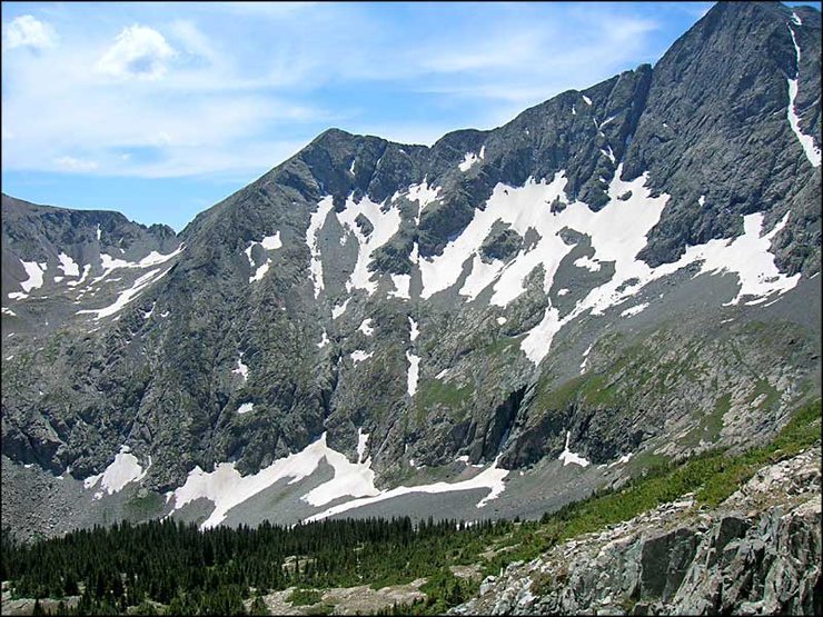
So I'm heading to the Gash Couloir on Blanca Peak in March or April and am curious of what the best way to get to the route is. |

|
Looks like you probably want the Lilly Lakes approach. |

|
Can't you see this thing from the top of Silverton? It looks amazing... if this is the same one. |
|
|
I have the general approach, more interested in the best way to get to the base of the route |
|
|
I think your best bet is to take the Lilly Lake approach. Follow the Lilly Lake trail for a few miles while it meanders up into the basin (S/SW) and gains some altitude. There is an obvious point in the trail where it starts to head N/NW and up to Lily Lake. At this point you leave the trail basically bushwack and talus up up to the base of the actual cliffs. You can get a good view of the rest of the approach from here as well since you will be standing in a bit of a clearing. I believe you should be able to follow this all the way around to the gash. There isn't a trail past the point where you turn off. |
|
|
Morgan Patterson wrote:Can't you see this thing from the top of Silverton? It looks amazing... if this is the same one.This is Gash Couloir on Blanca, nowhere near Silverton. |
|
|
sorry i was thinking the Gnar |
|
|
Thanks for the reply everyone. Someone who has done it contacted me and there is a hidden 55 degree couloir in the rock band below the face that leads right up to the climb. |
|
|
Kerr Adams wrote:Thanks for the reply everyone. Someone who has done it contacted me and there is a hidden 55 degree couloir in the rock band below the face that leads right up to the climb.Oh, that is awesome to know! If you get up there could you post a pic to the MP page as to its location? I was considering giving it a run this spring as well, and I like your idea much more than mine haha. |
|
|
I sure can! |