
 Continue with onX Maps
 Continue with Facebook


Devil's Bay Bouldering
Use onX Backcountry to explore the terrain in 3D, view recent satellite imagery, and more. Now available in onX Backcountry Mobile apps! For more information see this post.
| Elevation: | 7 ft |
| GPS: |
18.42703, -64.44615 Google Map · Climbing Area Map |
| Page Views: | 18,347 total · 184/month |
| Shared By: | Zach Bramel on Feb 21, 2016 |
| Admins: | Mikel Madsen |
 Access Issue: Climbing closures
Details
Access Issue: Climbing closures
Details
The majority of the areas on the island are now closed to climbing. Anything on National Parks Trust land is indefinitely closed.
Area Overview:

Beach Bouldering on the southern end of the island. This area is the most popular and developed. Devils bay is known for its beautiful beach and snorkeling. The area is popular amongst climbers and tourists so expect some people to be around. This area also has some of the hardest established and most classic lines on Virgin Gorda.
![]()
Devils Bay Aerial Overview. The Baths are to the left in the picture.
![]()
Looking Towards the Baths in the left corner of photo. Devils Bay Beach in center.
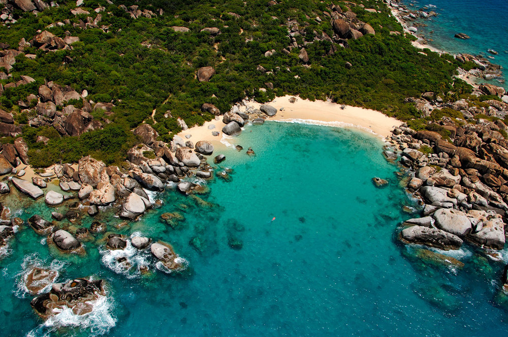
Devils Bay Aerial Overview. The Baths are to the left in the picture.
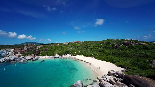
Looking Towards the Baths in the left corner of photo. Devils Bay Beach in center.
Classic Climbing Routes at Devil's Bay
Mountain Project's determination of the classic, most popular, highest rated climbing routes in this area.


Weather Averages
|
High
|
Low
|
|
Precip
|
Days w Precip
|
Prime Climbing Season
| J | F | M | A | M | J | J | A | S | O | N | D |
| J | F | M | A | M | J | J | A | S | O | N | D |
Photos


All Photos Within Devil's Bay
Most Popular · Newest · RandomMore About Devil's Bay
Printer-FriendlyWhat's New
Guidebooks (1)


0 Comments