
 Continue with onX Maps
 Continue with Facebook


East Ridge

5.3 YDS 3+ French 10 Ewbanks III UIAA 9 ZA VD 3a British Mod. Snow

 Avg: 3.7 from 38
votes
Avg: 3.7 from 38
votes
Routes in Mt. Edith Cavell
|
|
East Ridge T 5.3 3+ 10 III 9 VD 3a Mod. Snow |
|
|
North Face - Chouinard/Beckey/Doody T 5.7 5a 15 V+ 13 MVS 4b Mod. Snow |
|
|
West Ridge T 3rd 1- 1 I 1 M 1a Easy Snow |
Order Wrong?
Sort Routes
| Type: | Trad, Snow, Alpine, 5000 ft (1515 m), Grade III |
| FA: | J. W. A. Hickson and Conrad Kain, August 1924 |
| Page Views: | 12,986 total · 63/month |
| Shared By: | Peter Spindloe on Apr 15, 2007 |
| Admins: | Dave Rone, Tom Jones, Richard Rose |
Your To-Do List:
Add To-Do ·
Your Star Rating:


Use onX Backcountry to explore the terrain in 3D, view recent satellite imagery, and more. Now available in onX Backcountry Mobile apps! For more information see this post.
Description
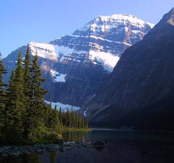
This is one of the most classic routes the Canadian Rockies and yet another fine FA by the King of Guides, Conrad Kain. The route follows the stunning left skyline of the mountain (see George's ![]() Mt Edith Cavell ).
Mt Edith Cavell ).
From the parking lot, take the trail to Cavell Meadows and then head up the moraines towards the bottom of the ridge. The scramble to the start of the ridge is one of the looser more unpleasant ones around, especially by headlamp.
At the base of the ridge you may want to wait until there's a bit of daylight. My partner and I arrived about two hours too early and felt that it was better to wait. We tried to nap but critters kept trying to get into our packs, even with us sitting on them.
The ridge has a snow couloir on its left and the north face on its right. Stay on the rock, but mostly on the left side closer to the couloir.
Depending on the snow and weather you may have bare rock the whole way (as we did) or snow and ice requiring crampons and an axe. Most of the climbing is fourth class and the rock is generally good, but it's still wise to be wary of the holds. If you pitch it out, you'll be there for days.
Roughly half way up the ridge there is a shoulder after which the route steepens a bit. One or two sections might be worth belaying, they'll be noticeably harder than the rest and it's fairly obvious from below.
It's not a knife-edged ridge so it's possible to do many variations in a lot of sections, but if it starts to feel harder than the grade would suggest, given the conditions, don't be afraid to scout a few options.
I'll post some pictures when I get the slide scans....
Location
To descend: Many, perhaps even most, parties reverse the route by downclimbing. Another option is to descend the West Ridge route which makes for a very large traverse of the mountain. The West Ridge is less technical (see the description once it's posted), but takes about six hours (but it could be a lot less depending on your fitness). Note that once you have crossed the summit and have started down the west ridge, stay on the ridge until the col with Mt. Sorrow. If you drop off the ridge sooner you may end up in some nasty cliff bands.
The West Ridge takes you into the Tonquin Valley which is relatively heavily populated by grizzly bears. I have no faith in bear bells -- we blew whistles, which made for a very long hike out. 'Didn't see any bears though. The most demoralizing part of using this descent is that at the end of a long day you have to finish by walking uphill on the road back up to the tourist parking lot since the trail dumps you out 2km down the road.
The West Ridge takes you into the Tonquin Valley which is relatively heavily populated by grizzly bears. I have no faith in bear bells -- we blew whistles, which made for a very long hike out. 'Didn't see any bears though. The most demoralizing part of using this descent is that at the end of a long day you have to finish by walking uphill on the road back up to the tourist parking lot since the trail dumps you out 2km down the road.
Protection
One thin shorter rope (30m even) should be plenty for any belayed sections or simul-climbing. There shouldn't be any rapelling on descent unless conditions are poor. A set of nuts and four or five cams up to hand size is more than enough. If snow or ice is present, and you still want to climb it, equip yourself accordingly. We saw no fixed gear at all.


5 Comments