
 Continue with onX Maps


ID 106008453 ·
·
Copyright Violation?


Rate Photo

Paul Huebner
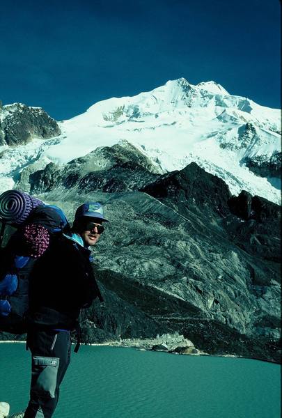
Aug 14, 2007
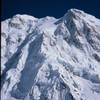
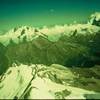
“Entire normal route up Huayna Potosi in Bolivia is shown (6/93). After crossing dam and walking along the viaduct, which ends near the lighter colored rock, the route follows up the sharp lateral moraine. Our Camp 1 was just below the black slope in the middle of the picture. High Camp is at about 18,500 feet on the snow plateau above. The route then goes to the right and up through headwall to snow ridge on the right edge of the picture. Eventually a very sharp ridge leads to the left up to the approx. 20,000-foot high summit, which is the second and furthest peak in the photo.
”


”


0 Comments