To save paper & ink, use the [Hide] controls next to photos and comments
so you only print what you need.
West Ridge
4th,
Trad, Alpine, Grade II,

 Avg: 3.5 from 35
votes
Avg: 3.5 from 35
votes
FA: unknown
Washington
> Northwest Region
> Hwy 20 & N Casc…
> N Cascades
> Twin Sisters Range
> N Twin
 Access Issue:
 Seasonal Raptor Closure at Newhalem Crags March 1st to mid-July
Details
Peregrine falcons select nest sites on cliffs in the Upper Skagit Valley, including the Climbing Management Areas of Newhalem West (Ryan’s Wall) and Newhalem East. As required in the NPS Superintendent’s Compendium, these areas will be closed to all public from March 1st to July 15th of each year, or until the young falcons have fledged or NPS staff have determined that nesting will not occur on a specific wall during this period. Access Fund, Washington Climbers Coalition and NPS partner on a volunteer raptor monitoring program to determine nesting activity. Contact the NPS and/or WCC for updates.
Description
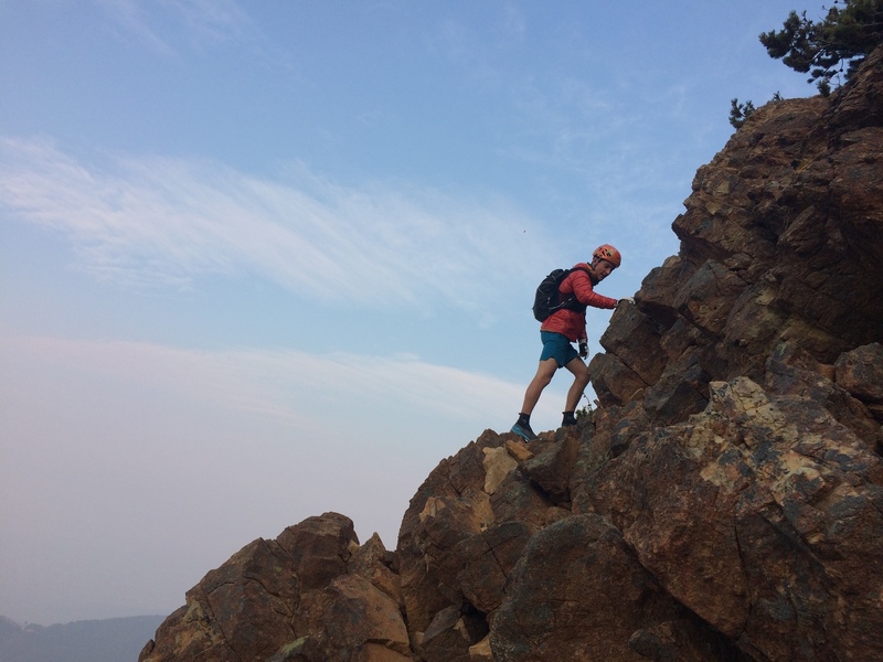
A long approach past Dailey Prairie to a ridge of solid sticky golden dunite. Once you've endured the slog, the route slowly turns from exposed hiking between stands of little fir trees into some sporting alpine scrambling. Options for 5th class abound. Easy route finding (just follow the ridge crest) with beautiful views and solid grippy rock! Lots of unnecessary handjams and fingerlocks can be had.
Excellent write-up on
Summit Post.
Protection
Most do it in a pair of sturdy hiking boots. If descending the north slope, bring ice axe and crampons. Helmets are always a good idea.
Directions
Drive to Acme, WA. Take Mosquito Lake Rd east for awhile, cross a one-lane bridge, then turn right into a gravel pit and follow the road out the other side. This is "Middle Fork of the Nooksack River" FS Road. Stay right at all forks. Just after crossing the bridge over Clearwater Creek, stay right at the final fork and stop at the bridge. The gate was closed for us. There are some nice campsites here.
Approach
Follow the road as it switches back up the Nooksack river valley. Do not take any branches, just continue straight towards Mt. Baker. Cross a bridge over a creek, then turn right at a quarry. Cross the bridge mentioned in the description, and then through Dailey Prairie towards the now-obvious west ridge. Take the first distinct single-track trail on your left (second overgrown logging road). Follow this up a couple switchbacks until the brush thickens. There will be a large firepit on your left - ditch bikes here. Continue up the trail until it emerges on the ridge.
![The Sisters Glacier, if I remember correctly..]()
[Hide Photo] The Sisters Glacier, if I remember correctly..
![At the beginning of the route, South Twin on right.]()
[Hide Photo] At the beginning of the route, South Twin on right.
![Winter ascent of west ridge, N. twin 1993 the clear cut logging takes away from the route]()
[Hide Photo] Winter ascent of west ridge, N. twin 1993 the clear cut logging takes away from the route
![looking to the South Twin winter]()
[Hide Photo] looking to the South Twin winter
![starting the short crux pitch winter 93]()
[Hide Photo] starting the short crux pitch winter 93
![Partners red helmet just coming up the crux pitch winter 93]()
[Hide Photo] Partners red helmet just coming up the crux pitch winter 93


 Continue with onX Maps
 Continue with Facebook


Two things are required to make this an enjoyable one-day experience. First, a mountain bike. You can ride it most of the way up. Second, ice axe and crampons. You will DEFINITELY want to glissade the north slope. This will require that you do it fairly early season. This year, the snow on the north slope was still thick and wide even in early July, but it probably wasn't like this in previous years. Jul 3, 2017