Mountain Project Logo
To save paper & ink, use the [Hide] controls next to photos and comments so you only print what you need.

Frostbite Ridge

4th AI1-2 Steep Snow, Ice, Snow, Grade II,  Avg: 3.4 from 9 votes
FA: unknown
Washington > Northwest Region > Darrington & Mt… > Glacier Peak Wi… > Glacier Peak

Description

This is a committing route in that it is a very long approach with lots of up and down that could difficult to retreat on. Total mileage (up Frostbite, down Cool Glacier) is slightly over 40 miles.

Based on the occasional washout of bridges/roads the best approach may vary year to year. Most parties will want to descend an easier route, with the Gerdine Ridge/Cool Glacier route being the standard route currently. If descending the standard (Cool Glacier) route, the North Fork Sauk Trail may be the best starting/ending point.

Take the North Fork Sauk Trail #649 to the PCT. Go north (left) on the PCT to Glacier Ridge. Approximately 19-20 miles from the trailhead, a small but obvious path leaves the PCT on Glacier Ridge appr. 0.7 miles after Glacier Creek. This trail departs the PCT just before the PCT goes around the bottom of the ridge.  The path leads to the crest of an alpine ridge, past some bivy sites to the lower slopes of the Ptarmigan Glacier. Traverse around the left (north) side of Kennedy Peak (48.132108 N, 121.12541 W).

Alternatively, depart the PCT just before crossing Glacier Creek, and ascend scree and bushy slopes to the peak of the old Kennedy Glacier moraine.  There are good bivy sites here around 6100 ft.  Drop down on the toe of the glacier and ascend the Kennedy Glacier, passing below the south side of Kennedy Peak.  This alternative route joins the "standard" route at the saddle above Kennedy Peak at around 8200 ft.

Continue to ascend on snow the Kennedy Glacier SE and the Frostbite Ridge will soon come into view (see photo).

Ascend the ridge on snow or loose rock. Most parties will probably desire protection on portions of the ridge. I found small to medium nuts useful for the belays. We found snow up to appr. 45 degrees on this section.

Pass through the rabbit ears notch at the very top of the ridge and descend class 3 rock for appr. 150 feet to a saddle. (Note: the rabbit ears will not look like rabbit ears until you are beyond and above them. The best way to find them is just realize that they are at the very top of the initial ridge. Cutting right through the rabbit ears notch will give you the view of the steep snow/ice climbing that comes next (see photo).

From the saddle, cross snow or loose rock along a ridge to the base of the low angle alpine ice face.  Ascend this face for 1-2 pitches until it begins to round off to a lower angle. Ascend the ridge to the crater rim and descend into the crater.  From the bottom, pick your path to the top. We took a ramp that started on the right and went up and left cutting directly up at the top.

Descent - Be sure to know the descent. The standard descent is the Gerdine Ridge/Cool Glacier. It may help to have certain locations such as Glacier Gap (48.080051 N, 121.108357 W) preprogrammed into your GPS. Peakbagger.com has GPS tracks of the descent route.

Hiking Strategy - we both packed as light as possible. Trail runners may be appropriate for the long sections of trail hiking, carrying lightweight climbing boots for the technical sections.

Most parties will take 2-3 days.

Protection

Rope, pickets and ice screws. (Optional: small to medium nuts)

Route may be snow in the early season, expect more ice later in the year.

Route may have a couple pitches of low angle alpine ice, but is mostly hiking and some scrambling; select axes/tools appropriately.

Photos [Hide ALL Photos]

Glacier Peak from north, showing Frostbite Ridge Route
[Hide Photo] Glacier Peak from north, showing Frostbite Ridge Route
Kennedy Peak at sunrise - August 2003
[Hide Photo] Kennedy Peak at sunrise - August 2003
Sunset on the unnamed headwall. 8/18/23
[Hide Photo] Sunset on the unnamed headwall. 8/18/23
Slightly drier conditions on the final section of the route below the Rabbit Ears in the summer of 2003. The crux was probably the steep headwall below the summit ridge in the back of this image.
[Hide Photo] Slightly drier conditions on the final section of the route below the Rabbit Ears in the summer of 2003. The crux was probably the steep headwall below the summit ridge in the back of this image.
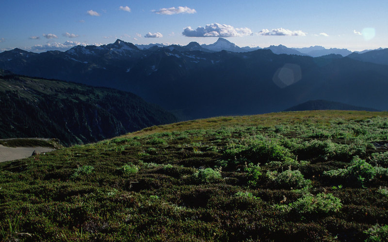
The first view of Frostbite Ridge
[Hide Photo] The first view of Frostbite Ridge
Seriously melted out at the Rabbit Ears - August 2003. Not very alpine, but much easier when you're travelling alone.
[Hide Photo] Seriously melted out at the Rabbit Ears - August 2003. Not very alpine, but much easier when you're travelling alone.
finishing up to the summit
[Hide Photo] finishing up to the summit
View from camp - a day from the road in August 2003.
[Hide Photo] View from camp - a day from the road in August 2003.
Betsy Harrison on the north side of Kennedy Peak in August 2003. We didn't go much further as a thick cloud bank enveloped the area shortly thereafter and visibility was next to nill. We didn't know the route so wisely turned back.
[Hide Photo] Betsy Harrison on the north side of Kennedy Peak in August 2003. We didn't go much further as a thick cloud bank enveloped the area shortly thereafter and visibility was next to nill. We didn't kno…
In late summer conditions, descending the route is quite easy and thus there's no need to carry over. It was so melted out that the Rabbit Ears section was a boot ski in the dirt. Few crevasses on this route. Easy to navigate solo.
[Hide Photo] In late summer conditions, descending the route is quite easy and thus there's no need to carry over. It was so melted out that the Rabbit Ears section was a boot ski in the dirt. Few crevasses on…
End of the day view of late summer conditons from my campsite. Got up really early so as to be back at camp before the snow got too soft.
[Hide Photo] End of the day view of late summer conditons from my campsite. Got up really early so as to be back at camp before the snow got too soft.
breaking out of the clouds on the vista glacier
[Hide Photo] breaking out of the clouds on the vista glacier

Comments [Hide ALL Comments]

Curt Veldhuisen
Bellingham, WA
 
[Hide Comment] With the new PCT re-route, the approach via the Suiattle River Road is shorter and easier than others. Follow the Suiattle trial about 6 miles, turn south onto the PCT, hike another 10 or so miles right to the north side of the mountain near Vista Ridge. Most of the elevation gain is in the last 5 miles. The new trail was completed in 2011, so not shown on most maps. Beautiful hiking with some huge old growth! Jul 7, 2017
Kyle Tarry
Portland, OR
  4th AI2 Steep Snow
[Hide Comment] We climbed it in July 2021, entering and exiting via the N. Fork Sauk TH (the same TH that most folks use for the regular route) and using the PCT to approach via Red Pass. We used the standard south side Cool Glacier route to descend. The route would have be difficult to descend in the conditions we found, but that may vary. Pretty good route, we were pleasantly surprised by both the scenery and the climbing on the route. Expect some choss wrangling, some steep snow, and some mellow alpine ice. Jul 12, 2021
T T
Washington
  4th AI1-2 Steep Snow
[Hide Comment] to follow up on Curts comment. The Suiattle river road is currently in decent shape to the Suiattle river/milk creek trailheads. The Milk Creek trail was "restored" in 2018 and using as an approach would cut the total mileage to ~31mi. Crossing the Suiattle near the trailhead would be tricky, along with a lot of bushwhacking since the Forest Service has it marked "primitive" until it junctions with PCT. Talking with rangers (7/2023) they do not recommend using the Suiattle River Trail or the Milk Creek Trail as an approach since they are not maintained and even if they were cleared there's not enough foot traffic to keep them cleared. They also mentioned the PCT in that area is extremely bad. Whatever time you thought you would save in mileage is lost due to blowdowns, unabridged river crossings, and constant bushwhacking. The North Fork Sauk Trailhead to PCT to Kennedy Glacier appears to be the best available option as approach for late season 2023. Jul 9, 2023