To save paper & ink, use the [Hide] controls next to photos and comments
so you only print what you need.
Smooth Emerald Milkshake
WI4,
Ice, Alpine, 800 ft (242 m),

 Avg: 3.3 from 26
votes
Avg: 3.3 from 26
votes
FA: Todd Cozzens & Pat Meese. 1992.
Wyoming
> Cody
> S Fork Shoshone…
> N Side Routes/S Facin…
Description
Smooth Emerald Milkshake is the longest moderate route to be found on the South Fork of the Shoshone River. This fantastic line can be reached in just a little over an hours hike from the Deer Creek trailhead in good snow conditions. Approach as for Bitches Brew; after reaching the Bitches Brew drainage, walk and climb down the drainage to reach the bed of Deer Creek itself. This may involve some down climbing using a fixed rope or some rappelling if the fixed rope is gone. Once in the bed of the creek, hike upstream just a short ways to reach the base of the route where it pours directly into the creek.
Begin by climbing a nice curtain of ice to where it lays back a bit and then go up to belay from some bushes on the left. Continue hiking and scrambling up the climb for several hundred meters over a few steeper bulges of ice before encountering the double tiered crux pitch.
At the crux, climb the first tier to reach a ledge and then start up the main curtain, which is about 40 meters in length. It may be steeper on the left and a little easier on the right. Look a tree with rap slings on the right at the top of the climb.
Continue up the drainage to encounter a couple of more pitches that are steep, but shorter than the crux. The first of which is a nice, steep curtain that could be bypassed to the left. Above that a twisting, turning section of ice ascends a gully to the top of a band of rock.
You could continue up the climb further from this point; the drainage splits and there are several bulges or curtains between 5 and 15 meter in length to be found. If you decide to start going down, rappel and down climb the route. Double ropes are really handy as well as some webbing that you can use to rig rappels. Enjoy; this is a wonderful long ramble up lots of moderate ice.
Protection
Double ropes and ice screws are all you need to climb this route.
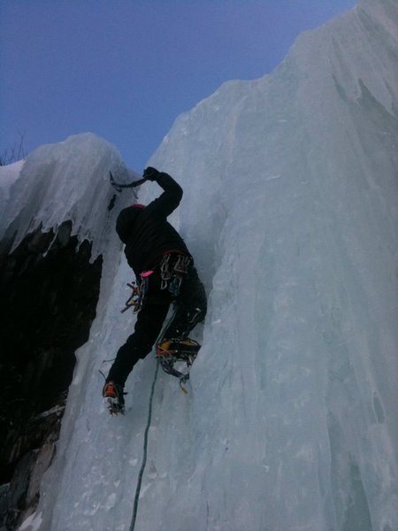
![Money pitch of Smooth Emerald Milkshake]()
[Hide Photo] Money pitch of Smooth Emerald Milkshake
![Follow the arrow down the ridge to the East of the Bitches Brew drainage eventually trending right when the ridge drops off into the ravine. You'll know you're at that drainage when you look across the ravine and clearly see the massive SEM drainage.]()
[Hide Photo] Follow the arrow down the ridge to the East of the Bitches Brew drainage eventually trending right when the ridge drops off into the ravine. You'll know you're at that drainage when you look across…
![Fixed line and down climb at the end of the Bitches Brew drainage in relation to the first pitch.]()
[Hide Photo] Fixed line and down climb at the end of the Bitches Brew drainage in relation to the first pitch.
![The last, long pitch. An 80 degree pillar before a long slab.]()
[Hide Photo] The last, long pitch. An 80 degree pillar before a long slab.
![Kirill slaying the second to last pitch. Short, steep pillar.]()
[Hide Photo] Kirill slaying the second to last pitch. Short, steep pillar.


 Continue with onX Maps
 Continue with Facebook


Lander, WY
Salt Lake City, UT
Take note, on the end of this track, is us rooting around trying to find the best crossing. You don't need to go quite as far as we did, in fact you are better to drop into the canyon just before the base of the route. This map will hopefully help you get there though. Feb 7, 2018
Cody, WY
Roberts, MT
Victor, ID
Seattle, WA