
 Avg: 3.9 from 19
votes
Avg: 3.9 from 19
votes
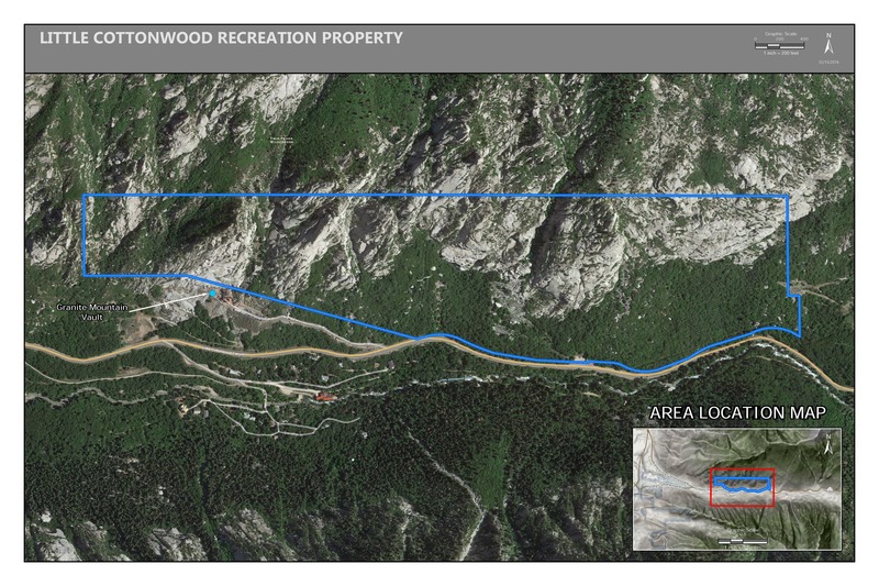
 Access Issue: Gate Buttress Area Recreational Lease: Climbs on Church Buttress above vault remain closed
Details
Access Issue: Gate Buttress Area Recreational Lease: Climbs on Church Buttress above vault remain closed
Details
This route is among the most difficult crack climbs in the world. Trench Warfare follows the yellow line. Wench Warfare, an extension, follows the green line.
I've never successfully redpointed the route. But I sure gave it a good try. I think exiting the pod is the crux. Most folks I've asked about it say there is no distinct crux location. The length of the route is what seems to give it its difficulty. Ironically, it's only about 60' long. But the logic behind it can't be easily dismissed. The route is an athletic event. Try not to throw up... or down. :-)
You may want a rack of 10 cams (2"-6") and 10 carabiners. A buddy can actually hand you each cam from the ground as you are climbing the route. If you look closely you'll notice you don't really need any protection for the crack when it grows beyond 4" because there is a fixed runner & carabiner in place now. If you don't have a cam bigger than 4" you can still keep from hitting the ground. But taking 1 or 2 bigger cams will help you "work" the route near the pod.
For reference:
New #4 Camalot: 2.6"-4.5"
New #5 Camalot: 3.4"-5.9"
If you can see Super Slab, directly across the canyon from the park and ride lot (and/or slightly up canyon from the electronic sign at the bottom, which is kinda straight across from the Scruffy Band, and Super Slab is slightly up and left of Scruffy Band), then, look to the left.
You'll pass a gully, then hit "Hanging Slab" as the next slabish rock left of that gully. Hanging Slab has a hut cut out in it, and the boulder that slid out of the cut out is what forms the roof crack of Trench Warfare.
If you park, walk up canyon until you kinda straight across from it, you'll see a faint trail through the weeds that drops down to LCC creek. Cross the creek, and pick up a trail that goes by some neat old quarry stuff from the mid 1800's. Follow the trail up hill staying left of the gully to the right (and you'll be able to see Super Slab as well). Trail should go right up to Trench Warfare boulder and then the base of Hanging Slab.
Warm up on the Steinfell route (fun, friction, so, not really a warm up for an upside down OW climb!). Place pro often, the ground is really close...
I previously reported the FA of this route as 2005. Sorry for the mistake. I meant 1995. I'm getting old. The decades are all starting to run together.

 Continue with onX Maps
 Sign in with Facebook


If you can see Super Slab, directly across the canyon from the park and ride lot (and/or slightly up canyon from the electronic sign at the bottom, which is kinda straight across from the Scruffy Band, and Super Slab is slightly up and left of Scruffy Band), then, look to the left. You'll pass a gully, then hit "Hanging Slab" as the next slabish rock left of that gully. Hanging Slab has a hut cut out in it, and the boulder that slid out of the cut out is what forms the roof crack of Trench Warfare. If you park, walk up canyon until you kinda straight across from it, you'll see a faint trail through the weeds that drops down to LCC creek. Cross the creek, and pick up a trail that goes by some neat old quarry stuff from the mid 1800's. Follow the trail up hill staying left of the gully to the right (and you'll be able to see Super Slab as well). Trail should go right up to Trench Warfare boulder and then the base of Hanging Slab. Warm up on the Stienfell route (fun, friction, so, not really a warm up for an upside down OW climb!). Place pro often, the ground is really close...
Some folks were complaining about posting routes you haven't sent, led, worked to death, broken a leg on, etc. This should hopefully prove that a guy that's never been to SLC can take ten seconds out of his day to be helpful rather than "trolling". Aug 28, 2007
USA
I don't agree with this statement. Just because someone else thinks something is good/bad, I reserve the ability to make my own judgement.
"Dont expect perfection or exactly the amount of beta you desire. The best anyone can do is provide what they figure is enough. If you really need more beta perhaps you should consider not attempting the route. If you e-mail me route beta I will probably add it. If you piss & moan in the comment section without giving me any beta I will probably ignore you."
I mostly agree with this statement, the whole paragraph really. However, I don't think anyone was pissing and moaning in the comments section here. You said it was a two to four inch crack, which is wholly innacurate. We wern't looking for better beta, we were looking for the correct beta, big difference. You then proceeded to go way overboard. Just to add my two cents: In a route description I hope to get a genral idea of which pieces will fit in, i.e. a range of what to bring, and a general description of what the crack is like. From this I can figure out which routes I want to go do, and what gear to bring up to them. Also, because this site has the space for it, I love to hear any history about the route. Thanks again John for adding your contributions. Also, thanks Killis for the good directions.
One a different note. We all have our own opinions and agendas, and I think the beauty of this site is that everyones opinions and agendas get muddled together into some form of "consensus". We can all bitch at and argue with one another, but none of what any of us say is the absolute rule or standard. Our own personal contributions simply provide different ways of looking at the same thing. Thank you for your viewpoint ooo. Nov 11, 2007
Grand Junction
Park at the temple quarry trail and hike up the paved section till it U turns. Go straight here onto a dirt trail for a minute till you hit the old concrete building, then cross the river aiming for a cairn on the opposite side. A small trail heads up east through thick brush for awhile till you hit a small wood bridge. Immediately after the bridge continue straight(not up and right) till you see an old rusted piece of metal on the side of the trail. Turn right and start heading up hill next to a streambed looking for cairns along the way. The streambed becomes bigger, but hike straight up it till you reach a bit slabby boulder. Right after this on the west side of the riverbed is a huge cairn. Hike straight west from here on a decent trail till you hit the TW boulder. Probably 20 minute hike up there. If its high water the old rusted piece of metal turnoff can be reached via the wasatch resort road.
Fixed draw in Pod gone as of may 2012 May 16, 2011
Ohio
youtube.com/watch?v=2Ok0tst… Nov 16, 2011
Las Vegas
I've found it best to park in the Temple Granite Quarry parking lot which is directly across the road from the park and ride. Follow the paved path until you get to an abandoned concrete building, from there you will cross the river bed and continue on a trail that starts up on the other side. Follow this single track trail up and to the left towards the Allen Ridge Area. You will come to a fork in the trail, the left path leads to a large arrow shaped boulder with blasting marks and a small campsite, the right side will continue up towards the crag, once here there will be cairns taking you up towards the Trench. Once you get there you can either go left or right around the block, it doesn't matter as they will both place you inside the climb.
There is a small camp spot tucked up towards the end of the crack. There is a fire-ring type thing and for some reason lots of old fruit cans and trash. PLEASE pick up your trash, I was up there 7/1/16 and there were balls of climbing tape littered throughout the area. If you are strong enough and brave enough to take on this route, you should be able to pick up after yourselves.
A spotter/ boulder pad would be nice for the last 15-20 feet or so. Jul 3, 2016
Salt Lake City
Idaho