
 Continue with onX Maps


All Locations >
Colorado
> CO Ice & Mixed
> RMNP - Mixed/Ice
> Glacier Gorge T…
> Loch Vale & uphill
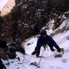
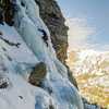
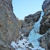
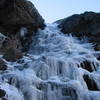
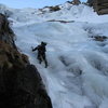
> Northwest Face Route… (WI3-4)


ID 119208285 ·
·
Copyright Violation?


Rate Photo


 4.5
from
2 votes
4.5
from
2 votes
Josh Bender
Jul 13, 2020
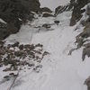
“This topo map shows the terrain and degree of slope for the area approaching the NE Gully of Thatchtop. (A.K.A. where the avalanche potential is).”


0 Comments