The Barre des Ecrins is the highest peak in the National Park in the southern French Alps (and visible from lots of places in the northern Alps).
. . . GPS lat long approx (N44.9223 E6.3593) . (elevation 4102 meters / 13,458 ft).
After climbing some snow/ice couloirs and traversing the summit ridge, Olivier and I skied from a couple of hundred meters below, first down sustained 35 degrees, then long ways on gentle glacier, and finally on dirty snow almost to the hiking approach trail (below the Refuge Glacier Blanc hut).
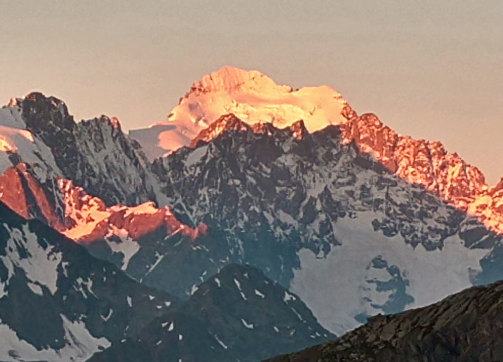
Barre + Dome de Neige from north (previous morning after sleeping Col Galibier)
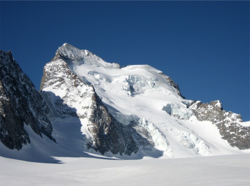
Barre from NE approach on Glacier Blanc (12 years ago when I skied the Dome):
I've been wanting to climb the Barre for years, but insisted that I would only do it if I could ski. This year the snowpack in France was so big that it made sense to ski it in June (likely we were the last ones this year because the low part was bad for our ski bases). For years I had assumed that I would get to the top on the rock ridge, but this year the summit ridge was covered with snow -- key reason we needed to make an early start 3:30am from the Glacier Blanc hut (N44.9378 E6.4116).
After carrying our skis up the trail 30 minutes in the dark, then skiing across the gentle glacier in growing light, we switched to crampons and climbed the couloir of the Barre Noir (sustained 47 degrees, this year alpine snow rather than ice).
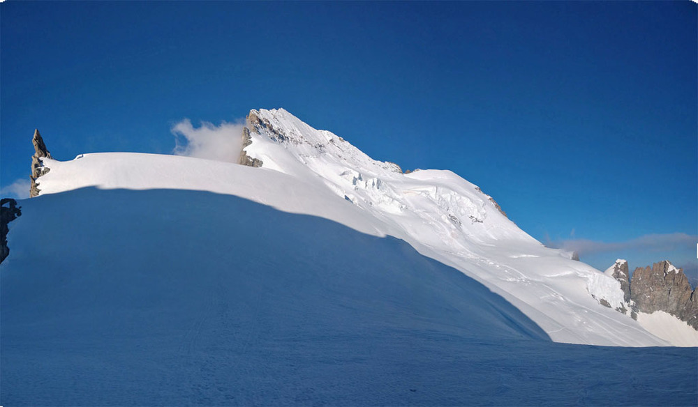
Barre + Dome west from top of Barre Noir couloir:
Next a rising traverse and we took our skis off our packs and left them at the base of the Whymper couloir (sustained 50 degrees, with the harder ice still covered by seasonal snow).
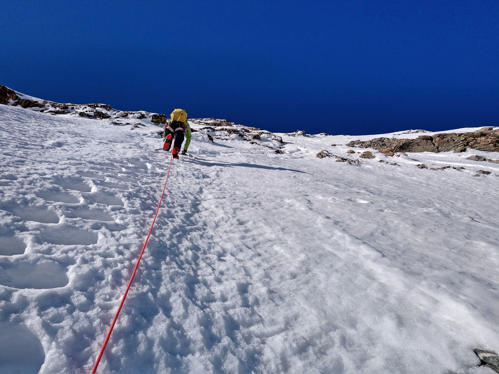
Olivier leading second pitch of Couloir Whymper:
Up this to reach the ridge, then traversed the narrow ridge east to west up and over the summit. Then easier hiking around back down to the base of the Whymper couloir to our skis.
Skied down the normal route, still some rough hardpack higher up (because of our early start) -- glad to find I could handle it in my (unaccustomed) super-light skis and boots. Mushy as we got a bit lower, not such fun skiing. The big skiing payback was when we reached the gentle glacier, so we had a long fast cruise. Skipped the trail-walking section we'd started in the dark. Indeed we skipped the hut enirely and skied down on the other side from the SW side of the glacier. Some steep (35 degrees?) narrow sections between rocks. Snow kept getting dirtier, and a couple places where we stepped our skis on rocks.
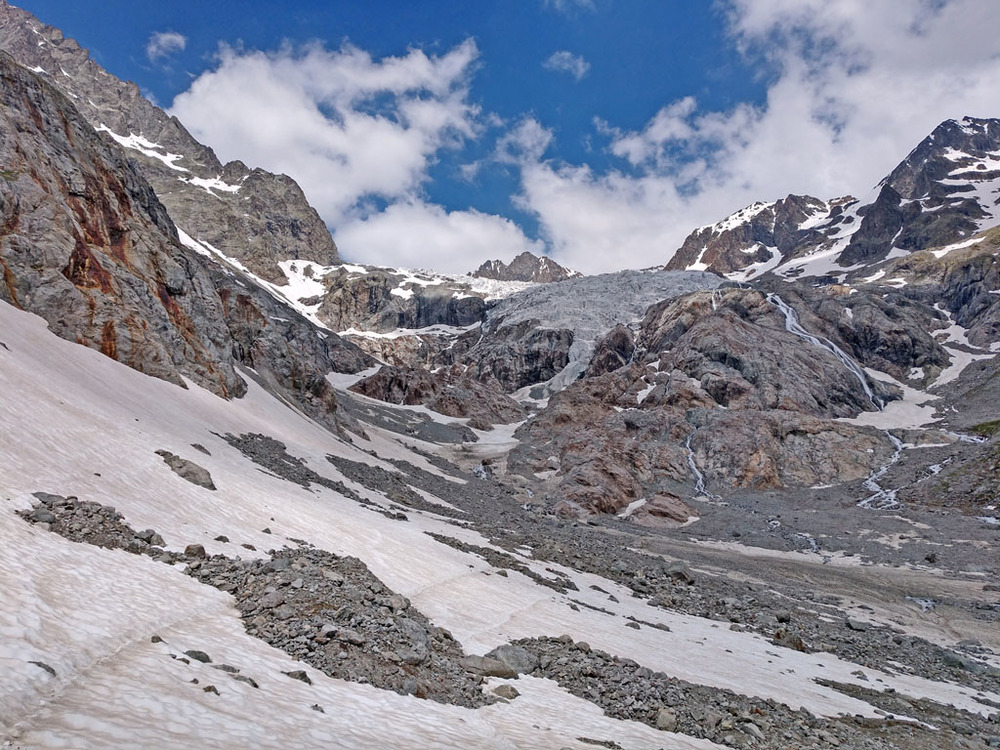
Looking back up to our skiing (center left) further below the glacier:
Finally a short walk carrying skis to reach the main trail for the hut, and easy jog down to parking at Pre de Madame Carle (N44.9172 E6.4166).
thoughts:
* We both were really glad we hauled our skis up the lower couloir.
* Great to do a "complete tour" of the north side of the mountain, instead of just the normal route up + back.
* I don't have much experience climbing alpine ice, but conditions made if feel easy.
* I think many parties do the upper face instead by Couloir Coolidge because it goes more direct to the summit -- but I was glad to arrive below on the ridge from Couloir Whymper, and take the summit as a traverse.
* the more obvious _skiing_ objective is the Dome de Neige (satellite peak WNW, elev 4009m), but that would have added time + effort, and I had previously skied it a few years ago in perfect conditions (so I felt comfortable doing that solo) -> [
photos ]
Ken


 Continue with onX Maps
 Continue with Facebook