
 Continue with onX Maps
 Continue with Facebook


Palisades beta photos?
|
|
Anyone have recent photos of the palisade basin, or more interestingly the crest itself? I know it's dry up there, just trying to gauge how dry exactly :) |

|
|

|
Cimbed the U-Notch last weekend (2/10/18), here are a couple pics from the glacier. Mt. Sill in the first pic and shot of the crest as well. It’s was in early spring conditions imho. I have more pics depending on what you are looking for. 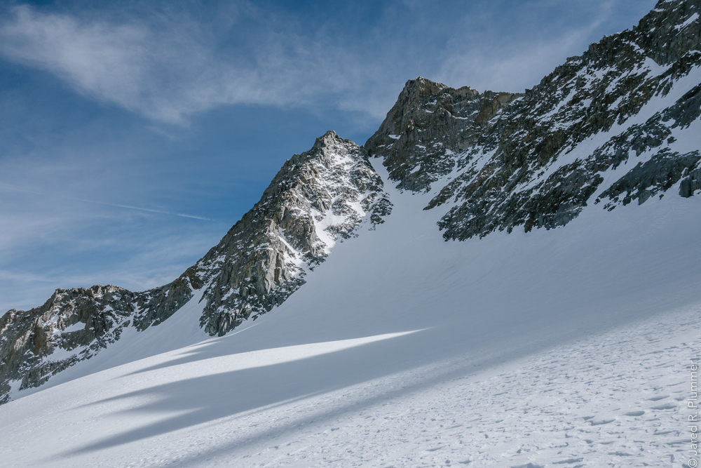 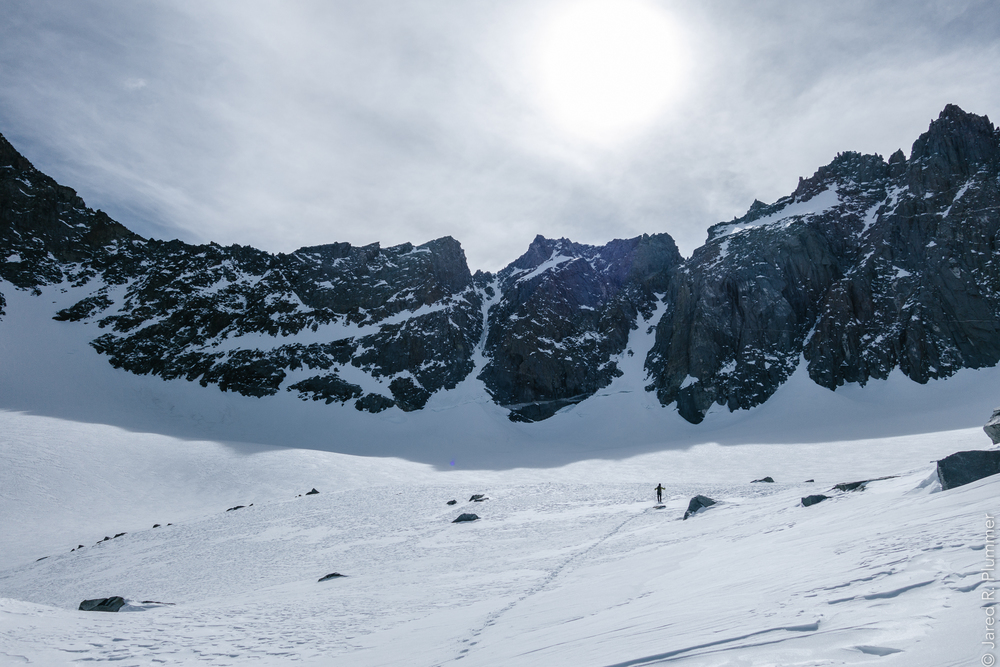 |
|
|
V-notch as of 2/10/18 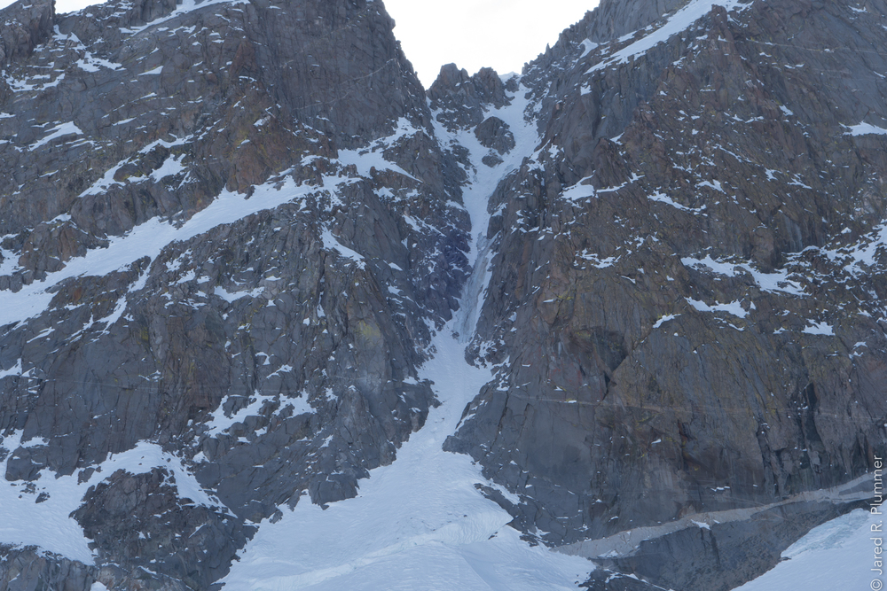 |
|
|
This pic is at the top of u-notch 2/10/18. 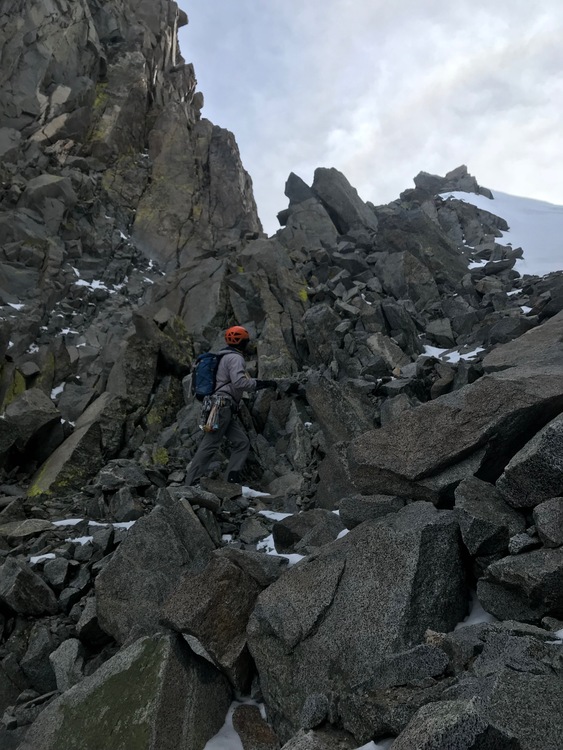 |
|
|
These are great, thanks for posting. Two questions: How were snow conditions on the approach up to sam mack? Also, how much rockfall / loose rock on the ascent compared to normal spring conditions? Jared wrote: |
|
|
We wore approach shoes nearly all the way to Sam Mack meadow. We put on our boots just for the last little bit of switchbacks (which were buried) just before Sam Mack at the creek crossing. We postholed a bit up this slope (50lb packs), but when we left on Sunday, it was better. There was a good boot pack from other day hikers. No rock fall in the couloir with the exception of what we kicked down at the very top when we were descending. We started up the couloir around noon. That said, most of that rock was swallowed by the snow in the chute and never reached the bottom. It will be much colder for the next week, so conditions will be different with a crustier/harder surface. |
|
|
Bumping on this thread rather than starting a new one. I was hoping to do a winter ascent of North Pal this upcoming weekend (March 24-26) from Glacier Lodge Rd via the U-Notch over three days (ski in, ascend, ski out, one item per day). I'm watching the current system moving through the Sierra (point forecast for Palisade crest here). It's supposed to be mostly cleared out, especially in terms of accumulation, by Friday. I am curious, with the wind loading and cold temperatures that will follow the system, if the couloir and avalanche-prone areas of the approach to the Palisade Glacier will be safe by Sunday. I'll be checking the Sierra Avalanche Center's site (though most of the reporting is clustered around Tahoe and not the central Sierra), but I don't know much about how the east side of the Palisades in particular or the timing of this system specifically affect avalanche dynamics there. Any input is appreciated, thanks! |
|
|
David, the Eastern Sierra Avalanche Center forecasts for the Eastern Sierra from Bishop to Lee Vining. Check it out. The snowpack up high is probably a lot more complex than 'average' seasons. More faceted weak layers, etc. I can't speak personally as to what it's doing in the Palisades. It's going to snow a lot this week and there will be a lot of wind. Danger will be considerable (and I don't use that term in the specific avalanche forecasting sense). As to when it's safe, that's a tough call, but if you go be prepared to assess the danger yourself and turn around if needed. Personally I'd make other plans. |
|
|
Thanks Mike. I'll wait for another weekend a bit more temporally distant from the late storms/blessings. |
|
|
Anyone have recent beta or photos from the approach and crest? |
|
|
I don't have Palisades pix but see my update from Evolution Basin. Generally continuous snow coverage is at ~ 9,500 ft although south facing aspects are melting fast. |
|
|
Thanks. |
|
|
Here’s the summit ridge of norpal from the top of the chimney yesterday 4/29/18 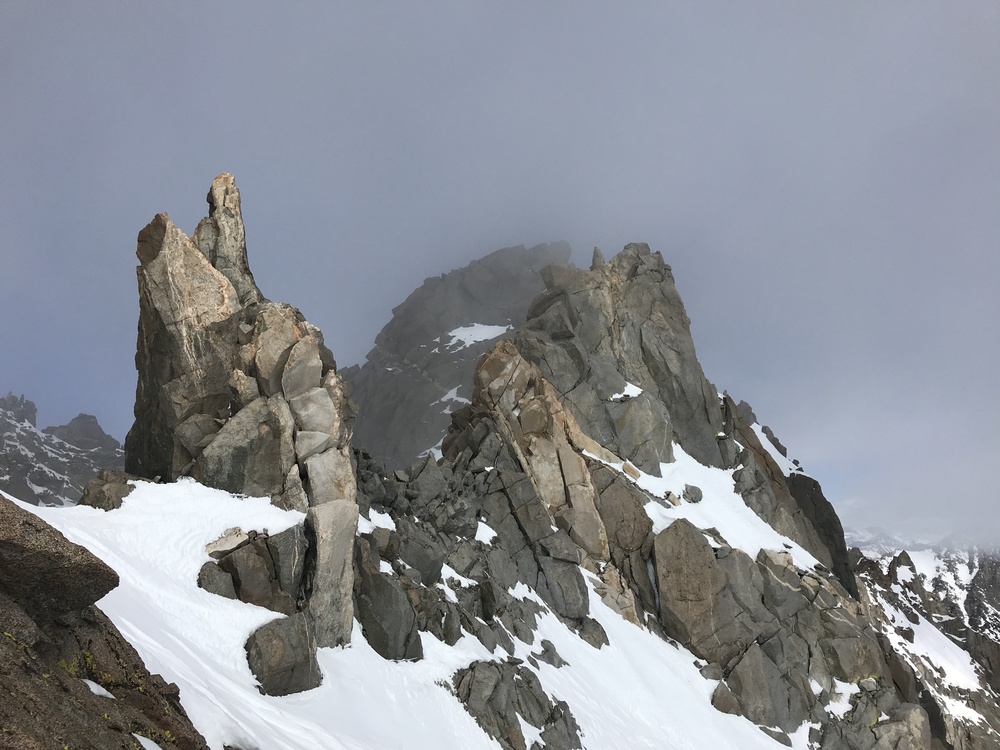 Chimney 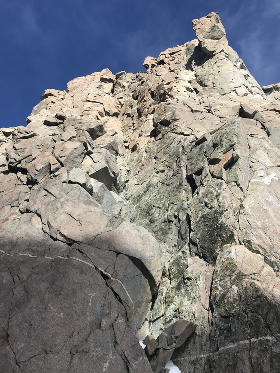 Unotch chute 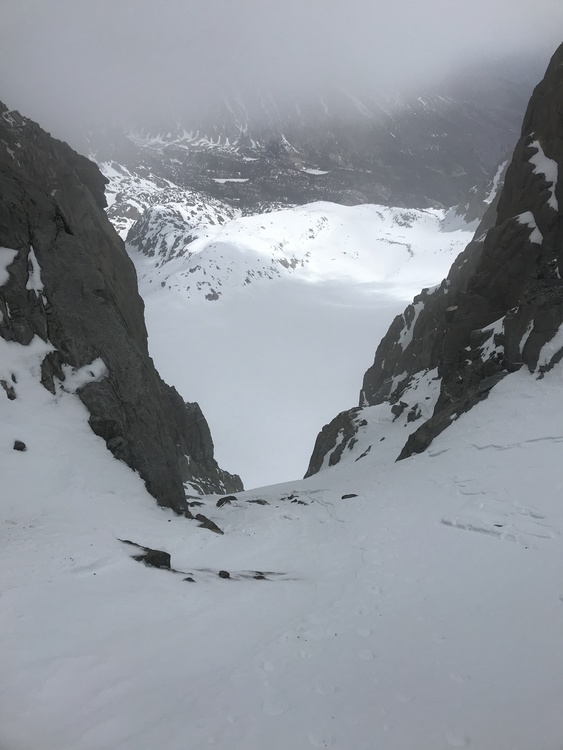 Bergschrund 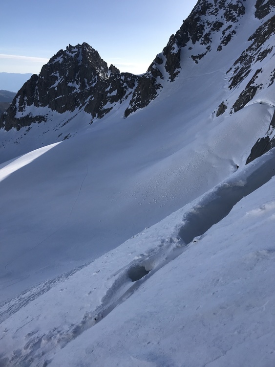 Top of the unotch from partway up the chimney (you can see my pack way down there at the notch) 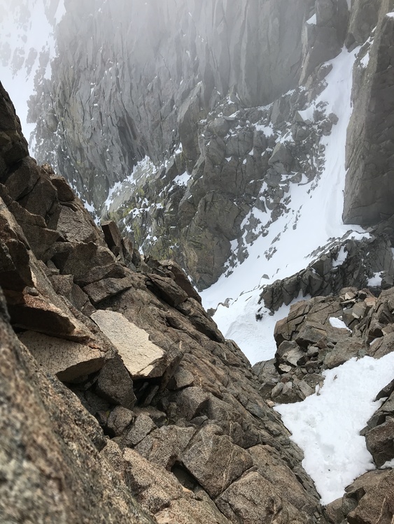 |
|
|
Thanks for those photos. |
|
|
kenr wrote: Thanks for those photos. Definitely. There were some recent tracks. I wished I had brought my skis... |
|
|
Thanks Jonah for the photos, that's great info. |
|
|
pjc30943 wrote: Thanks Jonah for the photos, that's great info. Kinda muddy and snow patches on the trail up to third lake. Then well consolidated snow the rest of the way. I camped at third lake with my wife so started at 2:30am to meet some friends who were going for Sill and were camped at Sam Mack. They were ready by 4am. No snow shoes needed the whole way. Good crampon conditions all the way from there. It was early and cold so the snow stayed pretty firm. Was back at Sam Mack by noon with minimal postholing once or twice as the day warmed up, but good glassading on the way back down. |
|
|
Anyone been up there over the last few weeks? |


