To save paper & ink, use the [Hide] controls next to photos and comments
so you only print what you need.
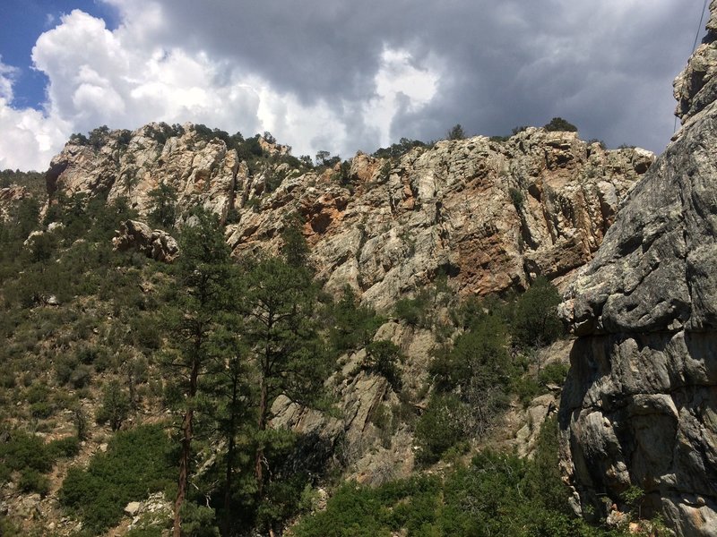
Trigo Canyon
New Mexico
> New Mexico, I-4…
> Manzano Mountains
> W Side
Description
Beautiful canyon with a seasonal stream running through it and several large bands of Quartzite and smaller bands of fractured gneiss.
Driving From Albuquerque
FROM ALBUQUERQUE:
Don't follow Google Map directions. Take exit 203 off I-25 and head east on NM 6 across the river to NM 47, take a right. Drive south to El Cerro, take a left. Drive east for 3 miles and take a right on Manzano Expy just past the school. Drive south for 4.5 miles to North Rio Del Oro, take a left. Take the next right on Bonita Vista Blvd and drive around Valencia High School, turn left onto the Rio Del Oro Loop and continue east for 3.7 miles. Turn right on an unnamed road (34.72646, -106.57714). The road will vear left and then right. Follow it south for 3.6 miles. At some stage you will vear right to join the road paralleling the fence. Turn left at the intersection with the white gate. The gate may be open or closed (shouldn't be locked if closed). Continue through the gate leaving it the way you found it. Follow the road as it makes its way towards the mountain. You'll come to a parking area on your left just before a green gate. Park here and hike in if the gate is closed. If the gate is open, drive through and take your first left and then left again to the Trigo Canyon trailhead. Immediately surrounding the trailhead is the John F Kennedy Campground which seems to have been abandoned by the US Forest Service. Downloadable GPX file for driving route:
https://www.mountainproject.com/approach-trail/gpx/118703783FROM BELEN:
Take exit 191 east into Belen. Follow Camino del Llano to S. Main St. and take a left. Take a right onto E. Reinkin Ave (NM 309). Follow NM 309 across the Rio Grande. Take a right just past the river onto NM 47 (Rio Communities Blvd). Head south on NM 47 almost 2 miles to North Navajo Road. Turn left and follow this 8 1/2 miles to the mountains. Turn left onto Trigo Springs Road and go just over 3 miles. Turn right onto Trigo Springs Rd. and follow it to the campground.
![The road into Trigo Canyon]()
[Hide Photo] The road into Trigo Canyon
![Trigo Canyon trailhead and the start of the Manzano Mountain Wilderness]()
[Hide Photo] Trigo Canyon trailhead and the start of the Manzano Mountain Wilderness


 Continue with onX Maps
 Continue with Facebook


Silver City, NM