
What is it that has kept this beautiful crag off the map for so long? Maybe it's the arduous approach hike. Maybe it's the lack of concentrated development. Maybe it's the absence from popular local guidebooks. Whatever the reasons may be, disregard them, as the Hunch is definitely worthy of exploration and could definitely use some traffic to keep clean / re-clean / continue cleaning routes.
This is a crag of approachable extremes. The hike is what it is: ~25 minutes of steep uphill schlepping on a very obvious, well-maintained trail (once you find it). The cracks go at generally moderate grades, though some bow out into uncomfortably-wide territory, while the face climbs start at the high end of "moderate" and progress immediately to the "extreme" end (think Broughton's Bat Wall at elevation with different features). A plethora of development opportunities remain which will involve a lot of moss scrubbing and/or hard-ass face climbing. What's already established presents at least a few days worth of fun to justify the hike. Supposing some intrepid developers were to fill in the obvious lines that remain, including the upper tier, and we'd have ourselves a veritable destination crag without the obnoxious crowds.
As it stands, it's a wonderful destination for 11-13 sport climbers and 9-10 trad climbers willing to lug extras in the 2-4" range. So like, umm, maybe the best Feb-July trad climbing within an hour of Portland?
The area has a relatively long season, being that it sits at 2,100 feet in elevation and is oriented in a somewhat southwesterly direction. The tall fir trees make that a bit complicated in the best way - they add shade in the summer, even if they hold a little moisture in the early spring and late fall. When compared to French's Dome, it is actually lower in elevation and has a more southerly aspect.
It is within the Mt. Hood National Forest so no access concerns currently exist. Conveniently, a NW Forest Pass is not necessary. Parking on the narrow shoulder allows for only 3-4 cars.
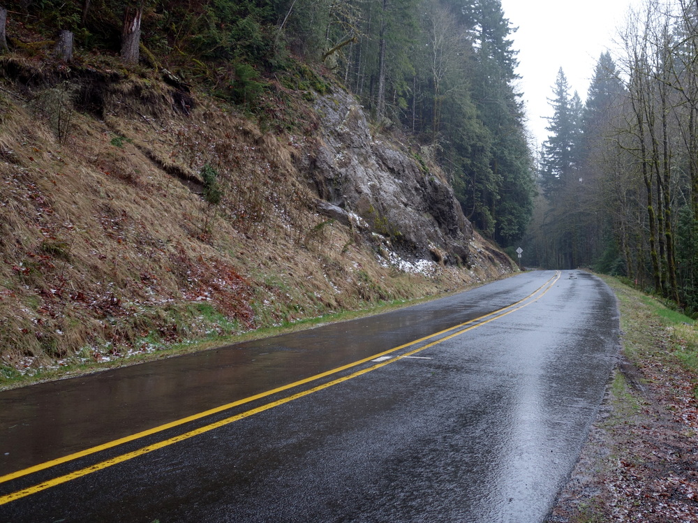
Approximately 1 hour (50-60 mins) from Portland. Drive east towards Mt. Hood and Hwy 26. After passing Welches' lone signal at the 76 gas station and continuing for another 1 mile, turn right onto Salmon River Rd. Continue for 0.8 miles, passing a guard rail on your right and a scrappy rock bluff on your left. Immediately park on the narrow shoulder to your right. Find an obvious water drainage just south (right) of the rock bluff and follow the well-trodden trail from there. If presented with another option, always take the more well-trodden, steeper-trending option.
Interestingly, it's about the same time door-to-crag as French's Dome. Less driving, more walking.
Rock bluff visible on the left (east) side of the road, parking along right (west) shoulder. Approach starting at barely visible sign past the rock bluff.
From the top of the trail to the main cliff, looking left to right
After the gully break, the amphitheater on the far right side

 Continue with onX Maps
 Sign in with Facebook


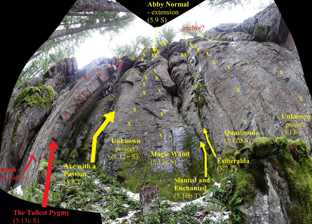
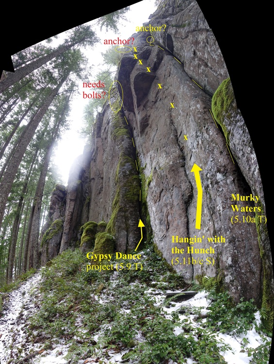
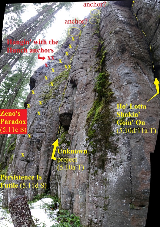
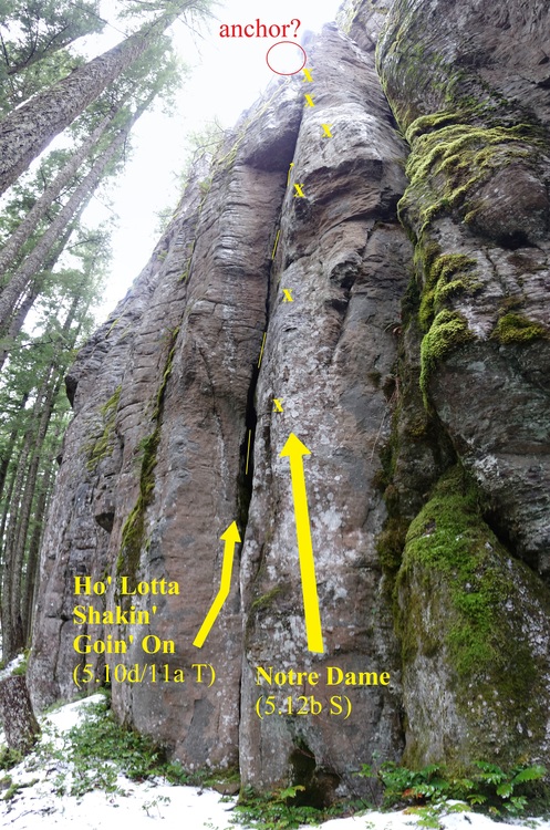
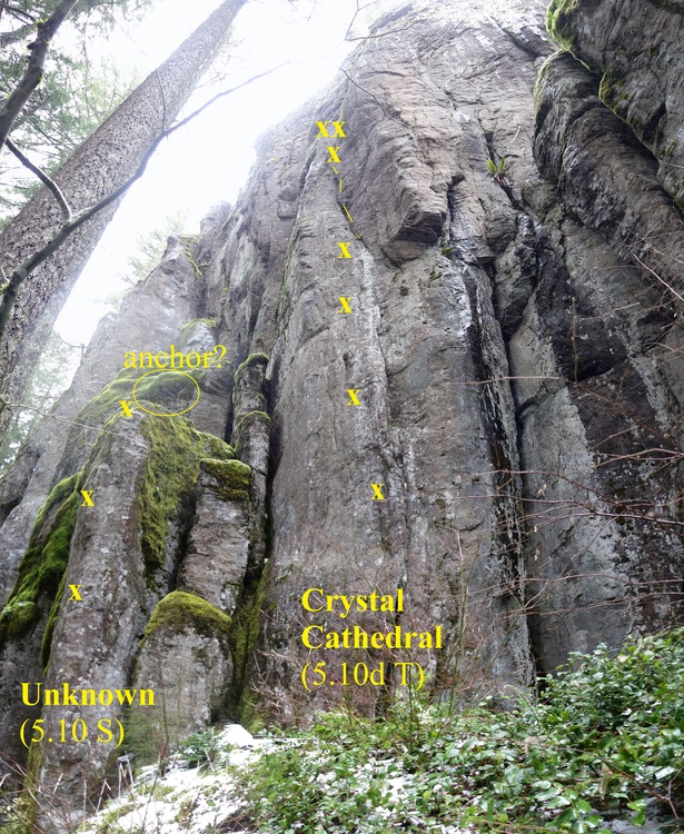
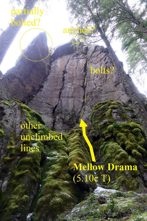


We explored the far left side of the established wall (the cliff itself keeps going but is too moss-covered to hold much potential further along) and found there are a lot of routes not listed in the most recent Olson guides. There are at least three new sport routes, an easy route to the upper ledge, and a bunch of unlisted trad lines that climb various cracks.
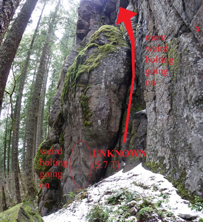
There is also a really weird ethic of bolting up here. We saw a set of stainless lower-offs above an off-width extension of what was already a mossy, dirty, wide crack which ended at an intuitive ledge above another (newer) route which only has aluminum biners for lowering. These should be switched out. This same wide crack was also bolted every 2-3' feet with extremely low-quality bolts and hangers. These should all be removed. The ledge out left of this wide crack has two anchor bolts widely spaced with no hardware except a rope connecting them (seen elsewhere at the crag but thankfully gone now). These should be removed. This ledge also had two other stainless bolts which can be clipped while standing, 15' away from each other, which obviously doesn't provide any fall protection or redundant anchor point. Anchors above Oasis had three bolts, all of which were stainless. The extra bolt/hanger should be removed and reused elsewhere if possible.
Nobody up here either day of a hot weekend while French's and SRS were teeming. Jun 20, 2021
Oregon
Does anyone know if this route is named on here? It would be very obvious because it seems to be the only true top-out anchor. Looks like an incredible climb, and any information on it should definitely be here. Will be taking pictures of it next time I am up there.
Thank you,
Cole May 6, 2023
Portland, OR