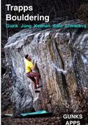
Stairmaster Bouldering
Use onX Backcountry to explore the terrain in 3D, view recent satellite imagery, and more. Now available in onX Backcountry Mobile apps! For more information see this post.
| Elevation: | 770 ft |
| GPS: |
41.7384, -74.18448 Google Map · Climbing Area Map |
| Page Views: | 2,638 total · 38/month |
| Shared By: | Jaime Odin on Jul 26, 2018 · Updates |
| Admins: | Morgan Patterson, M Santisi, chris vultaggio |
Description

There are a few boulders approaching the top of the stone staircase (AKA East Trapps Connector Trail) on the way to the undercliff rd via the visitor's center parking lot (wawarsing boulder). May have people gawking at you on a busy day. Climb on! Nice spot for after business hours if you don't have time to make it all the way to the undercliff rd
Getting There

Best approached by parking at the Gunks visitor center and walking around .25 miles up the stone staircase at the end of the upper lot. There are many boulders here, so definitely more to be explored. This area may already be documented in Gunks App or guidebook, not sure. There is normally someone checking that you have a daypass at the entry to the staircase during business hours.
Weather Averages
|
High
|
Low
|
|
Precip
|
Days w Precip
|
Prime Climbing Season
| J | F | M | A | M | J | J | A | S | O | N | D |
| J | F | M | A | M | J | J | A | S | O | N | D |
All Photos Within Stairmaster
Most Popular · Newest · RandomMore About Stairmaster
Printer-FriendlyWhat's New
Guidebooks (5)

 Continue with onX Maps
 Continue with Facebook


1 Comment