Access Issue: 2024 Crag Closures & Temporary Trail and Raptor Closures
Details
Access Issue: 2024 Crag Closures & Temporary Trail and Raptor Closures
Details
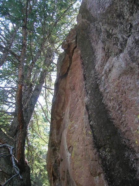
This is a small rock, with a made up name for now, that is along the approach to the bottom of the Red Devil from the Mallory Cave Trail. It does not appear to be in Richard Rossiter's Rock Climbing the Flatirons or Jason Haas' Climbing Boulder's Flatirons. On a brief break down towards the fern filled gully of Red Devil, one might just peer upwards and see a pair of old pins with aging webbing that appears to be an aid route. Anyone with better information is welcome to comment to help fill in the details.
From NCAR, hike towards the Mallory Cave. Just short of the cave, continue a contouring switchback north until you see a faint trail down and right towards Red Devil's nadir. At one point, if you keep going north, you'll sense a cliffing out. Angle back south past a scrambly bit, and keep looking up until you see rock similar to the photos here.
Okay, this new version of subarea entry is not fully functional, so no satellite imagery comes up to assist with locating the GPS site. So, don't use the GPS coordinates to find this chunk of rock.

 Continue with onX Maps
 Sign in with Facebook