To save paper & ink, use the [Hide] controls next to photos and comments
so you only print what you need.
Bald Rock Picnic Area
California
> Northeast Calif…
> Lost Sierra
> Bald Rock
Description
This area is named for the summit in its midst, Big Bald Rock. Together with Bald Rock Dome, it is part of the Bald Rock areas.
This is an area of rolling granite slabs covered with boulders and some some short cliffs with enough features to do as trad leads or topropes. Problems and routes of a variety of difficulties may be had here. Some of the granite is sharp to the tune of Joshua Tree rock.
A natural year round playground for Chico area climbers.
Getting There
Highway 162 east from Oroville, which may be your last stop for grub. Turn right at Bald Rock Road. Turn left on to a short dirt road at a Plumas National Forest sign for Big Bald Rock Trailhead. Park in the dirt lot with an outhouse and follow the signed trail for half a mile to the rolling slabs of Bald Rock.
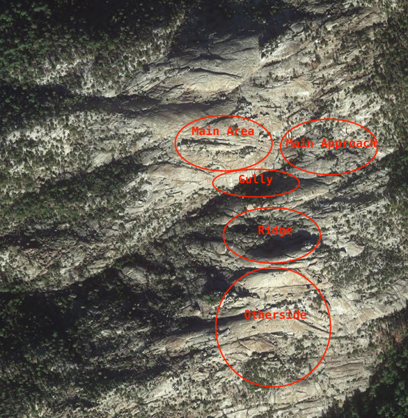
![The rolling granite landscape.]()
[Hide Photo] The rolling granite landscape.
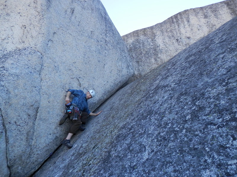
![A nice moderate trad crack on one of the taller walls near the summit marker of Big Bald Rock.]()
[Hide Photo] A nice moderate trad crack on one of the taller walls near the summit marker of Big Bald Rock.


 Continue with onX Maps
 Continue with Facebook


Homewood, CA
Check out the Camp 4 Press website for photos of Bald Rock Dome and to preview the guidebook (Rock Climbs of Northeast California) for that area. camp4press.com Sep 15, 2014
Sacramento, CA
There are several really fun arête problems on these boulders and a worthwhile location to boulder.
also, does anyone know the rating of the 30 foot overhanging splitter crack near the summit area? Jul 21, 2015