
 Continue with onX Maps
 Sign in with Facebook






Mont-King Rock Climbing
Use onX Backcountry to explore the terrain in 3D, view recent satellite imagery, and more. Now available in onX Backcountry Mobile apps! For more information see this post.
| Elevation: | 1,262 ft | 385 m |
| GPS: |
46.02545, -74.17837 Google Map · Climbing Area Map |
|
| Page Views: | 77,725 total · 556/month | |
| Shared By: | Luc-514 on Jun 18, 2013 | |
| Admins: | Thierry Berland, Richer Lariviere, Luc-514 |
 Access Issue: Site access fees - Frais d'accès
Details
Access Issue: Site access fees - Frais d'accès
Details
This area is under the Parc Régional de Val-David Val-Morin administration, a daily fee is required to climb, hike, bike etc in the park, FQME members benefit from a rebate as well as group outings. parcregional.com
Description

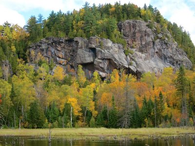
A beautiful series of cliffs 15 minutes hike into the park, home to quite a few classics like Ben's Roof and Sceptre. You can't say you've climbed in Val-David without spending a day at King. You may find it crowded on beautiful days but there's always something to do.
Une belle série de falaises à 15 minutes de marche dans le parc, qui abrite quelques classiques comme Ben's Roof et Sceptre. Vous ne pouvez pas dire que vous avez grimpé à Val-David sans passer une journée à King. Vous pouvez trouver qu'il y a beaucoup de monde par beau temps, mais il y a toujours quelque chose à y faire.
Areas from Left to Right:
Amphitheatre
Zébrée
Impériale
Crown (Above Impériale)
Profil Grec (Above Sceptre)
Traversée
Vallot
Staircase
Une belle série de falaises à 15 minutes de marche dans le parc, qui abrite quelques classiques comme Ben's Roof et Sceptre. Vous ne pouvez pas dire que vous avez grimpé à Val-David sans passer une journée à King. Vous pouvez trouver qu'il y a beaucoup de monde par beau temps, mais il y a toujours quelque chose à y faire.
Areas from Left to Right:
Amphitheatre
Zébrée
Impériale
Crown (Above Impériale)
Profil Grec (Above Sceptre)
Traversée
Vallot
Staircase
Getting There
Follow Chemin du Condor and park near the intersection of Rue du Lac. Follow the trail at the end of "Rue du Lac" and follow the indications to Mont King.
About 20 minutes moderately uphill.
Suivez le chemin du Condor et garez-vous près de l'intersection de la rue du Lac. Suivez le sentier au bout de la rue du Lac et suivez les indications pour le Mont King.
Environ 20 minutes en pente modérée.
About 20 minutes moderately uphill.
Suivez le chemin du Condor et garez-vous près de l'intersection de la rue du Lac. Suivez le sentier au bout de la rue du Lac et suivez les indications pour le Mont King.
Environ 20 minutes en pente modérée.
Classic Climbing Routes at Mont-King
Mountain Project's determination of the classic, most popular, highest rated climbing routes in this area.


Weather Averages
|
High
|
Low
|
|
Precip
|
Days w Precip
|
Prime Climbing Season
| J | F | M | A | M | J | J | A | S | O | N | D |
| J | F | M | A | M | J | J | A | S | O | N | D |
Photos


All Photos Within Mont-King
Most Popular · Newest · RandomMore About Mont-King
Printer-FriendlyWhat's New
Guidebooks (5)


0 Comments