To save paper & ink, use the [Hide] controls next to photos and comments
so you only print what you need.
Barrens
International
> N America
> Canada
> Newfoundland &…
> Newfoundland
> Avalon Peninsula
> Highway Barrens
Description
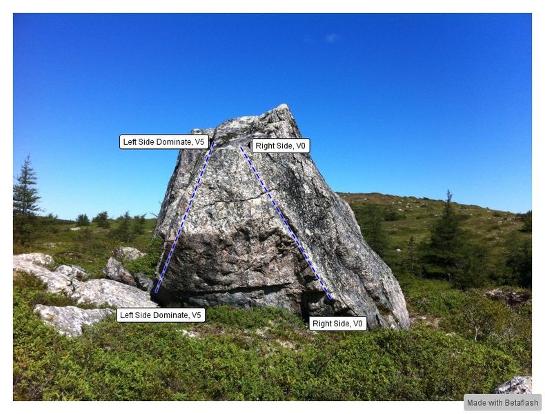
Though a bit of a trek to get to the barrens boulder has some of the best problems on the Avalon in beautiful scenery. However there are not many problems in the easier range so it is not an ideal novice destination.
Getting There
Heading west along the TCH about 5 minutes past the entrance to Butter pot park there is a blue sign that says "Witless Bay sea Bird Ecological reserve 20 km on route 13" Park just past this sign right in front of a small wooden sign that says "provincial park no cutting no hunting".
Cross the ditch where it is worn down and you should be right on a trail you will follow most of the way to the boulder. After a short while (2-3 minutes) you should walk past a low boulder surrounded by Juniper trees. This is the Prostitute boulder it has the V2 Roxanne and a couple other problems on it. Keep going along the trail until you have to cross a marshy section (waterproof boots recommended) Just after crossing the marshy section head left off the trail to cross the stream where it is smallest. Head straight across the stream and up the hill behind it, you will be facing a pond, the barrens boulder is on the far side of the pond. Go left and follow the edge of the pond until you come to a steep hill, head up the hill and follow along its plateau until you can see the boulder and then head down.


 Continue with onX Maps
 Continue with Facebook