To save paper & ink, use the [Hide] controls next to photos and comments
so you only print what you need.
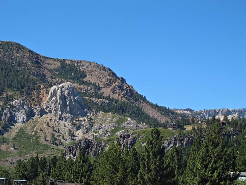
Mammoth Rock
California
> Sierra Eastside
> Mammoth Lakes Area
Description
Mammoth Rock is a large limestone/marble formation visible from nearly anywhere in the town of Mammoth Lakes. The rock by in large is heavily fractured and chossy. There are a couple Class 2-3 routes up the southern side from the saddle separating the rock from the Sherwins.
Getting There
From the town of Mammoth Lakes, follow Old Mammoth Road to the Mammoth Rock Trailhead. From there, many unmaintained trails lead up to the rock. Pick one and head up. Plan for 20-40 minutes to get to the rock, depending on snow conditions (if present) and acclimation.
[Hide Comment] Did this 10/19 and going up the scree field off the Mammoth Rock trail is super dangerous- lots of loose rocks and loose dirt that can dislodge big rocks. Once you make it to the base, traversing south to the chimney is even worse for potential rock slide, although the wall does have good hand holds. We were careful and slow and still sent rocks down. Don't go this way. Instead park at the trailhead and walk up the paved road to an old 4x4 road, about a quarter mile on the right. Then go up the road to the old mine camp (will smell like sulfer) (can also drive a 4x4 up here and park). At the end of the clearing there is a thin, steep trail- take this through the woods, through scrub, to the saddle on the north-ish side (maybe 10 minutes) . From the saddle, head right/south and up a much better but still loose trail to the base of the chimney/class 3. You should be able to see the chimney when you are headed up the scramble the last 100-150 meters. It'll end right at the chimney. Have fun!
Oct 23, 2019


 Continue with onX Maps
 Continue with Facebook


Mesa, AZ