Mountain Project Logo
To save paper & ink, use the [Hide] controls next to photos and comments so you only print what you need.

Weetamoo Area

Massachusetts > N Shore > Lynn Woods

Description

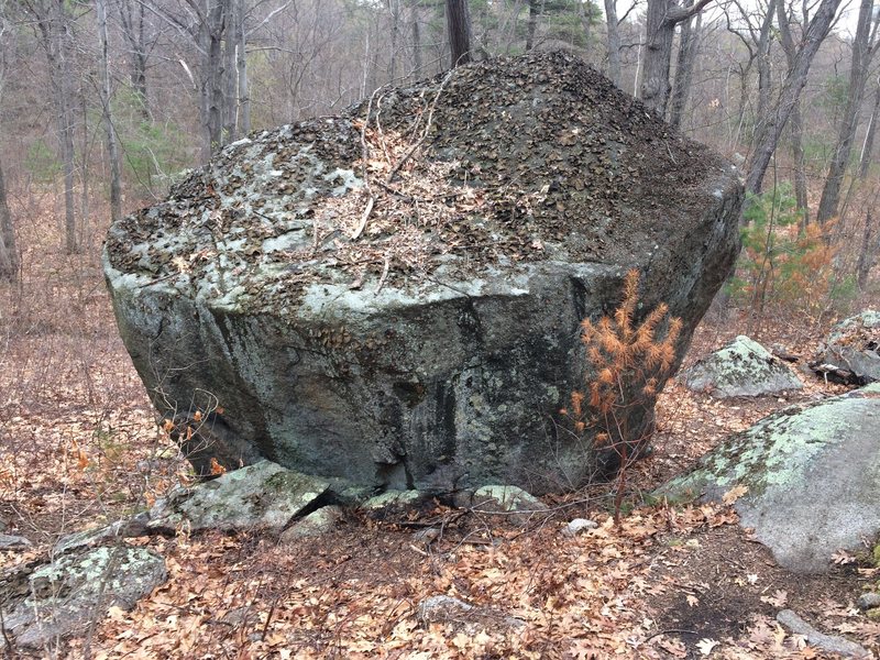
This area has probably the highest concentration of boulders and quality problems in the woods. As with the Stone Tower area across the pond, there is something for everyone here. The Summit Boulders offer the best warm ups in the woods and are the central location for this area. While the hike in is about 25-30 minutes, there is easily more than a days worth of problems here for even the most seasoned hard man or women.

Climbs in this area to not miss include: the slabby Stone Beachball (V2), Guillotine (V3), the mentally imposing Great Frog Arete (V6), and the slopey Golden Arete (V7).

Getting There

From the main parking lot at Lynn Woods, take the wide dirt road (Ox Pasture Road) around the right side of the pond. Walk for about 15 minutes (passing the Mt. Spicket/Goliath Rock Area along the way) until the pond bends around a corner and out of sight. You'll see a white boulder on the shore. Continue straight ahead on the wide dirt road for 12-15 minutes. Immediately after passing over a small stream/brook with a rusty metal culvert tube, break left into the woods on a faint climbers trail. Continue to follow this trail past the Elephant, Weetamoo, and Patina Boulders to reach the Summit Boulders.

If you are going to venture out to this area, it is best to contact one of the locals, who are always happy to show folks around. Hiking maps of the area can also be accessed through the Friends of Lynn Woods website, flw.org. Be aware that this area is heavily trafficked by mountain bikers, who actively share some of the same trails as climbers.

Photos [Hide ALL Photos]

Weetamo and Overlook areas. Trails are shown including climbers trails Weetamo Cut Through and Overlook Express.
[Hide Photo] Weetamo and Overlook areas. Trails are shown including climbers trails Weetamo Cut Through and Overlook Express.
Weetamoo - W26.
[Hide Photo] Weetamoo - W26.
Weetamoo - W38.
[Hide Photo] Weetamoo - W38.
Weetamoo - W20.
[Hide Photo] Weetamoo - W20.
Weetamoo - W12.
[Hide Photo] Weetamoo - W12.
Weetamoo - W30.
[Hide Photo] Weetamoo - W30.
Weetamoo - W30.
[Hide Photo] Weetamoo - W30.
Weetamoo - W31.
[Hide Photo] Weetamoo - W31.
Weetamoo - W36.
[Hide Photo] Weetamoo - W36.
Weetamoo - W36.
[Hide Photo] Weetamoo - W36.
Weetamoo - W06.
[Hide Photo] Weetamoo - W06.
Weetamoo - W06.
[Hide Photo] Weetamoo - W06.

Comments [Hide ALL Comments]

[Hide Comment] Went exploring for Weetamoo today to take a look. Beautiful area with rock all over the place. I guess that's pretty well known now. There are two streams with green tubes before the turnoff I took that got me to Elephant Boulder. It might be worth it to update the getting there section. It wasn't much of a trail though and went through a swampy part, so maybe there is a better way.

Thanks to all who put the info up here and developed the area! I didn't want to ask anyone to help me out as I'm only climbing super easy stuff and don't want to bore anyone. Aug 20, 2011
Ryan Bouldin
Somerville
[Hide Comment] Chag,
You found the right trail and unfortunately there is no shorter way to get there. Have fun out there. Aug 21, 2011
andyscott
Massachusetts
[Hide Comment] Right on, Chag!!! Glad to see you took it upon yourself to get out there and find the goods! Sep 1, 2011
[Hide Comment] Are there any projects in this area? Oct 21, 2013
Old Timer
North Andover MA
[Hide Comment] Tony,

There are about 20-25 open projects in the Lynn Woods Area. All are in the double digit range. Send me a PM if you want to see some.

Pete (Old Timer) Oct 21, 2013
Jonathan Gregg
Eastern MA
[Hide Comment] (Per Chag's approach beta) am I right in thinking that you should take a left at the third stream with green tubes instead of the first one? Mar 18, 2021
Eben Eben
Brattleboro, VT
[Hide Comment] The fastest access (15 minute walk) is parking at the end of Quinn Rd. and walking around the right side of the water tower. The following Strava track shows a GPS route from Bobcat Den right in the middle of the area: strava.app.link/mvipM2EnLsb. Aug 24, 2022
Tim McGivern
Medford, ma
[Hide Comment] Eben, no need to reinvent the wheel. A climber's trail was established and approved. Please review the maps on here. During wet times, there is an alternate route. Aug 25, 2022