To save paper & ink, use the [Hide] controls next to photos and comments
so you only print what you need.
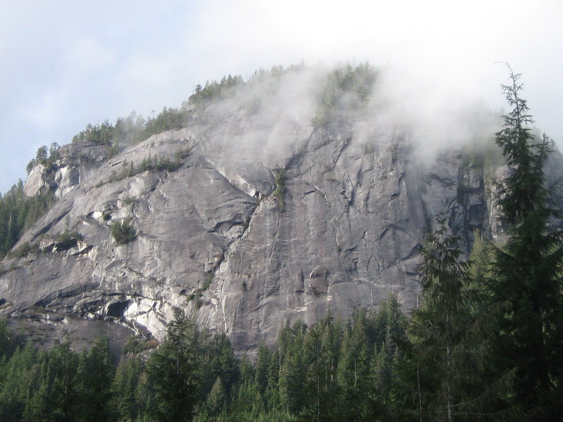
Khartoum
International
> N America
> Canada
> British Columbia
> Powell River
Description
Located in the upper "Lois Valley", just past Khartoum lake. With Mt. Diadem at the head of valley. "Khartoum" holds several(3) multipitch climbs from 7 to 10 pitches in length. As well as several shorter routes of 1 to 3 pitches. Rock is good, and very clean, by coastal B.C. standards. Routes are "moderate" (5.7 to 5.10), and involve extensive crack systems, interspersed with technical face climbing. The wall faces East, and has afternoon shade in summer months.
Getting There
South of Powell River,Goat lake main(Dixon rd.) to Stillwater main. Follow to Third Lake turn off(right).Follow this road to mile marker 22. Go 400 metres further and turn left to 4wd w/ clearance for 1.2kms. Or 20 min hike to camp. Driving time approx 50 min. from hwy 101. From camp follow trail to base of wall (15 min.)
[Hide Comment] The book says turn left 5.5km after the rec site. There's a steep, new-ish and rough gravel/sand road going up a clear-cut around 5.5km guarded by 2 small boulders, but we ignored that and turned left at about 7km after the rec site. Rotting wood bridges a ditch and an overgrown forest road leads to the climbers camp. The road is rough and became impassable with an old Pathfinder. It's narrow, so you might not be able to turn around. We parked at 700m MSL. There's a water source at the camp.
Jul 28, 2021


 Continue with onX Maps
 Continue with Facebook


There's a water source at the camp. Jul 28, 2021