
**14,060 ft (4,286 m)**
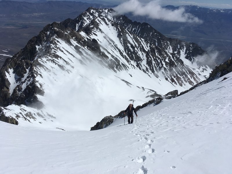
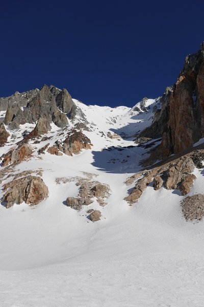
Split Mountain, like some of the other 14ers, can be seen from the 395. Aptly named, Split Mtn has a layered look to it with some darker, older sedimentary rock stacked on top newer, lighter colored ingnious rock. Split Mtn is also "split" by deep couloirs on its east face. In fact the Central Coulior splits the mountains northern and southern summits.
While on a map, Split Mountain does not seem far from the 395, do not treat this lightly. 4x4 and high clearance is REQUIRED to get out to the Red Lakes trailhead, the road is hardly maintained and can get washed out easily. Even in a modern Tacoma I had a wheel in the air once or twice.
See Porcella/Burns for driving directions to the Red Mountain Creek trailhead from Big Pine and the 395. Do not follow your maps directions through Tinemaha Creek, this goes through CLOSED private land. To get there, go by taking Glacier Lodge Road to Mc Murray Meadows Road. Take this road all the way south until you hit a T in the road. Do not go west towards the mountains but turn left (east) where the road marker points. Take this road down and eventually cross the creek. From there you'll be on the other side of the ranch. Turn right and go a few more miles until you reach the trailhead.
WARNING: the last mile before the trailhead regularly has running water eroding part of it, if you get a tire too close to this, your vehicle WILL SINK IN and can easily get stuck. Be prepared with a map (physical or digital) of all the roads in the area as well equipment that may be needed to pull out yours or someone elses vehicle. Should you get stuck, it could be a long time before rescue as tow services will not go out there at night and this trail is not as popular as many others.
The trail DOES NOT start in Red Mountain Creek, but rather about 1/8th of a mile to the north. From the trailhead follow the path as it winds and switchbacks up the hill until the trail turns sharply to the west. At this point you're a few hundred feet above Red Mountain Creek. Continue on the trail, which is kind of crappy all the way back to Red Lake and the base of Split Mountain.

 Continue with onX Maps
 Sign in with Facebook


Couple of notes:
1. I did find that some of the forest service roads on the caltopo either don't exist anymore, or trespass on the Tinemaha Ranch property - resident was none too pleased to see a visitor, so avoid deviations from the map below.
2. The road - for being labeled 4wd - was actually quite a bit more tame than expected - much more civil than the approach road to mountain light wall/Humphreys. Still not the best for a lower clearance vehicle, but seemed passable for a vehicle with decent clearance
3. The trailhead is as indicated on the map if you're headed to Red Lake. Start north of where the actual trailhead sign is. If you're looking at the trailhead sign, turn around and follow the road north and NNW and a trail starts where the road ends.
4. The trail winds its way up the first flank and is distinguishable, albeit not as explicit as the major trails in the Sierra, and becomes better later on. Follow the topo, and it will not lead you astray. Trail was actually in pretty good condition given the reports of delinquent maintenance for over a decade now. Plenty of overgrowth, so pants are advised.
the road in from mcmurray is pretty rough with one crux rock drop along Fuller Creek. Also lots of brush so don't take a full size 4wd out there unless you want scratches. Sep 3, 2019
South Lake Tahoe, CA
On another note this was a beautiful mountain but one of the ugliest and hardest approach trials I've ever seen in the Sierra. Jul 9, 2021