To save paper & ink, use the [Hide] controls next to photos and comments
so you only print what you need.
Smugglers Notch Ice
Vermont
> VT Ice & Mixed
 Access Issue:
 Seasonal Raptor Closures for access issues: please review cragvt.org
Details
Description
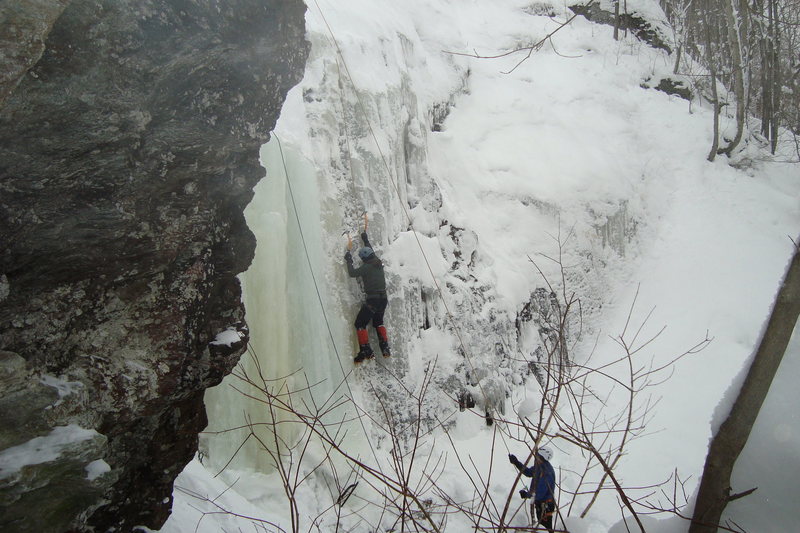
Smuggler's Notch has some of the best ice climbing and definitively the best mixed climbing in the Green Mountain State. Often referred to as "Smuggs" or "The Notch" by locals, it is comprised of climbing along the closed portion of Route 108 between Jeffersonville in the north and Stowe in the south, Smuggler's Notch is a gem of New England Climbing.
The approach times very greatly by snow conditions. Getting to Easy Gully from the Stone Hut, for example, can take 35 minutes or well over an hour depending on how much snow has come in and if the trail has been beaten in. Expect this for most climbs.
Areas/climbs listed are from North to South and the 'W' or 'E' denotes whether a climb is on the west or east side of the road.
Getting There
Ice climbing in The Notch can be approached by either the Stowe or Jeffersonville side. Generally, Jeffersonville is used to approach most climbing but use the next section as your guide.
Rt. 108 through the notch is closed from virtually the first snowfall of the season and usually stays closed until spring long after the ice is gone. As long as there is snowpack it's recommended to bring some kind of skis for the approach as the road is skiable throughout 90% of the ice season save for the first few weeks.
The lot at Smugglers notch side of the road is almost always free on weekdays and usually fills up on weekends. If climbing on a weekend, plan to be there early, the Jeffersonville/Smuggler resort side has more spots but is also more popular.
On the Stowe Resort side of the notch:
The Barnes camp parking is posted for only two hours.
Park at the resort if you don't want to get ticketed. On Friday, weekends and holidays, the resort charges for parking unless you’re 4+ per vehicle.
There is free parking at the cross country and toll house further down the road and a free shuttle bus.
Areas
Areas from Jeffersonville (from Stowe), distances on the road from the parking/gate.
* 0.9 (2.1), east side,
The Workout Wall* 1.0 (2.0), west side,
Jefferson Slide, Notch North* 1.2 (1.8), west side,
ENT Gully* 1.2 (1.8), west side,
Quartz Crack Face Area* 1.2 (1.8), west side,
Easy Gully Area1.2 (1.8),
Stone Hut1.3 (1.7),
High Point in Road* 1.3 (1.7), east side,
The Playground* 1.35 (1.65), west side, Hidden Gully
* 1.4 (1.6), east side,
Elephant's Head Area, Ragna Rock Area* 1.45 (1.35), west side,
Blind Fate Area* 1.5 (1.5), west side,
Terror-Tory* 1.9 (1.1), east side,
Blue Room, South Wall* 2.0 (1.0), east side,
Upper South Wall, Bastard* 2.1 (0.9), west side,
Driving Force Area* , east side,
Spruce Peak CragsGPS MAP WITH AREAS LABELED courtesy of Max Forbes:http://caltopo.com/m/RH9Q
![West side of Smuggler's Notch from the top of Elephant's Head Gully]()
[Hide Photo] West side of Smuggler's Notch from the top of Elephant's Head Gully
![Hidden Gully, Easy Gully, Quartz Crack Face with the The Snotcicle]()
[Hide Photo] Hidden Gully, Easy Gully, Quartz Crack Face with the The Snotcicle
![Dillon G coming up Jeff's slide. place holder photo--we did jeff's by headlamp during our SNUGL]()
[Hide Photo] Dillon G coming up Jeff's slide. place holder photo--we did jeff's by headlamp during our SNUGL
![Jefferson Slide looking down from approach above]()
[Hide Photo] Jefferson Slide looking down from approach above


 Continue with onX Maps
 Continue with Facebook


Bend
Winooski, VT
Bend
Burlington, VT
Winooski, VT