To save paper & ink, use the [Hide] controls next to photos and comments
so you only print what you need.
Scot Rock
California
> San Bernardino…
> Lake Arrowhead Area
 Access Issue:
 Residential area
Details
The trail starts from a residential area; stay on the pavement until you reach the clearing. Please be quiet and respectful.
Description
Scot rock is a beautiful 200 foot piece of granite, set on the south flank of the San Bernardino Mountains near Lake Arrowhead, visible from the San Bernardino valley on a clear day. The rock is of high quality and divided into two faces with technical climbing. The south face runs the full 200 feet featuring two bolted multi-pitch moderates, plus a 5.12a mixed route and the classic Tipton's Arete (5.12a). The west face is about 80 feet high and is home to five bolted lines, a trad route and a mixed route. Both faces have a variety of climbing from crack to face to slab; most routes reflect this diversity. All climbs end at bolted chain anchors for rappel. The best way to exit the area is to haul everything up to the anchor when doing the final climb, then load up and head back up the trail. Although not a destination crag, Scot Rock is a great place to spend a day climbing.
Getting There
Scot Rock is accessed from CA-18, the Rim of the World highway. There are two ways to reach the parking lot:
- Head up the CA-18 from San Bernardino (Waterman Ave. from the CA-210) toward Crestline. Continue east on CA-18 to Crest Park, about ½ mile past Rim of the World High School.
- Or take the CA-330 from CA-210 (CA-30) at Highland, towards Running Springs. Take CA-18 west toward Lake Arrowhead. Continue to Crest Park, about ¼ mile past the CA-173/Lake Arrowhead exit.
From this parking lot, walk west through the picnic area, heading slightly right to gain the paved fire road. This is also a private drive for a few homes in the area so please be respectful.
Follow the pavement as it curves downhill to the left. Head into the open lot on the left before reaching the homes. At the far side of the open space, find a trail and follow the cairns south along the ridge. The trail turns to the southwest at a hilltop and follows talus steeply down to the top of Scot Rock.
Pick an anchor and rap to the base of either wall. Be aware that this requires some exposed and unprotected easy scrambling. When rapping down the south face you will need to find the lower anchors; following the line of Highlander will require three raps.- Allow about 20 minutes for the hike in, somewhat longer to hike the 500 foot elevation gain back to the car.
![Nathan Fitzhugh having some fun on Neil's not Young Anymore.]()
[Hide Photo] Nathan Fitzhugh having some fun on Neil's not Young Anymore.
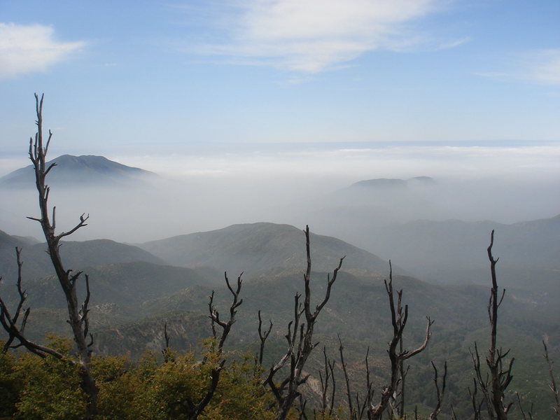
![Just one more nice shot of the valley on a beautiful day - Riverside lost under a sea of clouds.]()
[Hide Photo] Just one more nice shot of the valley on a beautiful day - Riverside lost under a sea of clouds.
![Watching the fog roll in from Scot Rock]()
[Hide Photo] Watching the fog roll in from Scot Rock
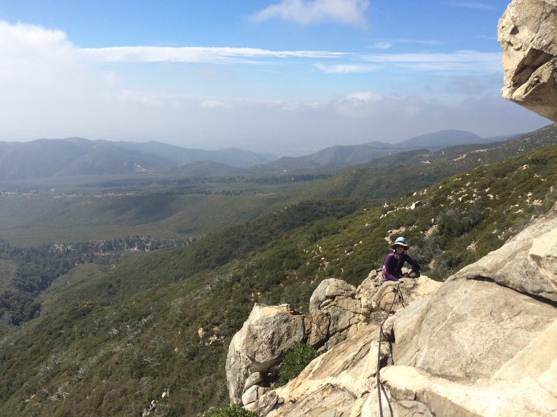
![At the rappel anchor for descending Bonnie Brae/Highlander.]()
[Hide Photo] At the rappel anchor for descending Bonnie Brae/Highlander.
![View from the top of Scot Rock, looking down at the anchor used to rap before climbing the west face.]()
[Hide Photo] View from the top of Scot Rock, looking down at the anchor used to rap before climbing the west face.
![The trail continues down to the rounded summit then turns to the right, heading steeply down to Scot Rock.]()
[Hide Photo] The trail continues down to the rounded summit then turns to the right, heading steeply down to Scot Rock.


 Continue with onX Maps
 Continue with Facebook


CA
Big Bear Lake
All up in yo bidniss.
Oak Park, CA
San Diego North County
San Diego, CA
Tustin, California
Stairmaster hike out... don't do it in the worst heat like we did. But... the whole place is in the sun after 1030.
The anchor bolts are very rusty. We backed them up.
Worthy though. Jul 18, 2022