Washington
> Northwest Region
> Hwy 20 & N Casc…
> N Cascades
 Access Issue:
 Seasonal Raptor Closure at Newhalem Crags March 1st to mid-July
Details
Peregrine falcons select nest sites on cliffs in the Upper Skagit Valley, including the Climbing Management Areas of Newhalem West (Ryan’s Wall) and Newhalem East. As required in the NPS Superintendent’s Compendium, these areas will be closed to all public from March 1st to July 15th of each year, or until the young falcons have fledged or NPS staff have determined that nesting will not occur on a specific wall during this period. Access Fund, Washington Climbers Coalition and NPS partner on a volunteer raptor monitoring program to determine nesting activity. Contact the NPS and/or WCC for updates.
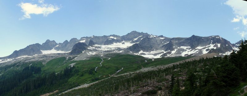
Boston Basin lies within the heart of Washington's stunning North Cascades. The big attraction here is Forbidden Peak, particularly its West Ridge, which is included among Steck and Roper's 50 Classics. Other draws here include Sahale Peak, Boston Peak, Mount Buckner, Mount Torment, and Sharkfin Tower.
The objectives here are truly alpine, and most require some snow and/or glacier travel. Be prepared for inclement weather. This is the Cascades, right?
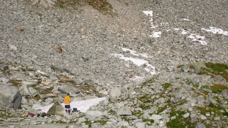
If you're not going car-to-car, permits are required to camp in Boston Basin.
For permit information, contact:
nps.gov/noca/planyourvisit/… Wilderness Information Center
7280 Ranger Station Road
Marblemount, WA 98267
Phone: (360) 854-7245
Fred Beckey wrote the definitive three-part guide to the Cascades. The Boston Basin area is covered in Volume II. Jim Nelson's and Peter Potterfield's "Selected Climbs in the Cascades" (Volumes I and II) is also a great series.
Driving directions: From Seattle, take I-5 North. Exit in Burlington for WA 20 East, which becomes the North Cascades Highway. Drive about 50 miles east to Marblemount. Make a right in Marblemount onto Cascade River Road. There's a small pullout on your left directly opposite Johannesburg Mountain, shortly after mile marker 22 (although Beckey’s guidebook says it’s 21.7 miles). Park here. If you've gone to the end of the road, you've gone too far.
The approach to Boston Basin starts directly from the parking pullout. After a short while, the trail climbs very steeply uphill and is very eroded. Stay on the trail, crossing several streams. Continue switchbacking uphill until out of the trees. Boston Basin lies at about 5700' . Campsites and a composting toilet (best crap you'll ever take) are located in Boston Basin. Several options for campsites are available.


 Continue with onX Maps
 Continue with Facebook